Israeli forces demolish residential homes in Marjayoun, southern Lebanon
What happened
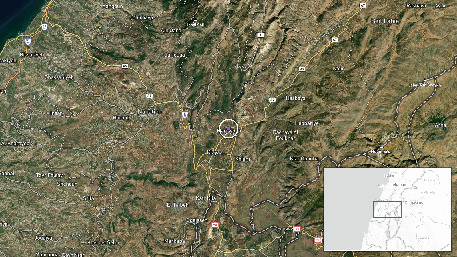
Israeli forces reportedly demolished residential homes in Marjayoun, a town in Lebanon's South Governorate, on August 31. The report, sourced from X account @ConflictTR, describes ongoing military operations in the region without specifying the number of structures affected or stated operational justification. Marjayoun lies approximately 3 kilometers from the Israeli border in an area that has experienced repeated cross-border military activity.
Context and assessment
The demolition occurs amid sustained Israeli military operations across the Lebanese-Syrian border region. On the same day, Israeli forces reportedly penetrated Syrian military barracks near Al-Maalqa with tanks, and on August 30 conducted a residence search in Turanja, Quneitra. These operations coincide with Lebanese parliamentary condemnation of Israeli military expansion during ceasefire negotiations. Marjayoun's strategic location near the border and history as a flashpoint suggests the demolitions may relate to Israeli security assessments of structures in areas near operational zones, though the specific tactical rationale remains unclear. The pattern suggests a broader sweep of Israeli military activity across southern Lebanon and southwestern Syria.
Sources and confidence
Single-source report from X account @ConflictTR with no apparent cross-confirmation from other channels. Confidence score of 6.0 reflects limited sourcing and lack of independent verification. Confirmation from Israeli military statements, Lebanese government response, or visual documentation would substantiate the claim. Contradictory reports from other outlets or official denials would lower confidence.
Location
Marjayoun is a town in Lebanon's South Governorate, located approximately 33.36°N, 35.59°E, roughly 3 kilometers north of the Israeli border. The town sits in the upper Galilee region and serves as a district center. Nearby settlements include Kfarchouba to the northeast and several smaller villages. The area has been subject to repeated military operations and cross-border fire.
Related events nearby
- Lebanese Directorate of Intelligence raided a residential complex in Al-Buara, Kesrouan, and arrested 12 Syria2026-08-30 21:10 UTC · Security · Al-Buara, Kesrouan District, Lebanon
- Israeli occupation forces penetrate into Al-Dariyat military barracks west of Al-Maalqa village in southern Qu2026-08-31 07:48 UTC · Combat · Al-Dariyat, Quneitra Governorate, Syria
- Lebanese Parliament Speaker Nabih Berri condemns Israel's continued military expansion during ceasefire negoti2026-08-31 14:52 UTC · Statement · Beirut, Lebanon
- Denmark's Foreign Minister Lars Løkke Rasmussen announces $76 million in additional aid for Syria's early reco2026-08-31 16:54 UTC · Statement · Damascus, Syria
- Denmark's Foreign Minister Asaad al-Shebani welcomes the official reopening of Denmark's embassy in Damascus a2026-08-31 15:34 UTC · Diplomacy · Damascus, Syria
▶ View this event on the live map
Intel Mapper aggregates open-source reports from monitored Telegram and X channels, geolocates them, cross-checks duplicates across sources and assigns a confidence score. Entries are updated as new confirmations arrive. Read how we verify events.