HTS forces prepare to enter Al-Hasakah city center in northeastern Syria
What happened
According to a report via X, Syrian military forces aligned with Hayat Tahrir al-Sham (HTS) are preparing to enter the city center of Al-Hasakah in Hasaka Governorate. The report describes this as a planned operational repositioning in an area previously controlled by the Syrian Democratic Forces and affiliated Kurdish groups. No engagement or resistance is mentioned in the available report.
Context and assessment
Al-Hasakah is Syria's largest city in the northeast and a strategic urban center in a region where Kurdish-led and Arab-led Syrian forces have maintained competing zones of control since 2015. The SDF has administered much of northeastern Syria with coalition support, while HTS and other opposition groups operate primarily in the northwest. Any shift in territorial control in Al-Hasakah would mark a significant change in the regional balance of power and could reflect broader realignments following recent developments in Syrian opposition dynamics. Such repositioning, if confirmed, would represent material consolidation of HTS influence eastward.
Sources and confidence
Reported via the X account @ConflictTR. Only a single source currently carries this report, limiting independent cross-confirmation. Confidence is moderate (6/10) due to single-source reporting and lack of corroborating accounts. Confirmation from additional regional monitoring channels, visual documentation, or Syrian military statements would strengthen confidence. Contradictory reports from SDF or other local actors would lower confidence.
Location
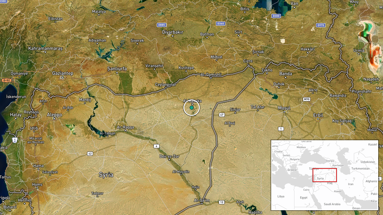
Al-Hasakah city center is located in Hasaka Governorate in northeastern Syria at approximately 36.43°N, 40.72°E. The city sits on the Khabur River and serves as a major urban hub in a region historically divided between Kurdish and Arab-majority areas. Nearby features include the Khabur valley and the Turkish-Syrian border lying roughly 60 kilometers to the north.
Related events nearby
- First meeting of newly appointed Hasaka Governorate executive office convened to distribute administrative pos2026-09-01 09:16 UTC · Diplomacy · Hasaka Governorate Building, Hasaka City, Hasaka G
- Displaced Arab families returned to Gweiran and Aziziyah neighborhoods in Hasaka for the first time in 10–13 y2026-09-01 11:48 UTC · Humanitarian Aid · Gweiran and Aziziyah, Hasaka Governorate, Syria
- Conoco gas facility in Deir ez-Zor resumed operations after rehabilitation. Two wells now producing 2.5 millio2026-09-01 14:52 UTC · Humanitarian Aid · Conoco Gas Plant, Deir ez-Zor, Syria
- First direct commercial flight from Cologne-Bonn Airport (Germany) arrived at Deir ez-Zor Airport, marking res2026-09-01 08:37 UTC · Deployment · Deir ez-Zor Airport, Deir ez-Zor Governorate, Syri
▶ View this event on the live map
Intel Mapper aggregates open-source reports from monitored Telegram and X channels, geolocates them, cross-checks duplicates across sources and assigns a confidence score. Entries are updated as new confirmations arrive. Read how we verify events.