Ukrainian FPV drone completes attack despite Russian air defense attempts near Kupiansk
What happened
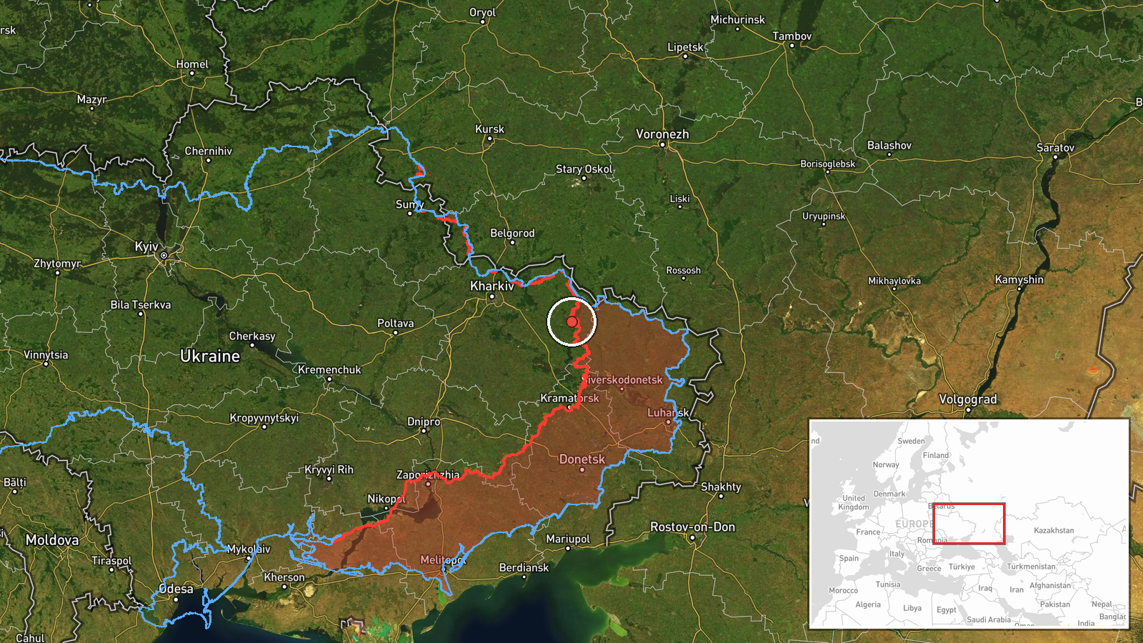
A Ukrainian first-person-view (FPV) drone reportedly successfully executed an attack in the Kupiansk area of Kharkiv Oblast on September 9, 2026, after Russian air defense systems failed to intercept it during its attack run. The report, posted on X by @ConflictTR, indicates the drone reached its target despite defensive measures. No details on the specific target or damage assessment were provided in the available source material.
Context and assessment
Kupiansk, located in eastern Kharkiv Oblast near the Russian border, has remained a focal point of intense fighting since Russia's 2022 invasion. The town sits in a contested zone where Ukrainian and Russian forces conduct frequent offensive and defensive operations. The successful completion of this FPV drone attack suggests either a gap in Russian air defense coverage or the continued Ukrainian ability to operate unmanned systems in proximity to defended positions. Ukrainian forces have increasingly relied on FPV drones—fast, maneuverable unmanned aircraft—for precision strikes against Russian armor, fortifications, and personnel in recent months, particularly in positional warfare across Kharkiv Oblast.
Sources and confidence
Reported by X account @ConflictTR. Single-source reporting with no independent cross-confirmation noted. Confidence score of 6 reflects the reliance on one channel and lack of corroborating sources. Additional confirmation from Ukrainian military sources, Russian military statements, or multimedia evidence would substantially raise confidence. Russian denial of the incident would lower but not eliminate the report's standing.
Location
Kupiansk, Kharkiv Oblast, in eastern Ukraine approximately 40 kilometers from the Russian border. The town is situated on the Oskil River in a relatively open steppe region. Geographic precision is regional rather than specific facility, indicating the drone attack occurred somewhere in the vicinity of the town. Kupiansk itself has served as a logistics hub and command area during the conflict.
Related events nearby
- Russian drone struck a duck during transit over Kharkiv Oblast. Drone continued flying after impact, indicatin2026-09-08 20:40 UTC · Drone Transit · Kharkiv Oblast, Ukraine
- Russian forces conducted 221 combat engagements across multiple Ukrainian frontline sectors on 9 September 2022026-09-09 19:07 UTC · Combat · Eastern Ukraine Frontline (Multiple Sectors)
▶ View this event on the live map
Intel Mapper aggregates open-source reports from monitored Telegram and X channels, geolocates them, cross-checks duplicates across sources and assigns a confidence score. Entries are updated as new confirmations arrive. Read how we verify events.