Tanker attacked near Rashid Port in Dubai amid Persian Gulf tensions
What happened
A tanker vessel reportedly came under attack near Rashid Port in Dubai, United Arab Emirates, on 9 September 2026. The incident was reported via social media by conflict monitoring accounts, with initial reports indicating the vessel was targeted in waters proximate to one of the region's major commercial ports. No details regarding damage, casualties, or the precise nature of the attack were provided in available reporting.
Context and assessment
Rashid Port is a critical container and general cargo facility serving the Dubai maritime hub, one of the world's busiest. The attack, if confirmed, would represent an escalation in maritime tensions affecting Gulf shipping corridors. The region has experienced recurring incidents involving drone and missile strikes on commercial vessels, often attributed to Iranian-aligned actors or operations. Such incidents disrupt global trade flows and raise insurance and operational costs for shipping transiting the Gulf. The targeting of infrastructure near major ports suggests potential intent to inflict economic pressure or demonstrate capability against high-value maritime chokepoints.
Sources and confidence
The incident was reported by @ConflictTR on X (Twitter), a conflict monitoring account. With a single source and no corroborating reports from regional maritime authorities, major shipping services, or international news agencies mentioned in available data, confidence remains low. Cross-confirmation from UAE official statements, insurance records, or shipping incident databases would substantially strengthen assessment. Regional maritime tracking services or Lloyd's List updates would provide additional verification.
Location
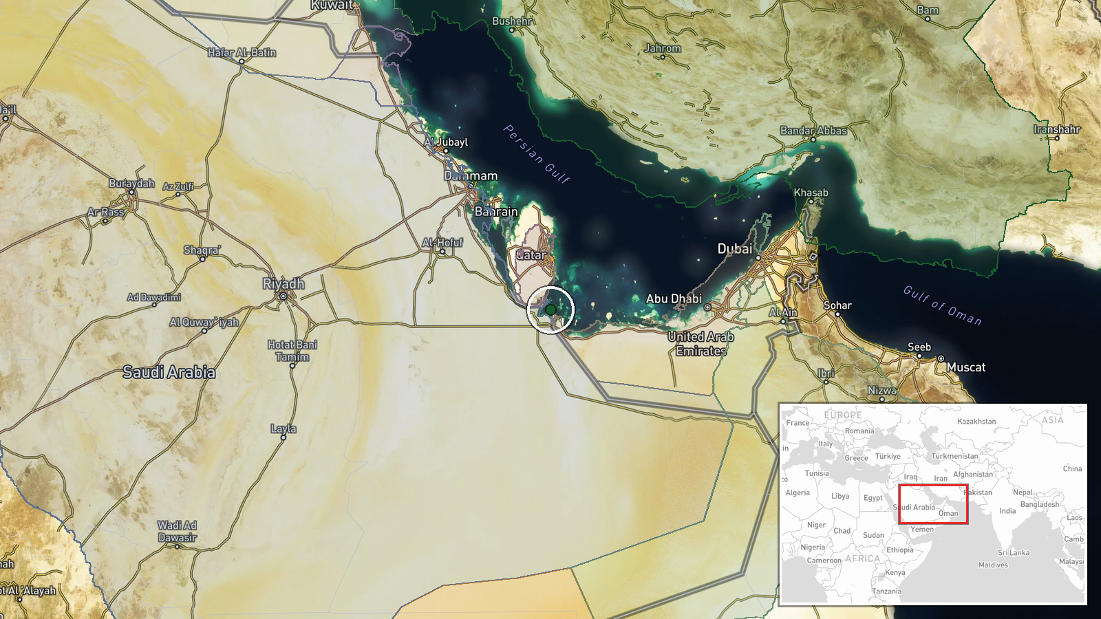
Rashid Port lies in Dubai's Jebel Ali area on the southern coast of the Persian Gulf, approximately 24.42°N, 51.54°E. The port complex is one of the world's largest container terminals and serves as a major transhipment hub for regional and global trade. The location's commercial significance and proximity to major shipping lanes make it a strategically sensitive maritime chokepoint.
▶ View this event on the live map
Intel Mapper aggregates open-source reports from monitored Telegram and X channels, geolocates them, cross-checks duplicates across sources and assigns a confidence score. Entries are updated as new confirmations arrive. Read how we verify events.