Panama-flagged tanker hit by drone in Iraqi waters carrying 2 million barrels of crude
What happened
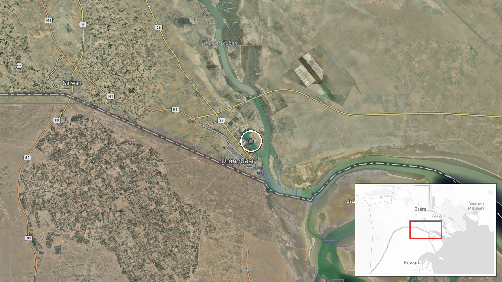
A Panama-flagged tanker transporting approximately 2 million barrels of Iraqi crude oil was struck by an unmanned aerial vehicle (UAS) in Iraqi territorial waters of the Persian Gulf on 9 September 2026. The report, relayed via X (@ConflictTR), does not specify the extent of damage, casualties, or the identity of those responsible for the attack. The incident occurred at coordinates in the central Persian Gulf region.
Context and assessment
Maritime attacks in the Persian Gulf have intensified tensions over freedom of navigation and regional security. Iraqi crude exports are economically vital to the country; tanker strikes disrupt global energy markets and create insurance complications for commercial shipping. Attacks on vessels in Iraqi waters may reflect broader regional friction, though the lack of attribution leaves the operational motive unclear. Such incidents typically prompt responses from regional and international naval forces concerned with protecting shipping lanes critical to global trade.
Sources and confidence
The report originates from a single source: X account @ConflictTR. No cross-confirmation from additional channels or official statements is noted in the available data. The confidence score of 6.0 reflects single-source reporting; independent verification from shipping companies, Iraqi authorities, or maritime monitoring agencies would increase confidence. Visual evidence or statements from affected parties would strengthen assessment.
Location
The attack occurred in Iraqi territorial waters of the Persian Gulf at approximately 30.05°N, 47.94°E, positioning it in the central gulf region off Iraq's coastline. The exact maritime location suggests the tanker was transiting shipping lanes commonly used for crude exports from Iraqi ports.
▶ View this event on the live map
Intel Mapper aggregates open-source reports from monitored Telegram and X channels, geolocates them, cross-checks duplicates across sources and assigns a confidence score. Entries are updated as new confirmations arrive. Read how we verify events.