U.S. naval forces warn Chinese-flagged vessel before engaging tanker in Strait of Hormuz
What happened
A U.S. naval force reportedly issued a radio warning to a Chinese-flagged vessel in the Strait of Hormuz on September 15, stating intent to fire on the vessel's stern and providing a three-minute evacuation window for crew. The warning preceded an engagement with a nearby oil tanker. The account originates from a single social media source citing the Turkish-language broadcast of the warning.
Context and assessment
The Strait of Hormuz remains a critical chokepoint for global oil transport and a focal point of regional tensions. This incident follows a pattern of escalating maritime activity in the Persian Gulf over 24 hours: Iran's Islamic Revolutionary Guard Corps reportedly conducted a drone strike on the Panama-flagged tanker El Gaia on September 14, rendering it inoperable, and separately claimed to have shot down a U.S. MQ-1 reconnaissance drone in the same waterway. The warning to the Chinese vessel may reflect heightened U.S. operational tempo or efforts to separate military assets from civilian shipping during active engagements, though the broader tactical context remains unclear from available reporting.
Sources and confidence
Reported via X (formerly Twitter) by @ConflictTR, a Turkish conflict monitoring account, citing intercepted radio communications. Single-source reporting with no independent cross-confirmation from U.S. military or maritime authorities. Confidence score of 6.0 reflects limited corroboration; score would improve with U.S. Defense Department acknowledgment or additional monitored communications.
Location
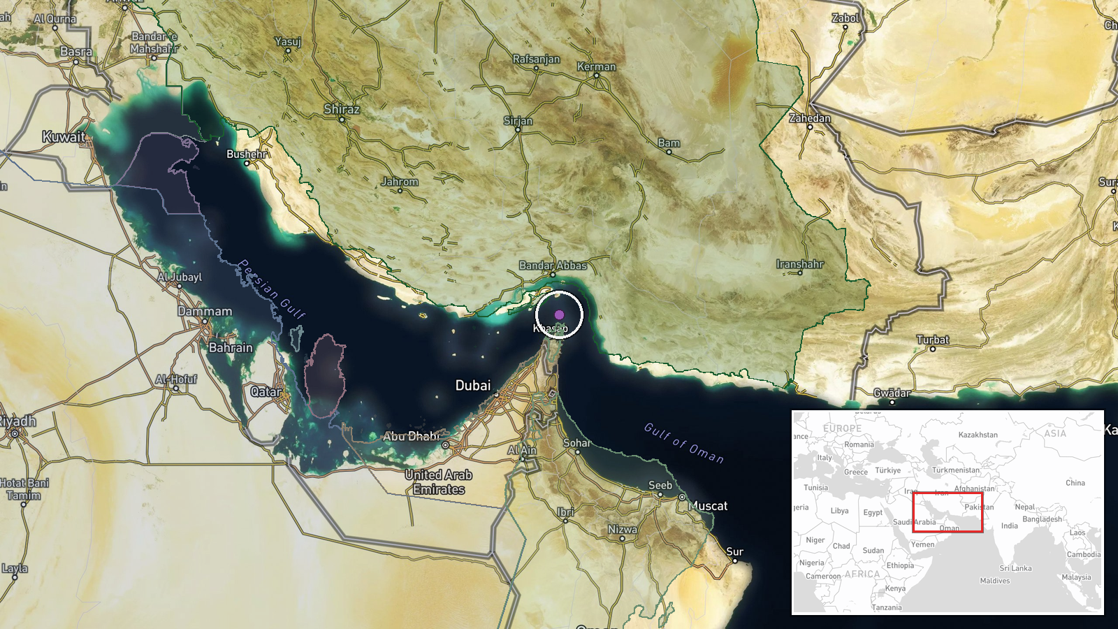
Strait of Hormuz, Persian Gulf, between Oman and Iran. Precise geographic coordinates unavailable; location confidence marked as low. The waterway is approximately 90 kilometers wide at its narrowest point and handles roughly one-third of global seaborne oil trade, making it a frequent venue for naval operations and incidents.
Related events nearby
- Iran's IRGC conducted drone strike on Panama-flagged tanker El Gaia in Persian Gulf waters off Oman coast. Ves2026-09-14 19:03 UTC · Cargo Ship · Strait of Hormuz, Persian Gulf
- Iran's IRGC claims it shot down a US MQ-1 reconnaissance drone over the Strait of Hormuz using a newly deploye2026-09-14 06:21 UTC · Drone Shootdown · Strait of Hormuz, Persian Gulf
▶ View this event on the live map
Intel Mapper aggregates open-source reports from monitored Telegram and X channels, geolocates them, cross-checks duplicates across sources and assigns a confidence score. Entries are updated as new confirmations arrive. Read how we verify events.