Aerial footage shows Kostyantynivka after year of sustained combat in Donetsk
What happened
Aerial footage released on social media on 19 September documents the condition of Kostyantynivka, a significant city in Donetsk Oblast, Ukraine, following approximately one year of sustained combat operations. The imagery provides visual documentation of the city's state amid ongoing warfare. The report was shared via X by @ConflictTR, a Turkish-language conflict monitoring account, with accompanying video evidence.
Context and assessment
Kostyantynivka, located in the contested Donetsk region, has remained a key urban center in active combat zones throughout the Russia-Ukraine conflict. The release of aerial documentation of a major city after extended warfare aligns with broader patterns of 19 September 2026, which saw 213 combat clashes reported across all frontline sectors, including 89 Russian airstrikes and sustained Ukrainian counter-strikes against Russian command posts. The timing of this imagery documentation may reflect ongoing efforts by Ukrainian sources to visually record and publicize the effects of prolonged combat on civilian infrastructure, consistent with patterns of documentation and information warfare alongside kinetic operations.
Sources and confidence
Single source: X account @ConflictTR, which specializes in conflict monitoring. Confidence of 6.0 reflects the single-source reporting and the general nature of the report (visual documentation rather than a specific tactical incident). Confirmation from additional open-source imagery analysis or Ukrainian military channels would strengthen confidence. The lack of corroboration from independent imagery or second sources moderately limits assessment reliability.
Location
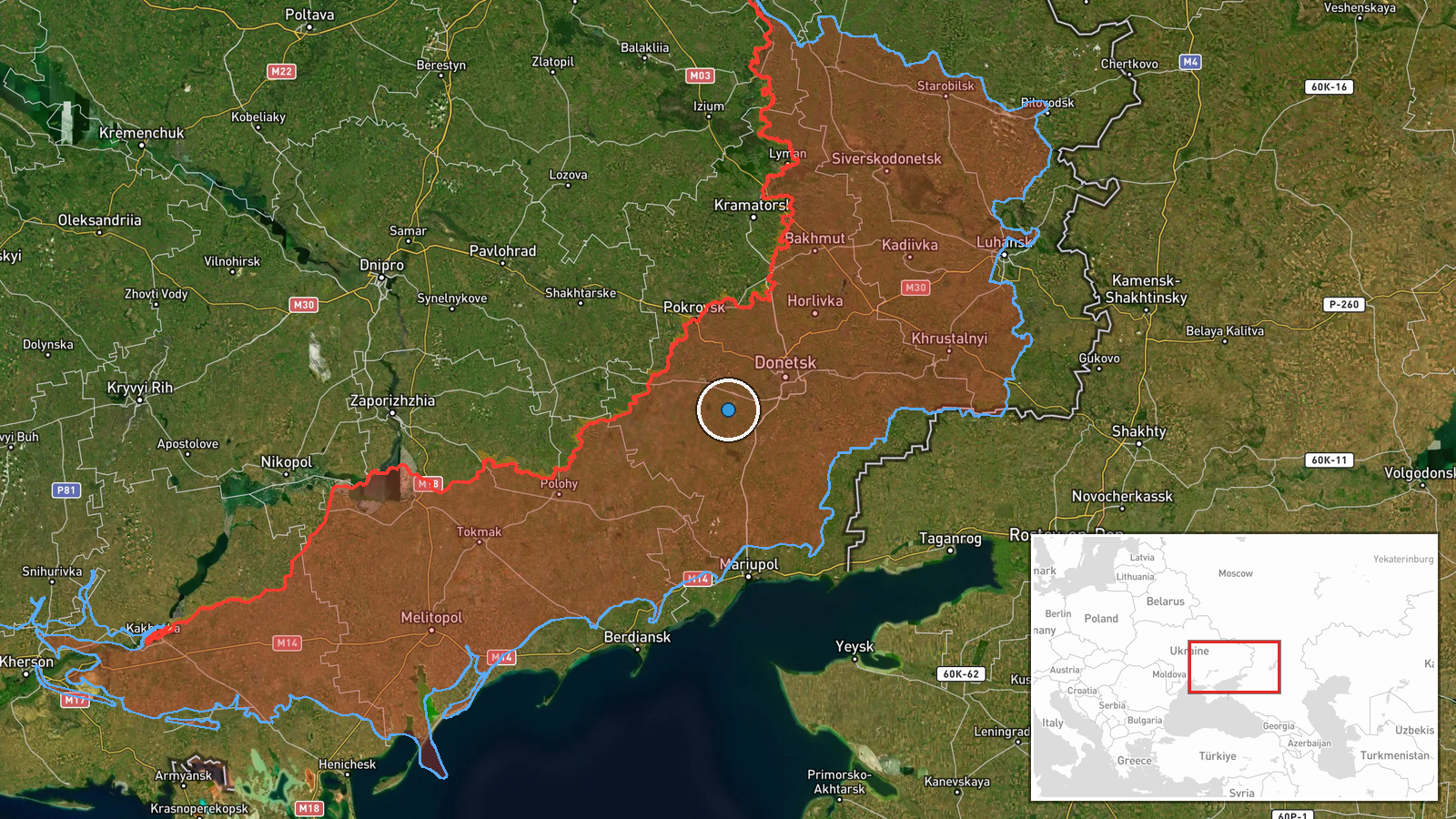
Kostyantynivka is a settlement-level location in Donetsk Oblast, eastern Ukraine, pinpointed at coordinates 47.87°N, 37.41°E with high confidence. The city lies in an active combat zone in the Donetsk region, part of the broader eastern Ukrainian battlespace where sustained ground and air operations continue.
Related events nearby
- Day 1669 of Russia-Ukraine war: 213 combat clashes reported across all fronts. Russia conducted 1 ballistic + 2026-09-19 05:09 UTC · Report · Ukraine (Multiple Frontline Sectors)
- Ukrainian forces struck multiple Russian military targets on 18-19 September: UAV command posts in Luhansk/Pok2026-09-19 11:16 UTC · Report · Novoprokopivka, Zaporizhzhia Oblast, Ukraine
- Ukrainian air defense monitoring detected 1 Russian reactive (jet-powered Shahed-136) drone transiting over Pa2026-09-18 18:04 UTC · Drone Transit · Pavlohrad, Dnipropetrovska Oblast, Ukraine
▶ View this event on the live map
Intel Mapper aggregates open-source reports from monitored Telegram and X channels, geolocates them, cross-checks duplicates across sources and assigns a confidence score. Entries are updated as new confirmations arrive. Read how we verify events.