SDF removes PKK/YPG symbols from Al-Hasakah; Syrian flag raised in symbolic shift
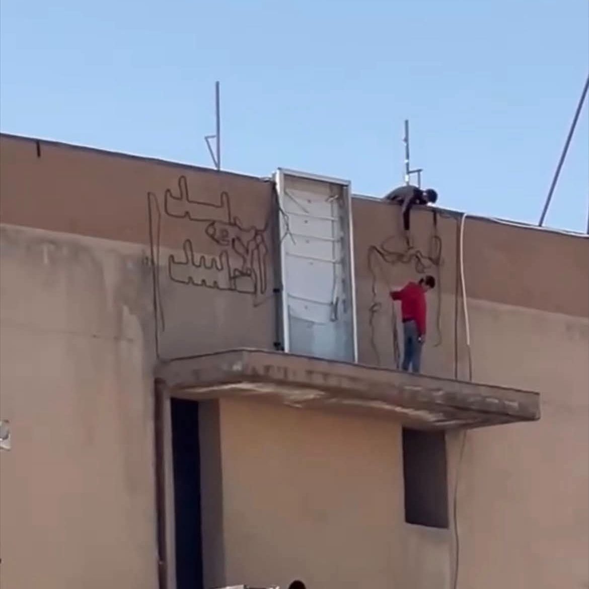
What happened
According to a report from a Turkish conflict monitoring account on X, the Syrian Democratic Forces (SDF) have begun removing PKK/YPG organizational symbols from Al-Hasakah city in northeastern Syria. The Syrian national flag has reportedly been raised in the city for the first time in years, marking a symbolic transition away from the autonomous Kurdish administration that had governed the area for an extended period.
Context and assessment
Al-Hasakah has served as a key SDF-controlled urban center in the northeastern Syria's oil-rich Al-Hasakah Governorate. The symbolic actions—removal of Kurdish party emblems and raising the Syrian state flag—suggest a significant political shift, potentially reflecting broader pressures on Kurdish-led autonomous governance structures or negotiations with Damascus. This occurs amid concurrent displacement activity in nearby Ras al-Ayn, where internally displaced persons from Ghweiran are returning home, and reported sabotage incidents against oil infrastructure in the broader region, indicating heightened instability and possibly contested control over strategic resources and territories.
Sources and confidence
Single source: X account @ConflictTR, which focuses on Turkish and regional security reporting. No cross-confirmation from independent observers or Kurdish-affiliated media noted. Confidence score of 6.0 reflects single-source reporting and lack of corroboration. Score would increase with statements from SDF leadership, Damascus, or established news agencies; would decrease if contradicted by Kurdish sources.
Location
Al-Hasakah city, northeastern Syria (36.41°N, 40.53°E), located in Al-Hasakah Governorate near the Turkish and Iraqi borders. The city sits on the Khabur River and serves as the governorate's administrative center. It is surrounded by oil and agricultural areas and positioned within the primary SDF-administered zone of northeastern Syria.
Related events nearby
- 50 families of internally displaced persons from Ghweiran district departed Ras al-Ayn en route to return to t2026-10-08 10:02 UTC · Displacement · Ras al-Ayn, Al-Hasakah, Syria
- Syrian Petroleum Company reports sabotage on oil pipeline near km 50 before Tel Hamis in Hasakah. Maintenance 2026-10-07 15:55 UTC · Report · Tel Hamis, Al-Hasakah, Syria
- Syrian Interior Security forces arrested three individuals in Deir ez-Zor who were caught red-handed stealing 2026-10-07 18:22 UTC · Security · Deir ez-Zor, Deir ez-Zor Governorate, Syria
- Residents discover war remnants (ordnance, debris) inside a building in Deir ez-Zor city. No casualties or act2026-10-07 12:24 UTC · Report · Deir ez-Zor, Deir ez-Zor Governorate, Syria
▶ View this event on the live map
Intel Mapper aggregates open-source reports from monitored Telegram and X channels, geolocates them, cross-checks duplicates across sources and assigns a confidence score. Entries are updated as new confirmations arrive. Read how we verify events.