Yemeni Government clears Houthi mines from Bab al-Mandeb Strait
What happened
Yemeni Government forces are reportedly conducting mine-clearing operations in the Bab al-Mandeb Strait, removing ordnance that Houthi forces had placed in the strategic Red Sea waterway. The demining effort is ongoing according to a report posted on X by @ConflictTR on 10 October 2026. No details on the scale, timeline, or specific results of the operation were provided.
Context and assessment
The Bab al-Mandeb Strait is a critical chokepoint for global shipping between the Red Sea and Indian Ocean, making it strategically vital for Yemen's government and regional maritime security. Houthi forces have repeatedly targeted and seeded mines in this corridor as part of their ongoing conflict with the internationally recognised Yemeni Government. The mine-clearing operation follows a pattern of intensified Yemeni Government military activity, with drone strikes reported against Houthi positions near Rada' in Ta'izz on 9 October. These operations suggest sustained government efforts to maintain territorial control and restore navigation security in contested waters.
Sources and confidence
Single source report from X account @ConflictTR. No corroborating reports from other channels identified. Confidence score of 6.0 reflects limited source confirmation and regional-level geolocation precision. Verification from Yemeni Government military statements or international maritime authorities would raise confidence. Additional reporting from independent conflict monitors or direct government confirmation would strengthen assessment.
Location
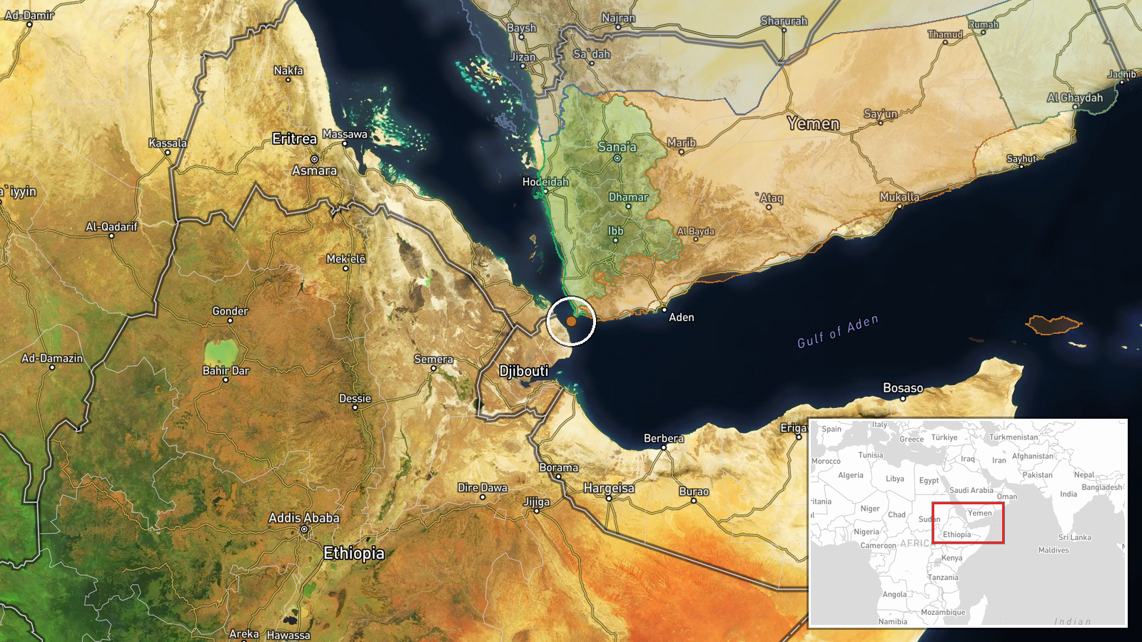
The Bab al-Mandeb Strait lies between Yemen's western coast and Djibouti in the Horn of Africa, roughly 20 nautical miles at its narrowest point. The strait connects the Red Sea to the Gulf of Aden and Indian Ocean. Geolocation confidence is low, reflecting the regional designation rather than a specific facility or coordinate.
Related events nearby
- Yemeni Government military released video footage of drone strikes conducted against Houthi positions. Specifi2026-10-09 21:00 UTC · UAS Strike · Near Rada`, Ta'izz, Yemen (front line, estimated)
- Yemen's National Army conducted drone strikes against Houthi positions. Details on specific targets and casual2026-10-09 19:34 UTC · UAS Strike · Near Rada`, Ta'izz, Yemen (front line, estimated)
▶ View this event on the live map

Intel Mapper aggregates open-source reports from monitored Telegram and X channels, geolocates them, cross-checks duplicates across sources and assigns a confidence score. Entries are updated as new confirmations arrive. Read how we verify events.