Yemeni government forces deploy FPV drone against Houthi positions
What happened
Yemen government forces reportedly deployed a first-person-view (FPV) kamikaze quadcopter drone targeting Houthi militia positions on October 11. The attack is part of ongoing military operations in Yemen's civil conflict. The report, posted via X by conflict tracking account ConflictTR, provides no details on specific targets, damage assessment, or casualties. The coordinates place the engagement in Houthi-controlled territory, though the exact site remains unspecified.
Context and assessment
This FPV drone strike follows a pattern of intensive coalition air operations against Houthi military formations. On October 10, Saudi Arabian Air Force conducted airstrikes against rebel positions, followed by concentrated strikes along the Taiz Governorate frontline on October 11 morning. The escalating use of loitering munitions by government forces reflects broader technological adoption in Yemen's protracted conflict, where both sides increasingly employ unmanned systems. FPV drones offer tactical advantages for precision strikes against dispersed militia targets without requiring manned aircraft sorties, reducing coalition exposure to air defense systems.
Sources and confidence
Single-source report from X account ConflictTR, a conflict documentation channel. No corroboration from additional open-source channels provided. Confidence score of 6.3 reflects limited sourcing and regional-level precision only. Confirmation from independent conflict monitors, military statements, or visual evidence would strengthen confidence. Absence of casualty or damage claims in original report maintains factual restraint but limits assessment completeness.
Location
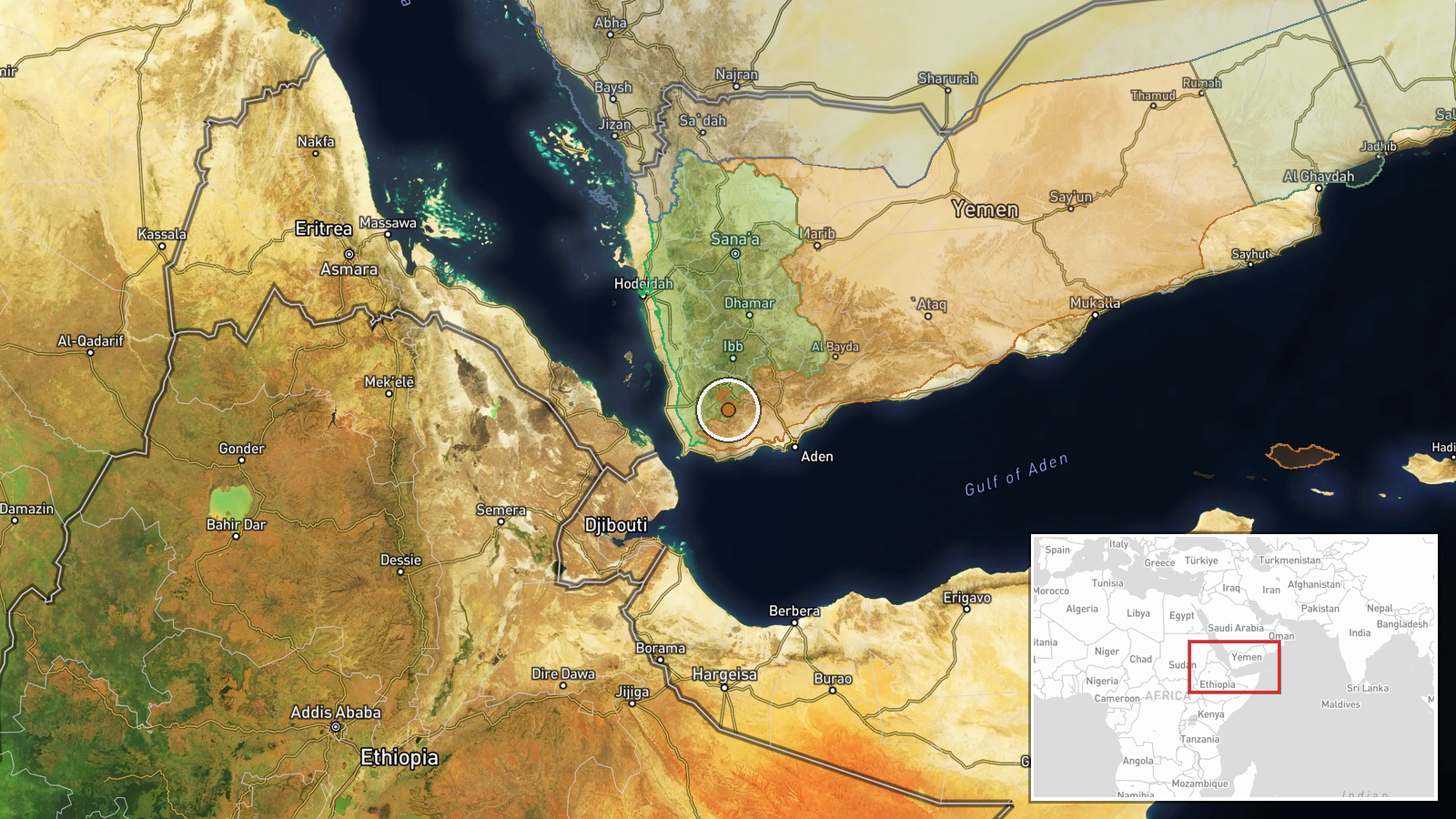
Coordinates (13.29°N, 44.11°E) indicate south-central Yemen within Houthi-controlled territory. Regional precision only; no specific settlement or facility identified. Area lies in disputed zone between government and rebel forces. Geographic coordinates place engagement in southern Yemen's complex frontline landscape, though exact tactical position remains unspecified in available reporting.
Related events nearby
- Intensive airstrikes commenced against Houthi positions along the Taiz frontline. Saudi-led coalition air camp2026-10-11 05:05 UTC · Airstrike · Taiz Governorate, Yemen
▶ View this event on the live map

Intel Mapper aggregates open-source reports from monitored Telegram and X channels, geolocates them, cross-checks duplicates across sources and assigns a confidence score. Entries are updated as new confirmations arrive. Read how we verify events.