Greek media report Turkey may deploy Oruç Reis south of Crete after Libyan endorsement
What happened
A Turkish-language post on X from the account @ConflictTR, relaying Greek media, reports that Greece's foreign ministry has suffered a second setback over the Turkey-Libya maritime memorandum. The post says Libya's endorsement of that memorandum would let Ankara seek an advantage over Greece on the ground, and that Turkey may send the research vessel Oruç Reis, or an alternative unnamed vessel, to waters south of Crete. The vessel is named only as an option, and the second option appears in a link that could not be independently checked. The report is dated 20 October 2026 at 18:16 UTC. The claims are attributed to Greek media rather than to official Turkish, Greek or Libyan statements, and the post gives no independent evidence of a vessel movement, a Libyan government statement, or an operational order. The item is classified as a deployment with Turkey as the named actor.
Context and assessment
Southern Crete lies within the contested maritime zones of the eastern Mediterranean, where Greece, Turkey, Cyprus, Egypt and Libya have overlapping claims over continental shelves and exclusive economic zones. The 2019 Turkey-Libya memorandum of understanding on maritime delimitation, signed while Ankara backed the Tripoli-based government, is widely regarded in Athens as disregarding the maritime rights of Greek islands, and Greece and Cyprus have rejected it. Libya's internal division, with rival administrations in the east and west, has complicated the question of which authority can ratify such an agreement, which is why any Libyan endorsement carries legal and political weight. Oruç Reis was involved in survey work in disputed waters in 2020, a period that saw naval standoffs and a heightened military posture by both Greece and Turkey. Against that background, a deployment south of Crete would most plausibly be read as a signal of leverage in maritime negotiations rather than a kinetic development. Operationally, a survey or presence mission would fit the pattern of exploratory activity in the area, but this single-source, low-precision report does not establish whether any vessel has moved, what its mandate would be, or how Greek or Libyan authorities have responded. No related events are linked to this item, so the trend cannot be checked against other recent incidents on this map.
Sources and confidence
The item rests on a single channel, the X account @ConflictTR, which relays Greek media reporting in Turkish. No independent outlet, official statement, or second channel appears in the record, so cross-confirmation is absent. The confidence score of 6.1 reflects a plausible and well-documented policy dispute, along with a named vessel that has a known history in the region, offset by single sourcing, an unverified attribution chain, and the absence of any observed vessel movement. Confidence would rise with maritime tracking data showing Oruç Reis or another vessel in the area, or with statements from the Greek or Turkish foreign ministries or Libyan authorities. It would fall if the Greek original cannot be located or if the claimed Libyan endorsement is denied.
Location
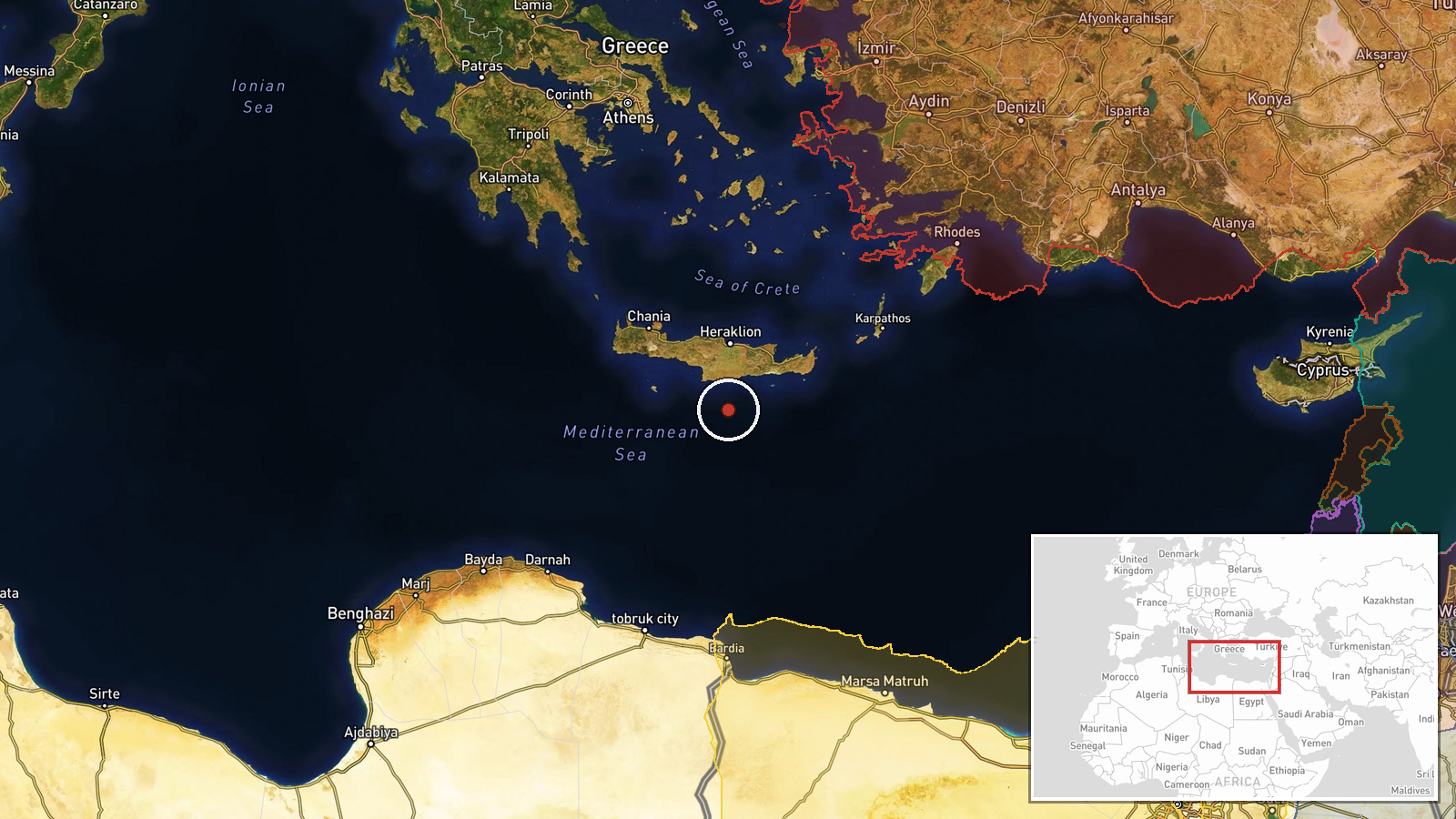
The location is a region-level approximation. Coordinates of 34.6 N, 25.1 E sit in open water south of Crete rather than at a settlement or facility, and the precision is marked low. The point lies between Crete and the Libyan coast, in the Libyan Sea portion of the Mediterranean. The Hellenic Trench, a deep feature running south and west of Crete, and the island's southern coast are the most notable nearby features.
▶ View this event on the live map

Intel Mapper aggregates open-source reports from monitored Telegram and X channels, geolocates them, cross-checks duplicates across sources and assigns a confidence score. Entries are updated as new confirmations arrive. Read how we verify events.