Israeli jets reportedly active near Iran border; flight route said to fit possible strike
What happened
A single post on X from the account @ConflictTR, written in Turkish, states that Israeli fighter jets carried out an operation near the Iranian border. It adds that the observed flight route was consistent with a possible attack on Iran and attributes that reading to Axios. The report is time-stamped 21 October 2026 at 21:09 UTC. No target, damage, casualties, or precise location were given, and no official Israeli or Iranian statement appears in the material available. The Turkish text describes the operation as taking place at the border, while the English summary frames it more cautiously as a route consistent with a possible attack, so the two versions differ in emphasis.
Context and assessment
Direct Iran-Israel exchanges have occurred since April 2024, when Iran launched missiles and drones at Israel and Israel responded with a limited strike near Isfahan, and a wider confrontation in June 2025 included Israeli and US strikes on Iranian nuclear and military sites. Against that backdrop, reported movements of Israeli combat aircraft near Iran's frontier attract attention, though they may reflect deterrence signalling, patrol activity, or preparation for a strike. The eastern border area is sparsely populated and mountainous, bordering Pakistan and Afghanistan, and is not a usual focus for Israeli air operations, which makes the reported route notable but harder to check independently. A strike on Iran would ordinarily require long-range aircraft, aerial refuelling and suppression of air defences, so analysts often watch for tanker movements, airspace notices and unusual route patterns. None of those indicators appears in the material provided. The item has no linked related events, so it cannot be placed in a sequence, and any reading of intent rests on one secondary characterisation.
Sources and confidence
The item rests on one channel, the X account @ConflictTR, which attributes the claim to Axios and links to an Axios post. No other outlet in the provided data reports the activity, and no related events corroborate it, so the score of 6.1 reflects a single-source basis. Confidence would rise with a directly verified Axios report, matching flight-tracking data, or official confirmation. It would fall if the Axios post cannot be found or if the wording proves to be interpretation rather than observation.
Location
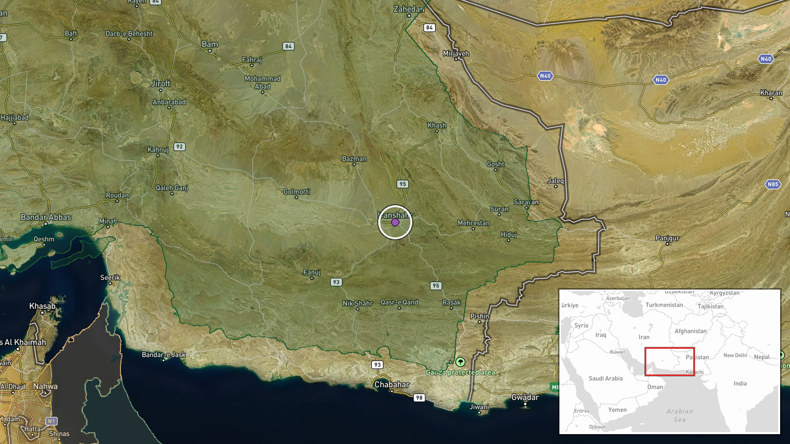
The coordinates are region-level rather than tied to a settlement or facility, and they appear to sit in the Sistan-Baluchestan area of southeastern Iran near the Pakistan border, which conflicts with the stated 'Western Iran' label. The source gave no place name, so the point should be read as an approximation of a broad border zone. Nearby terrain is largely arid desert and mountain ranges, with few major roads and sparse settlement.
▶ View this event on the live map

Intel Mapper aggregates open-source reports from monitored Telegram and X channels, geolocates them, cross-checks duplicates across sources and assigns a confidence score. Entries are updated as new confirmations arrive. Read how we verify events.