Footage reportedly shows Iranian missile landing metres from US soldiers at UAE base
What happened
Newly released footage, shared on X by the account @ConflictTR and logged for 23 October 2026, reportedly shows an Iranian missile strike on a United States base in the United Arab Emirates. The post, written in Turkish, states that the missile fell only a few metres from American soldiers. The base is described only as undisclosed. The post gives no casualty figures, no description of damage, and no statement from any government. The event record time-stamps the report at 06:34 UTC. The wording says the footage shows the missile landing near the troops, so the report describes what the video appears to depict rather than an official account. The record includes no independent verification of the clip's date, location, or attribution.
Context and assessment
The Gulf states host a significant US military presence, and the UAE is widely known as one location where American forces are stationed, so a strike on a US position there would carry considerable political weight. Iran's ballistic missiles are a long-range weapon used to hit fixed targets, and a near miss at close range would raise questions about either the accuracy of the launch or the intent behind it. The event database contains no related incidents before or after this report, so it is not possible to place this footage within an established pattern of attacks on US positions in the UAE. Operationally, a strike landing close to troops without causing reported casualties could indicate a deliberate signal intended to demonstrate reach while stopping short of lethal effect. It could equally reflect an errant launch or interception debris. Footage alone cannot distinguish between these explanations, and any assessment of intent should wait for corroborating evidence about the launch, the trajectory, and the official responses from the parties involved.
Sources and confidence
The report rests on a single channel, X account @ConflictTR, and the record lists no other outlet or account reporting the same footage. There is no cross-confirmation from wire services, official statements, or other open-source analysts. The confidence score of 6.3 out of 10 reflects this single-source basis and the fact that the footage has not been independently geolocated or dated. The score would rise with geolocated or chronolocated video, satellite or imagery analysis of the impact site, official statements from the US, UAE, or Iranian governments, or reporting by multiple independent outlets. It would fall if the footage were shown to predate the event, come from a different incident, or be recycled from earlier material.
Location
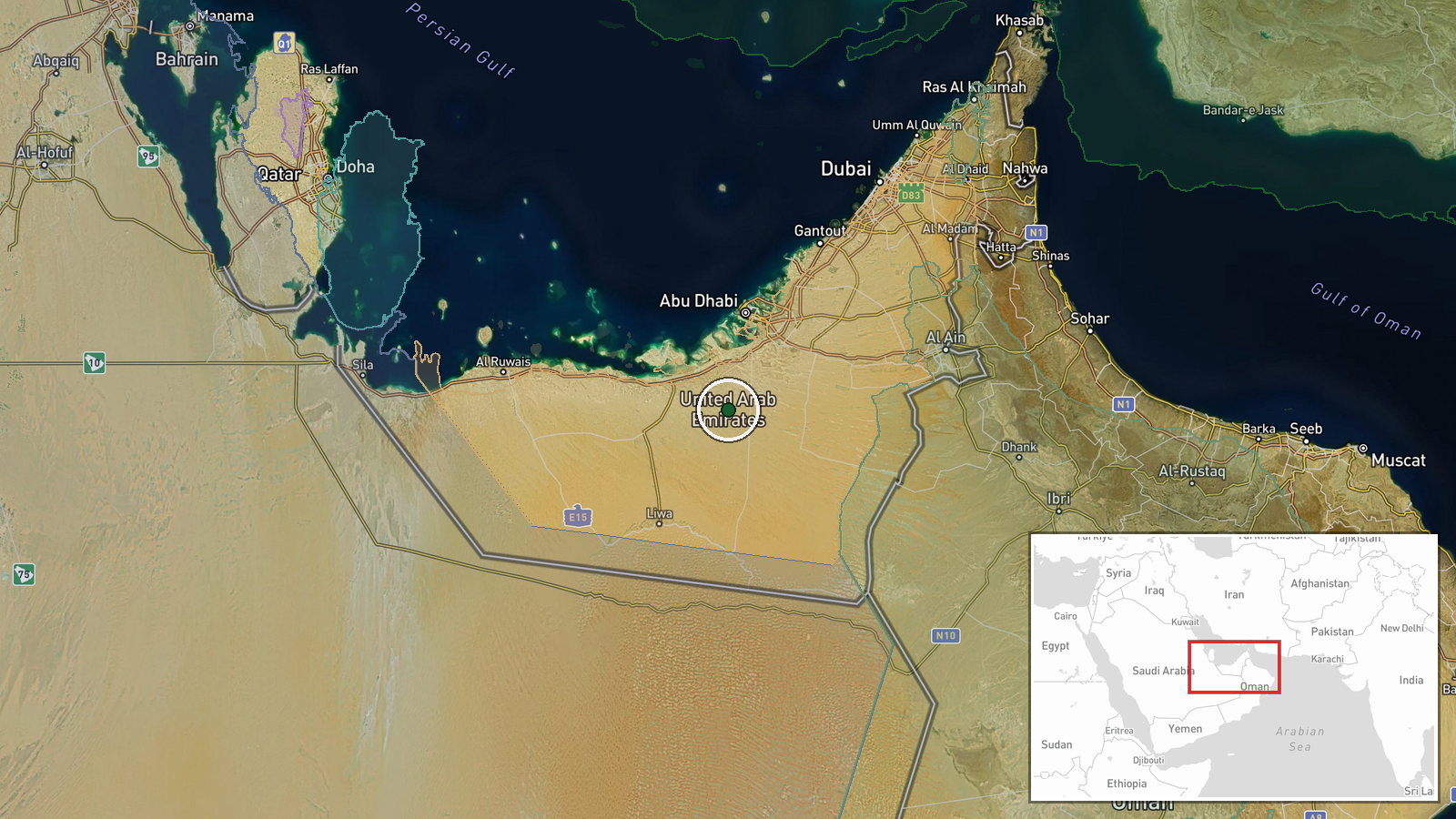
The coordinates, 23.85 and 54.26, are a settlement-level approximation placed in the desert interior of Abu Dhabi emirate, southwest of the capital. The base is undisclosed, so the point does not mark a confirmed facility. The surrounding terrain is largely flat, sparsely populated desert, well away from the coastal urban centres, with few distinctive landmarks that would aid visual identification.
▶ View this event on the live map

Intel Mapper aggregates open-source reports from monitored Telegram and X channels, geolocates them, cross-checks duplicates across sources and assigns a confidence score. Entries are updated as new confirmations arrive. Read how we verify events.