Houthis capture Red Sea port of Al-Mokha after breaking through National Resistance lines
What happened
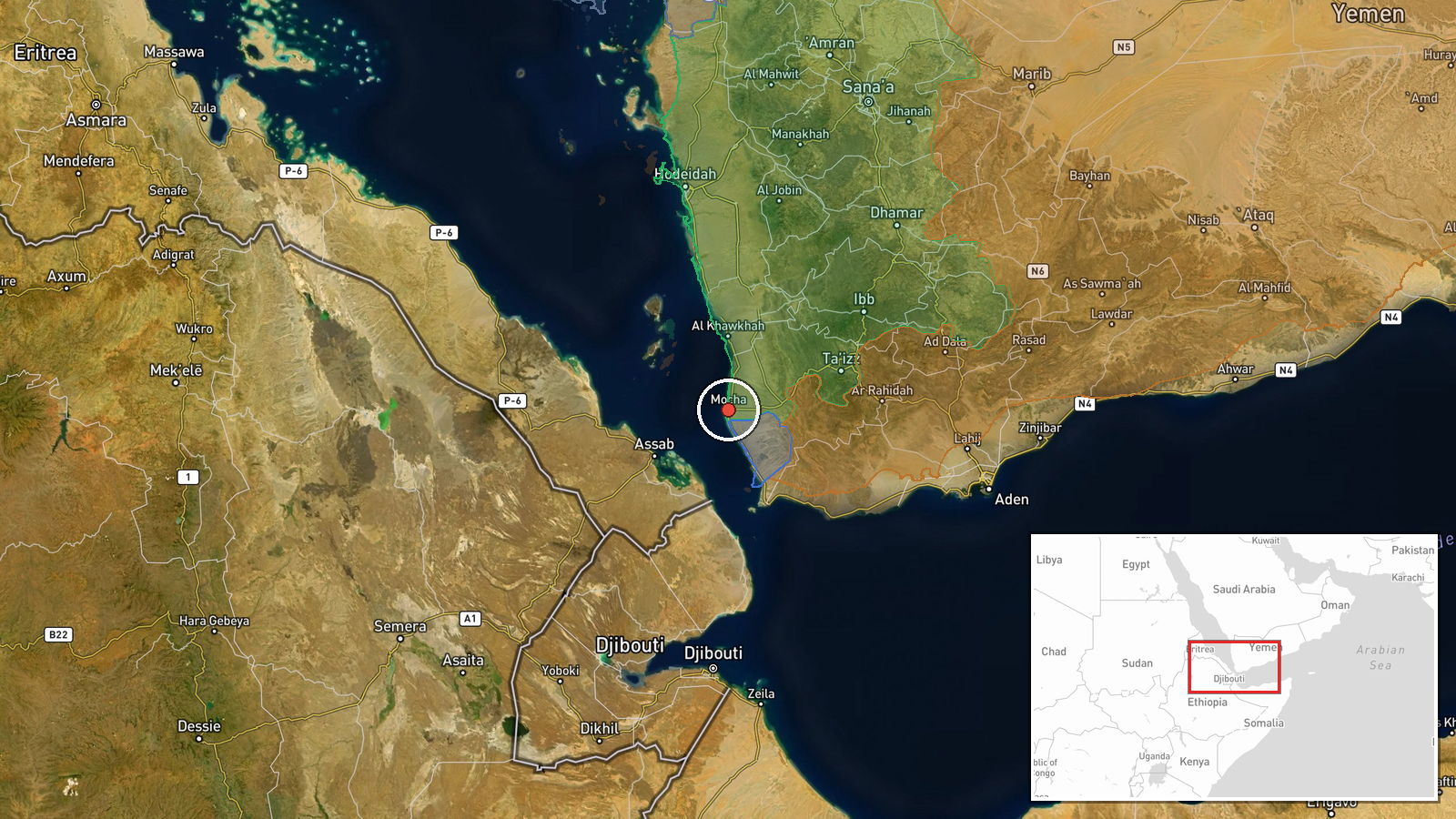
Houthi forces (Ansar Allah) captured the Red Sea port city of Al-Mokha in Taiz Governorate on September 10, according to reports from CNN, France 24, and Euronews. The advance followed a breakthrough of National Resistance defense lines in the area. The capture extends Houthi control closer to the Bab al-Mandab strait, a critical chokepoint for maritime traffic between the Red Sea and Gulf of Aden.
Context and assessment
Al-Mokha's seizure represents a significant shift in the tactical balance along Yemen's western coast. The port city sits on a contested corridor between Houthi-held territory inland and Saudi-backed government positions. This advance follows a pattern of oscillating territorial gains: government forces captured Nakil and Jabal al-Kura on September 7, Houthis retook El-Mufrak Junction on September 8, and now have taken Al-Mokha. The proximity to Bab al-Mandab—one of the world's most strategically important maritime passages—suggests this may reflect Houthi efforts to consolidate control over Red Sea approaches, potentially enabling greater leverage over shipping and regional commerce.
Sources and confidence
Three international news outlets (CNN, France 24, Euronews) reported the capture, providing consistent corroboration. The confidence score of 8.0 reflects multiple independent Western sources covering the event same-day. The cross-confirmation elevates confidence above single-source reporting. Score would rise with confirmation from regional military analysts or satellite imagery; it would lower if reports proved to conflate this event with nearby clashes.
Location
Al-Mokha is a settlement-level identified port city in Taiz Governorate, western Yemen, located at approximately 13.32°N, 43.25°E. It sits on the Red Sea coast roughly 80 km southwest of Taiz city, within the contested corridor leading to the Bab al-Mandab strait. The nearby Jabal an-Nar position, subject to Saudi airstrikes on the same day, lies approximately 24 km inland to the east.
Related events nearby
- Saudi-backed Yemeni Army forces captured Nakil and Jabal al-Kura on the El-Kadha front west of Taiz city, adva2026-09-07 14:12 UTC · Capture · Nakil & Jabal al-Kura, El-Kadha front, Taiz, Yemen
- Houthi forces retook El-Mufrak Junction in Taiz Governorate in a counterattack, reversing part of the governme2026-09-08 19:00 UTC · Capture · El-Mufrak Junction, Taiz Governorate, Yemen
- Houthi forces seized Zuqar Island in the southern Red Sea after rocket attacks and a boat-borne ground assault2026-09-10 12:00 UTC · Capture · Zuqar Island, Red Sea, Yemen
▶ View this event on the live map

Intel Mapper aggregates open-source reports from monitored Telegram and X channels, geolocates them, cross-checks duplicates across sources and assigns a confidence score. Entries are updated as new confirmations arrive. Read how we verify events.