Russian forces gain approximately 6 km² around Kriva Luka in Donetsk Oblast
What happened
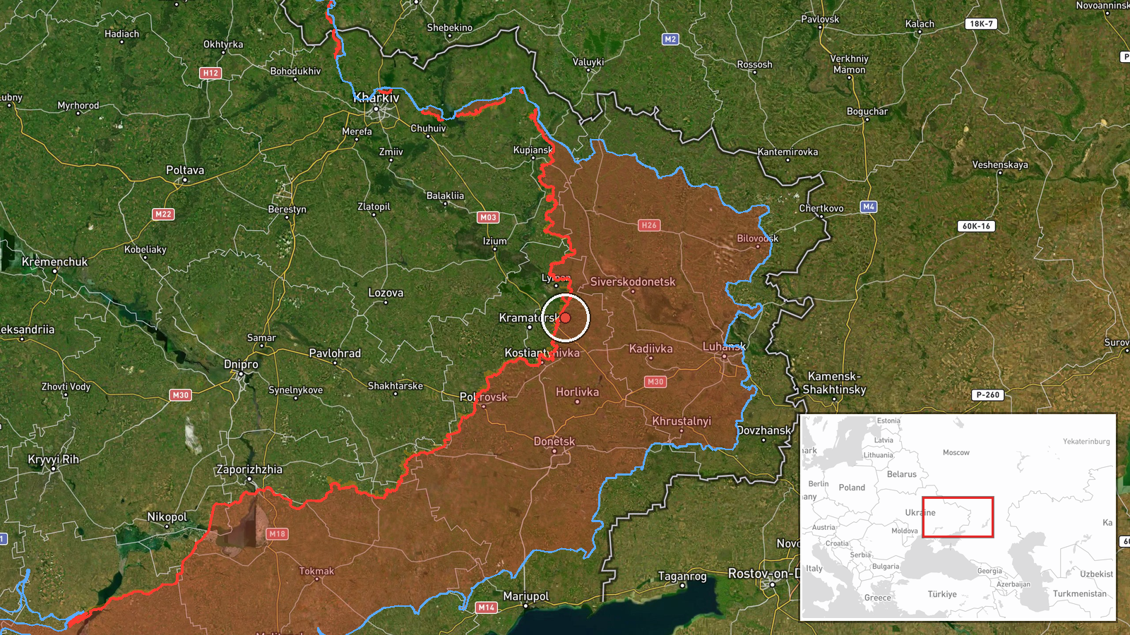
DeepState, a Ukrainian frontline monitoring channel, reported that Russian forces advanced roughly 6 square kilometers in the Kriva Luka sector of Donetsk Oblast as of 28 September 2026. The advance occurred in open or sparsely settled terrain; no settlement center changed hands according to the report. The timeframe of the advance was not specified in the available data.
Context and assessment
Kriva Luka lies in the broader Donetsk Oblast conflict zone, where Russian and Ukrainian forces have been engaged in sustained attrition warfare. Related reports from 27 September indicate intense Russian activity across multiple sectors: Ukrainian forces reported 10,660 Russian casualties (killed and wounded) in a single week, while Ukraine simultaneously conducted strikes on Russian ammunition and drone facilities in the region. This pattern of mutual attrition and infrastructure targeting suggests both sides remain operationally active despite heavy losses. The advance at Kriva Luka, though modest in territorial terms, may reflect ongoing Russian offensive pressure in eastern Donetsk, though it does not represent a major breakthrough.
Sources and confidence
DeepStateMAP, a Ukrainian military analysis channel, provided the sole report. No independent cross-confirmation from other open-source monitors or Ukrainian military statements is noted in available data. The confidence score of 7.5 reflects reliance on a single source; cross-confirmation from additional mapping services or official statements would strengthen confidence.
Location
Kriva Luka is located in Donetsk Oblast in southeastern Ukraine, at approximately 48.80°N, 37.89°E. The area lies in open steppe terrain characteristic of the eastern Donbas. Geolocation precision is regional rather than point-specific, indicating the advance was mapped across a broader sector rather than a specific settlement or facility.
Related events nearby
- Ukrainian forces under Operation Vivaldi encircled and captured approximately 250 Russian soldiers in the Lyma2026-09-28 08:36 UTC · Combat · Lyman, Donetsk Oblast, Ukraine
- Ukrainian General Staff reports 10,660 Russian casualties (killed and wounded) across all active sectors this 2026-09-27 12:15 UTC · Report · Pokrovsk, Donetsk Oblast, Ukraine
- Donbas Battalion (Ukraine) neutralized Russian infiltrators who had penetrated into Mykolaivka via a special o2026-09-27 20:38 UTC · Security · Mykolaivka, Donetsk Oblast, Ukraine
- Ukrainian General Staff reported destruction of Russian ammunition storage facilities in Makiivka and Ustynivk2026-09-28 08:19 UTC · UAS Strike · Makiivka and Ustynivka, Donetsk Oblast, Ukraine
▶ View this event on the live map
Intel Mapper aggregates open-source reports from monitored Telegram and X channels, geolocates them, cross-checks duplicates across sources and assigns a confidence score. Entries are updated as new confirmations arrive. Read how we verify events.