Russian forces advance ~6 km² in Udachne sector without settling ground
What happened
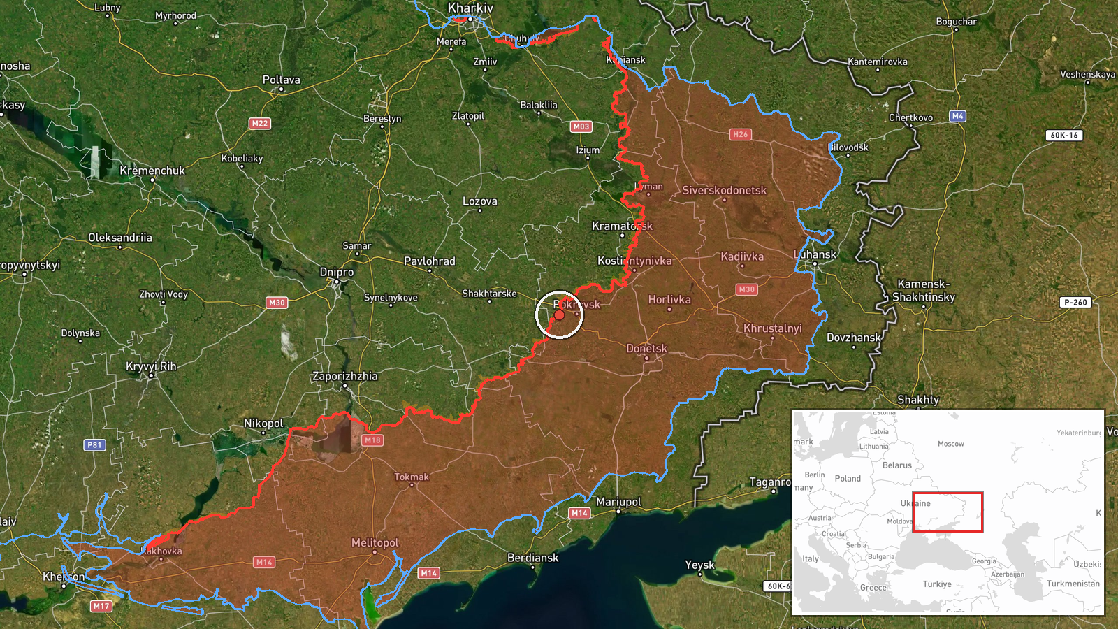
DeepState's frontline map recorded a Russian territorial gain of approximately six square kilometres in the Udachne sector of Donetsk Oblast on 4 October. The update noted that no settlement centre changed hands in the sector during this period, suggesting the advance consisted of movement through intermediate or sparsely populated terrain. The report reflects ongoing Russian pressure in this portion of the front.
Context and assessment
The Udachne sector lies in southern Donetsk Oblast, part of a broader zone of contention between Russian and Ukrainian forces. Recent activity in the wider region, including Ukrainian strikes on Russian pontoon crossings at the Mokri Yali River and reports of drone facility destruction in Donetsk, indicates sustained Ukrainian efforts to disrupt Russian logistics and air capabilities. Russian gains without settlement capture may reflect incremental positional advances rather than breakthrough operations. Such limited territorial shifts have characterised much of the eastern front in recent months, with both sides contesting ground methodically.
Sources and confidence
DeepStateMAP, a Ukrainian crowdsourced mapping project, provided the sole report of this advance. No independent cross-confirmation from other OSINT sources or military statements is presently available. The confidence score of 7.5 reflects DeepState's established track record in frontline documentation, though single-source reporting on tactical movements carries inherent uncertainty. Confirmation from additional mapping services or official statements would increase confidence; absence of corroboration from other monitors would warrant review.
Location
The Udachne sector is located in southern Donetsk Oblast, near coordinates 48.27°N, 37.02°E. Precision is regional rather than point-specific. The area lies in steppe terrain with limited urban infrastructure, consistent with the report that territorial gains did not encompass settlement centres. The Mokri Yali River system lies nearby to the south, a significant logistical feature in the operational environment.
Related events nearby
- Ukrainian forces damaged Russian telecommunications nodes in Hirnik, Yasynuvata, and Donetsk city areas, Donet2026-10-04 08:06 UTC · Report · Hirnik, Donetsk Oblast, Ukraine
- Ukrainian General Staff reports 163 combat clashes across all fronts on 04 October 2026. Russia conducted 1 ba2026-10-04 19:14 UTC · Report · Ukraine (Eastern Front)
- Ukrainian forces destroyed a Russian attack drone storage, preparation, and launch facility in Donetsk Oblast.2026-10-04 08:05 UTC · UAS Strike · Donetsk Oblast, Ukraine
▶ View this event on the live map
Intel Mapper aggregates open-source reports from monitored Telegram and X channels, geolocates them, cross-checks duplicates across sources and assigns a confidence score. Entries are updated as new confirmations arrive. Read how we verify events.