Ukrainian forces gain ~14 km² in Shandryholove sector without settlement changes
What happened
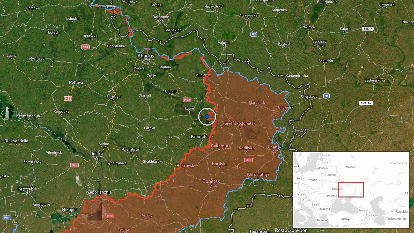
According to DeepState's frontline mapping update on 15 September, Ukrainian forces regained approximately 14 square kilometers of territory in the Shandryholove sector. The update specifies that no settlement centers changed hands during this operation, suggesting the gains were made in contested intermediate zones rather than through capture of populated areas. The precise timing and tactical details remain limited to the source reporting.
Context and assessment
The Shandryholove sector lies in eastern Ukraine's contested zone where Russian and Ukrainian forces have been locked in attritional warfare. This modest territorial gain occurs amid a broader operational tempo reflected in 225 reported combat clashes across all fronts on 14 September alone, per Ukrainian General Staff figures. Recent days have seen Ukrainian defensive operations commended in Donetsk Oblast and sustained Russian airstrikes (55 on 14 September). The gain may reflect localized Ukrainian advances in static positions rather than a major breakthrough, consistent with the sector's grinding character and the absence of settlement captures.
Sources and confidence
Reported solely by DeepStateMAP, a crowdsourced frontline tracking channel widely used by conflict analysts. No cross-confirmation from Ukrainian official sources or independent analysts is noted in available data. Confidence scored at 7.5 of 10, reflecting single-source reporting but DeepState's established track record in frontline mapping. Confirmation by Ukrainian General Staff or satellite analysis would strengthen confidence; conflicting reports or lack of follow-up would lower it.
Location
Shandryholove sector in eastern Ukraine, located at approximately 49.11°N, 37.70°E. The sector designation suggests the broader region rather than a pinpoint location. Shandryholove itself lies in the contested territories of Donetsk Oblast, characterized by rolling agricultural terrain typical of eastern Ukraine's interior plateau zone.
Related events nearby
- Ukrainian General Staff operational update (22:00, Sept 14): 225 combat clashes across all fronts. Russia cond2026-09-14 19:09 UTC · Statement · Eastern Ukraine Frontline (Donetsk, Luhansk, Khark
- Analysis report asserts Ukrainian strike on Russian command post in Donetsk killed multiple top Russian milita2026-09-14 19:38 UTC · Statement · Donetsk Oblast, Ukraine
- Ukrainian General Staff reports defensive operations in Donetsk Oblast. Commends 3rd Army Corps, 66th and 125t2026-09-14 13:26 UTC · Statement · Donetsk Oblast, Ukraine
- Russian Geran-2 (Shahed-136) drone struck a road section in Pavlohrad occupied by civilian vehicles, causing c2026-09-14 15:45 UTC · UAS Strike · Pavlohrad, Dnipropetrovsk Oblast, Ukraine
▶ View this event on the live map
Intel Mapper aggregates open-source reports from monitored Telegram and X channels, geolocates them, cross-checks duplicates across sources and assigns a confidence score. Entries are updated as new confirmations arrive. Read how we verify events.