South Sudanese refugees reportedly arriving in East Darfur camps amid drought and fighting
What happened
Darfur24, a Sudanese Arabic-language outlet, reported on Monday 19 October 2026 that camp sultans in the Ed Daein area of East Darfur had recorded large numbers of South Sudanese refugees reaching the camps over recent weeks. According to the report, the arrivals were fleeing drought, poor rainfall and spreading fighting in Kordofan and Darfur. Camp sultan Ibrahim Wil told the outlet that the refugees had moved from camps in areas the report names as Al-Eit. The article gives no headcount, no breakdown by age or sex, and no number of camps affected. The source describes the scale only as large numbers, so the figures should be treated as unquantified.
Context and assessment
Darfur has been among the most affected areas of Sudan's war, which has pitted the Sudanese Armed Forces against the Rapid Support Forces since April 2023. Fighting in Kordofan, which borders Darfur to the west, has been widely reported as a source of displacement, and the report links the current movement to that spread. Drought and erratic rainfall add a second pressure, since they damage harvests and livestock and push households to seek food, water and aid. Refugee flows into East Darfur are therefore best read as a combination of conflict and environmental stress rather than a single trigger. Because this item has no linked events in the dataset, it cannot be placed within a verified sequence of attacks or movements here. Operationally, sustained arrivals of this kind may suggest that routes between Kordofan, Darfur and the South Sudan border region are being used under pressure, and that camp capacity, water supply and health services in East Darfur could come under strain. Any reading of armed-group movements would need independent confirmation before being drawn from this report.
Sources and confidence
Only one channel reported the event: Darfur24, a local Sudanese outlet, with no cross-confirmation in the dataset from UN agencies, humanitarian clusters, wire services or other regional media. The confidence score of 6.0 reflects a specific local named source, a named camp leader, and a settlement-level location, offset by the single-channel basis and the absence of any numbers. Confidence would rise with registration or flow-monitoring data from UNHCR, IOM or OCHA, or with corroborating reports from camp management or independent journalists. It would fall if agency data show no notable increase in arrivals or if the named origin areas cannot be linked to the displacement described.
Location
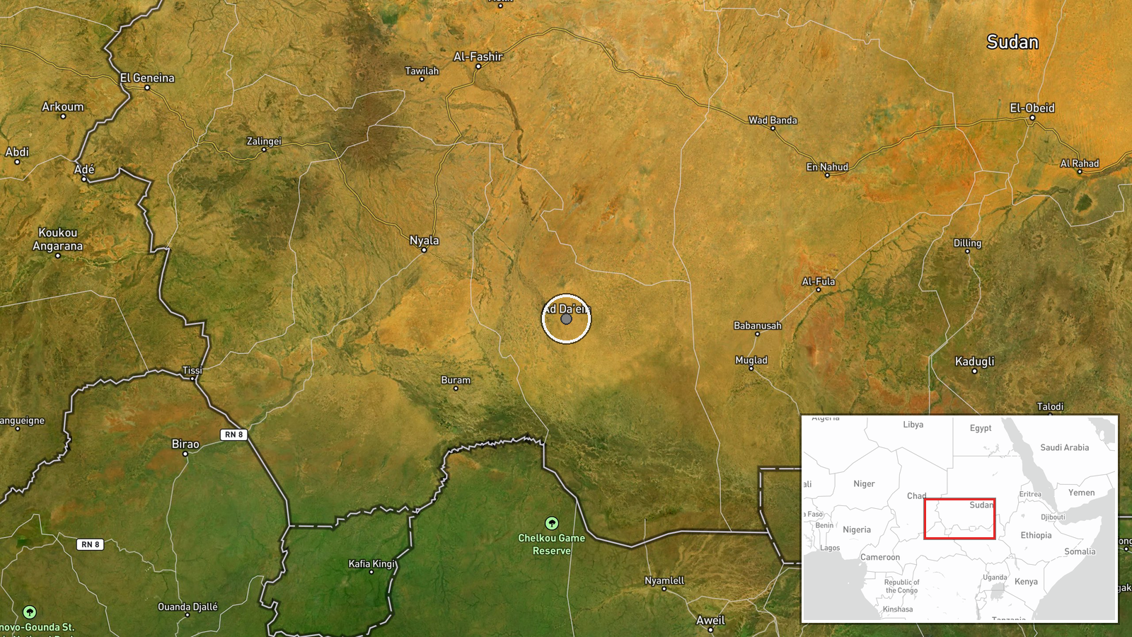
The event is placed at settlement level, using the coordinates of Ed Daein, the capital of East Darfur, rather than at individual camps, which the report does not map. Ed Daein is a town in the semi-arid savannah of eastern Darfur, a flat landscape with seasonal watercourses and farmland that depends heavily on rainfall. Its position in the southeast of the region places it in the broader border belt with South Sudan, which the refugee movement is reported to cross.
▶ View this event on the live map

Intel Mapper aggregates open-source reports from monitored Telegram and X channels, geolocates them, cross-checks duplicates across sources and assigns a confidence score. Entries are updated as new confirmations arrive. Read how we verify events.