Thousands displaced in Bili Serif, East Jebel Marra, reportedly living in the open without food, water or health care
What happened
A Darfur24 report, published in Arabic on 19 October 2026, says thousands of displaced people in the town of Bili Serif in the East Jebel Marra locality of Darfur, Sudan, face deteriorating humanitarian conditions. The report describes acute shortages of food, drinking water and health services, a decline in maternal and child care, and an absence of humanitarian aid. It cites a volunteer in the town who told Darfur24 that more than three thousand displaced people are affected. The headline and body describe the displaced as living in the open, meaning without adequate shelter. The item is a single-outlet account relayed through a local news channel, and the figures are the volunteer's estimate rather than an independently verified count.
Context and assessment
Bili Serif sits in the Jebel Marra massif, a mountainous area of Central Darfur that has long been a refuge for displaced communities and a focus of armed contestation. Its importance for the wider picture lies in the fact that humanitarian access in remote Darfur tends to be the first casualty of fighting, so reports of shortages in such places often signal a gap between displacement and aid delivery rather than a single acute event. The related items on the same day concern South Darfur, not Jebel Marra directly. They include an RSF-aligned administration graduating police in Nyala, an RSF claim of a drone strike on a Nyala livestock market, and reported detention of a trader travelling from Blil to Nyala. Taken together they suggest a period of intensified contest over movement, security and information in Darfur, though none of these items links the Bili Serif displacement to a specific operation. The pattern is best read as context: the displacement is a humanitarian consequence of a wider conflict whose military dynamics the sources do not establish for this town.
Sources and confidence
The event rests on one channel, Darfur24, a regional Arabic-language outlet, with no second outlet, aid agency or official statement in the data to corroborate the population figure or the conditions described. The confidence score of 6 out of 10 reflects a credible local source with a named-type but unverified volunteer quote and no cross-confirmation. Confidence would rise with independent reporting from UN agencies, humanitarian clusters or other Sudanese outlets, ideally with a counted or assessed figure. It would fall if the volunteer's estimate proved inflated or if local officials disputed the account.
Location
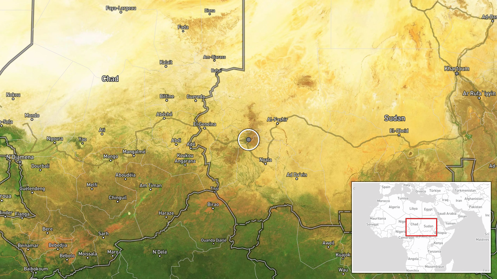
The location is recorded at region level, not as a precise point, and the coordinates given (13.0 N, 24.2 E) should be treated as approximate within East Jebel Marra and Bili Serif. Location confidence is rated low because the source names the town but the data does not confirm a facility or exact placement. Bili Serif lies in the mountainous Jebel Marra highlands of Central Darfur, an area of volcanic massif terrain, seasonal streams and dispersed farming and settlement, which typically complicates road access during the rainy season.
Related events nearby
- RSF forces arrested trader Saif al-Din Mohamed while he travelled from Blil to Nyala; he has been missing abou2026-10-19 13:18 UTC · Police Operation · Blil, South Darfur, Sudan
- RSF claims its 'Rapid Intervention' unit reports readiness to its commander and vows to advance on Port Sudan.2026-10-19 14:19 UTC · Statement · Nyala, South Darfur, Sudan
- RSF claims a SAF Akinci drone strike killed dozens at Nyala livestock market and Dabab area, and accuses pro-S2026-10-19 12:44 UTC · Statement · Nyala, South Darfur, Sudan
- RSF-aligned Tasis government graduated a new class of federal police in Nyala after advanced training, pledgin2026-10-19 13:18 UTC · Security · Nyala, South Darfur, Sudan
▶ View this event on the live map

Intel Mapper aggregates open-source reports from monitored Telegram and X channels, geolocates them, cross-checks duplicates across sources and assigns a confidence score. Entries are updated as new confirmations arrive. Read how we verify events.