Drone hits forestry office near girls' school in West Kordofan; no damage reported
What happened
A drone reportedly struck an area opposite a government forestry office in Al-Muglad, West Kordofan, Sudan, on 19 October 2026, at about 13:18 UTC. The report, published by the Sudanese outlet Darfur24, says the strike caused no recorded damage but frightened students at the nearby Al-Amal girls' school. Witnesses told Darfur24 that the drone was a 'strategic' one, a description that reflects the outlet's wording rather than any verified assessment. The original Arabic text uses the headline 'a drone strikes a government office near a girls' school,' while the body describes the target as the forestry bureau. The operator is not identified.
Context and assessment
Al-Muglad lies in the Kordofan region of western Sudan, where the Sudanese Armed Forces and the Rapid Support Forces have fought since April 2023, and where drones have become a recurring weapon. The same day, a separate drone strike is reported in the data at 06:27 UTC against a van carrying about 200 mourners in Al-Dabab, with a reported death toll of about 150 and a similar number wounded. The related entry attributes that strike only to suspected SAF-linked drones and places it in Al-Mujlad, while the summary names Al-Dabab, so the locations should be treated as unresolved. Taken together, the two reports suggest that drone activity in the area was intense that day, but they do not establish a link between the incidents. A strike that caused no damage may indicate a missed target, a deliberate show of reach against a government facility, or a reconnaissance or harassment mission. Only the strike itself is documented, so none of these explanations can be confirmed from the available material.
Sources and confidence
This event rests on a single channel, the Darfur24 website, which reported both the strike and eyewitness accounts. No independent outlet, official statement, or imagery in the data corroborates it, and the confidence score of 6.0 reflects that single-source status. The score is moderate rather than low because the outlet names a specific school and office, and the same-day related event shows that drone strikes were occurring in the same province. Confidence would rise with corroboration from a second outlet, local officials, the school or forestry bureau, or verifiable imagery of the site. It would fall if witness accounts could not be matched to a documented incident or if the reported target were disputed.
Location
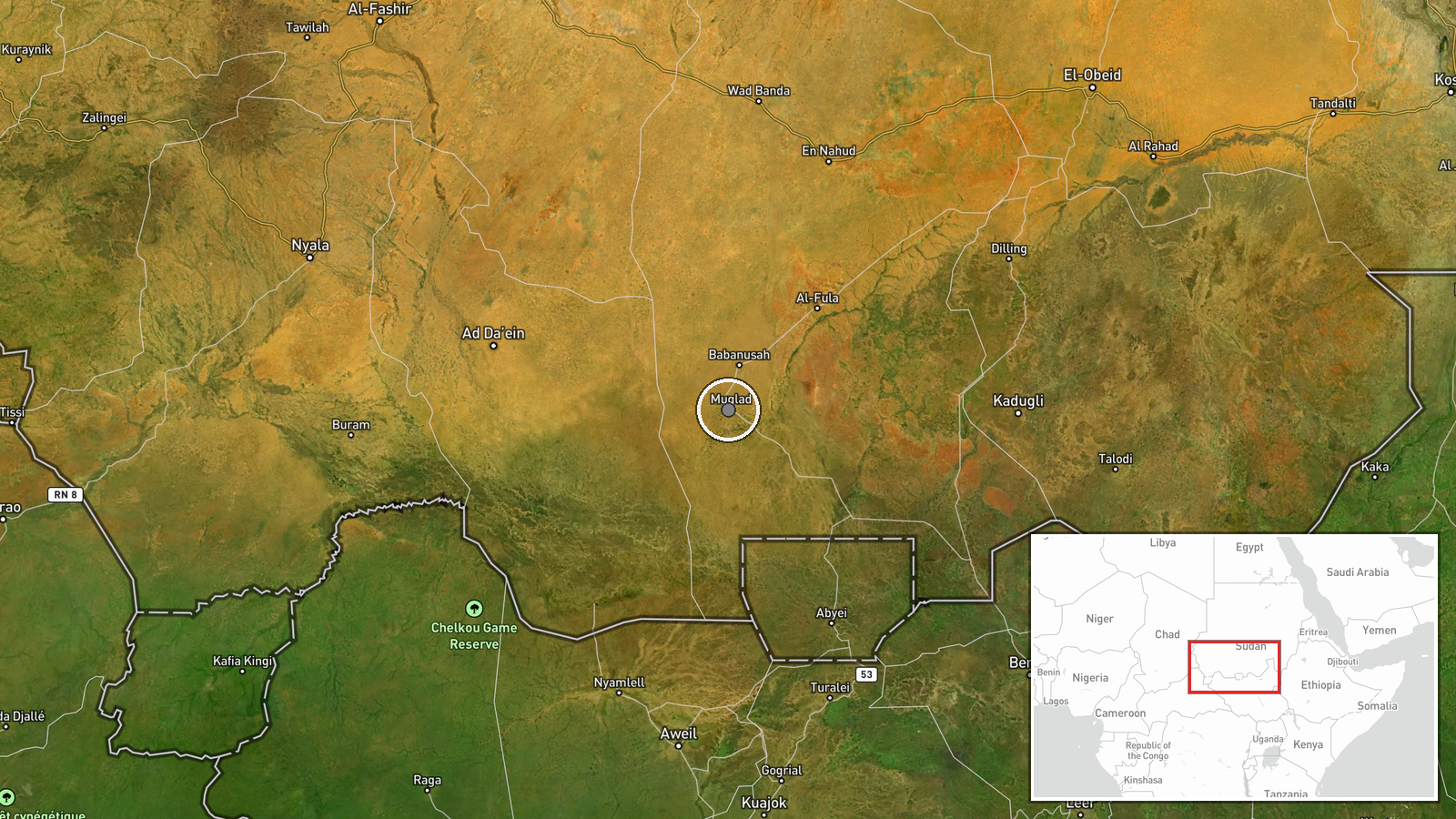
The event is placed at the settlement level, at the town centroid of Al-Muglad in West Kordofan, with high location confidence. The reported target, the forestry office and the Al-Amal school, has no independent coordinates, so the exact building is not fixed. The town sits on the semi-arid plains of Kordofan, a largely flat savanna landscape with scattered settlements, seasonal watercourses and open ground. Nearby features are not documented in the data, so the immediate surroundings of the strike cannot be described in detail.
Related events nearby
- Suspected SAF-linked drones struck a Jumbo van carrying about 200 mourners and a mourning tent in Al-Dabab, ki2026-10-19 06:27 UTC · UAS Strike · Al-Mujlad, West Kordofan, Sudan
▶ View this event on the live map

Intel Mapper aggregates open-source reports from monitored Telegram and X channels, geolocates them, cross-checks duplicates across sources and assigns a confidence score. Entries are updated as new confirmations arrive. Read how we verify events.