UN reports deadly drone strikes across Sudan, including an East Khartoum attack that reportedly killed children
What happened
The UN Office for the Coordination of Humanitarian Affairs (OCHA) expressed deep concern about reports of continued deadly drone strikes across Sudan that have killed civilians, including children, and disrupted essential services. According to the Arabic-language report, UN confirmation covers strikes on Monday 19 October 2026 on several sites, including areas near the airport, with reports indicating one civilian killed before the account is cut off in the record. A separate drone attack on the Imtidad Nasir neighbourhood of East Khartoum is described in the original wording as carried out by the Rapid Support Forces, which reportedly killed three children. The structured event record lists the actor as unattributed, and the image of the children was sourced from social media. The Sudanese Red Crescent also reported 25 volunteers killed since the war began in April 2023. The item comes from a single web channel, Sudan War Monitor.
Context and assessment
Imtidad Nasir lies in East Khartoum, a district exposed to fighting between the Sudanese Armed Forces and the Rapid Support Forces since the war began in April 2023. The airport area named in the UN-linked reporting is a long-running focus of fighting because of its strategic value for air movement and its proximity to military and logistical sites. Drones have become a recurring tool in this conflict, used for reconnaissance, strikes on fixed positions and, as reported here, attacks on populated neighbourhoods. The broader OCHA statement, as summarised on this event page, also cites similar strikes in Nyala, West Darfur, North Kordofan and Blue Nile, which would suggest a multi-theatre pattern rather than an isolated incident. This record, however, has no linked related events, so that pattern is drawn from the summary text rather than from corroborated sister reports. Operationally, if the RSF attribution in the original wording were confirmed, it would fit a broader pattern of drone use by that force. The structured record leaves the operator unattributed, and launch sites and munition types are not established here. The link between these strikes should be treated as provisional until further reporting identifies operators and impact sites.
Sources and confidence
Only one channel, Sudan War Monitor, is listed, so there is no cross-confirmation at the event level. The UN OCHA statement anchors the general strike claims, but nothing in the record independently corroborates the Imtidad Nasir child casualties or the one-civilian death near the airport. The confidence score of 6.1 reflects this single-source status: the UN reference adds weight to the broader reporting, while the specific deaths remain unconfirmed by a second outlet. Confidence would rise with confirmation from OCHA situation reports, Sudanese health authorities, wire services or independent outlets, along with geolocated verification of the imagery. It would fall if the child deaths could not be confirmed or the photograph proved to come from another incident.
Location
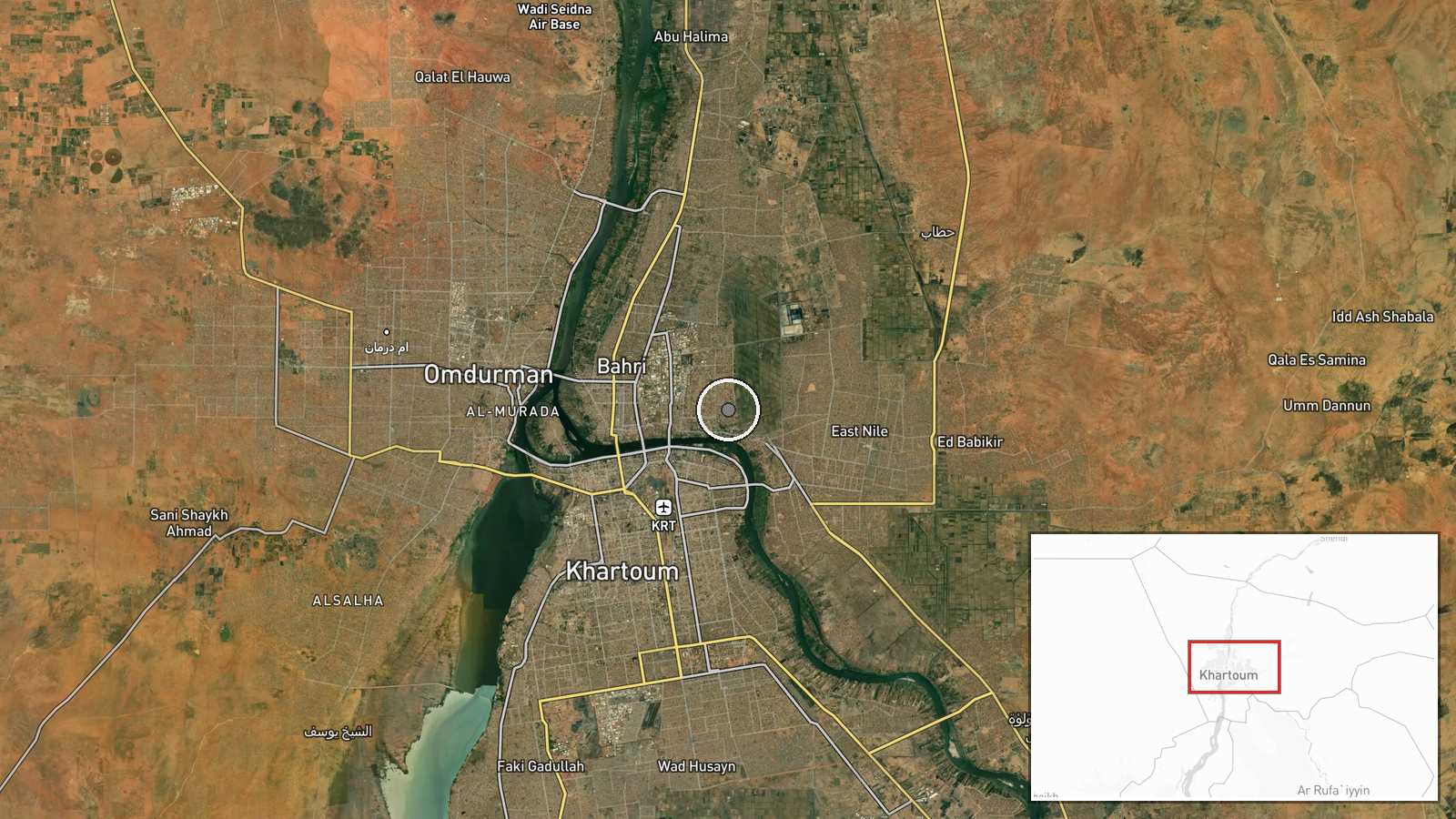
Coordinates place the event at facility-level precision in the Imtidad Nasir neighbourhood of East Khartoum, at approximately 15.63 N, 32.58 E. The location confidence field is empty, so the precision reflects the source tag rather than independent geolocation. The area sits in eastern Khartoum, on the dense residential side of the capital and within the wider Khartoum metropolitan area. The airport, referenced in the same UN-linked reporting, is a separate nearby reference point.
▶ View this event on the live map

Intel Mapper aggregates open-source reports from monitored Telegram and X channels, geolocates them, cross-checks duplicates across sources and assigns a confidence score. Entries are updated as new confirmations arrive. Read how we verify events.