Deir ez-Zor authorities elevate flood readiness as Euphrates water levels rise
What happened
Syrian emergency and disaster management officials in Deir ez-Zor governorate reported raising operational readiness in response to elevated Euphrates River water levels on 30 August. According to the statement, teams have been positioned on the riverbed and around a military bridge for continuous 24-hour field monitoring. Officials stated they are conducting regular inspection tours of the affected area, monitoring water movement and river levels, and providing guidance to civilians.
Context and assessment
Deir ez-Zor lies on the middle Euphrates in eastern Syria, a strategically significant location where water levels and infrastructure crossing the river carry both civilian and military importance. The readiness alert coincides with Turkish and Syrian military activity in the same governorate, including construction and deployment of portable bridges across the Euphrates at nearby Mayadin on the same day. These concurrent developments suggest heightened attention to river crossing infrastructure and civilian safety management. Rising water levels may reflect seasonal variation or upstream dam releases, but the timing alongside military bridge construction indicates dual concern for both civilian flood risk and military logistics.
Sources and confidence
Single source: Syrian Telegram channel @AJSyriaNow on 30 August 2026. No cross-confirmation from independent media or rival sources reported. Confidence score of 7.5 reflects official channel status and specific operational detail, but limited corroboration. Confirmation by humanitarian organisations or satellite imagery of deployment would raise confidence; absence of broader reporting or contradictory assessments from other Syrian actors could lower it.
Location
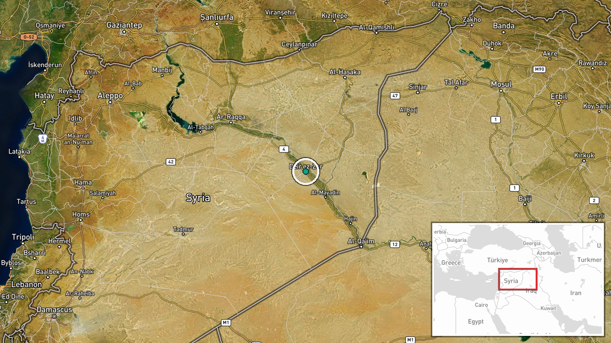
Deir ez-Zor city and surrounding district in Deir ez-Zor Governorate, eastern Syria, on the middle Euphrates River. Precision determined at settlement level (35.3395°N, 40.1451°E). The governorate's main population centre and administrative hub, located approximately 450 kilometres southeast of Damascus. Reference to riverbed and military bridge indicates focus on Euphrates crossing points near or within the city proper.
Related events nearby
- Turkish Armed Forces supporting construction of second mobile bridge in Deir ez-Zor. Military engineering proj2026-08-30 07:36 UTC · Deployment · Deir ez-Zor, Deir ez-Zor Governorate, Syria
- Turkish and Syrian military personnel crossed a newly constructed floating bridge over the Euphrates River. Th2026-08-30 15:36 UTC · Deployment · Al-Mayadin, Deir ez-Zor, Syria
- Turkish Army and Syrian engineers installing a second portable bridge across the Euphrates at Mayadin, Deir ez2026-08-30 07:43 UTC · Deployment · Al-Mayadin, Deir ez-Zor Governorate, Syria
- Dust storm sweeping across Syria. Meteorological phenomenon with no military or security implications reported2026-08-29 17:44 UTC · Security · Syria
▶ View this event on the live map
Intel Mapper aggregates open-source reports from monitored Telegram and X channels, geolocates them, cross-checks duplicates across sources and assigns a confidence score. Entries are updated as new confirmations arrive. Read how we verify events.