Syria announces final stages of Qamishli Airport rehabilitation
What happened
The head of the Syrian Civil Aviation Authority, Omar al-Hasouri, announced on 6 September that rehabilitation and equipment work at Qamishli International Airport in Hasakah Governorate has reached its final stages. The statement, reported via Telegram, indicates progress in restoring the facility's operational capacity. No timeline for full reopening was specified in the available reporting.
Context and assessment
Qamishli Airport, located in northeast Syria near the Turkish border, has been a strategic asset contested during Syria's conflict. Infrastructure rehabilitation announcements typically reflect efforts by Damascus to reassert control and normalcy in contested or recovering regions. The timing coincides with other reconstruction indicators in Hasakah Governorate, including the reopening of Walid Nofal School on 6 September with visible structural damage, and displacement operations returning families to eastern Ras al-Ain. These concurrent developments suggest a broader pattern of Syrian government efforts to restore civilian infrastructure and population stability in the northeast, though the extent of actual operational readiness remains unclear from available sources.
Sources and confidence
Reported solely through Telegram channel @AJSyriaNow on 6 September. The single-source status and lack of corroboration from independent observers, airport authorities, or international monitors constrains confidence to 7.5 out of 10. Confidence would increase with confirmation from commercial aviation databases, independent journalist verification from the site, or statements from international organizations present in Syria.
Location
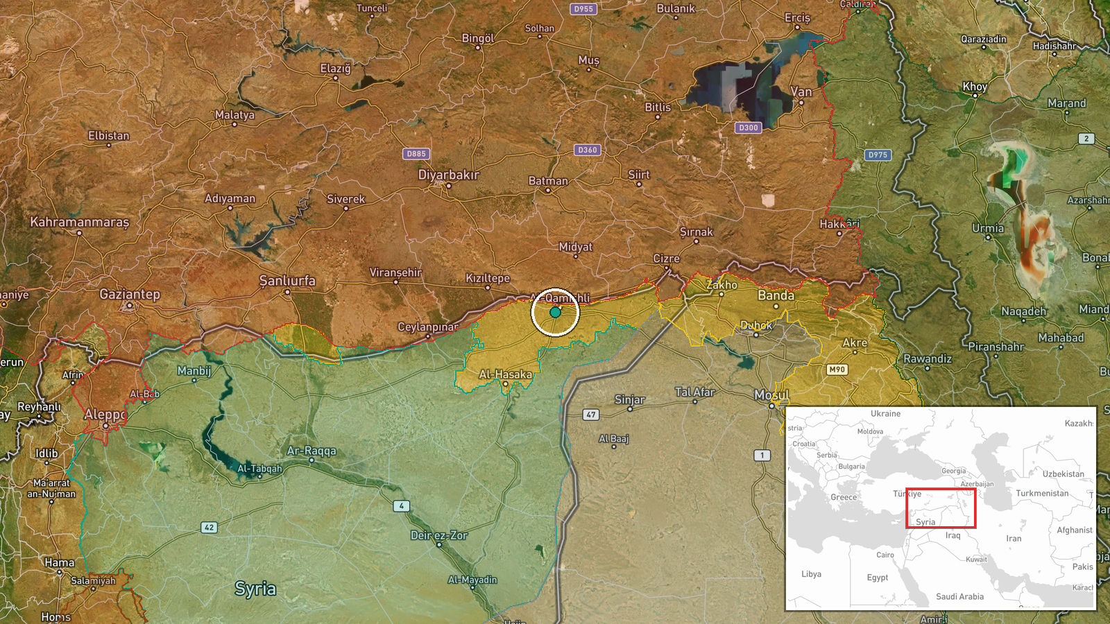
Qamishli International Airport is situated in northeastern Syria in Hasakah Governorate, approximately 40 km south of the Turkish border and near the Iraq-Syria frontier. The airport lies in the Hasakah plain and serves as a regional transportation hub. Precise coordinates place it at 37.02°N, 41.19°E with high settlement-level geographic confidence.
Related events nearby
- Syrian Civil Aviation Authority head Umar Al-Hasri met with Saudi counterpart to discuss institutional coopera2026-09-06 21:33 UTC · Diplomacy · Qamishli International Airport, Hasakah Governorat
- First day of new school year at Walid Nofal School in Al-Hasakah's Al-Lailiya district. Classroom footage show2026-09-06 10:27 UTC · Humanitarian Aid · Al-Hasakah, Hasakah Governorate, Syria
- 725 families prepare to leave Ras al-Ain refugee camp on Tuesday, returning to their original homes in eastern2026-09-06 07:42 UTC · Displacement · Ras al-Ain, Hasaka Governorate, Syria
▶ View this event on the live map
Intel Mapper aggregates open-source reports from monitored Telegram and X channels, geolocates them, cross-checks duplicates across sources and assigns a confidence score. Entries are updated as new confirmations arrive. Read how we verify events.