Houthis strike Saudi energy facilities in Abha region with missiles and drones
What happened
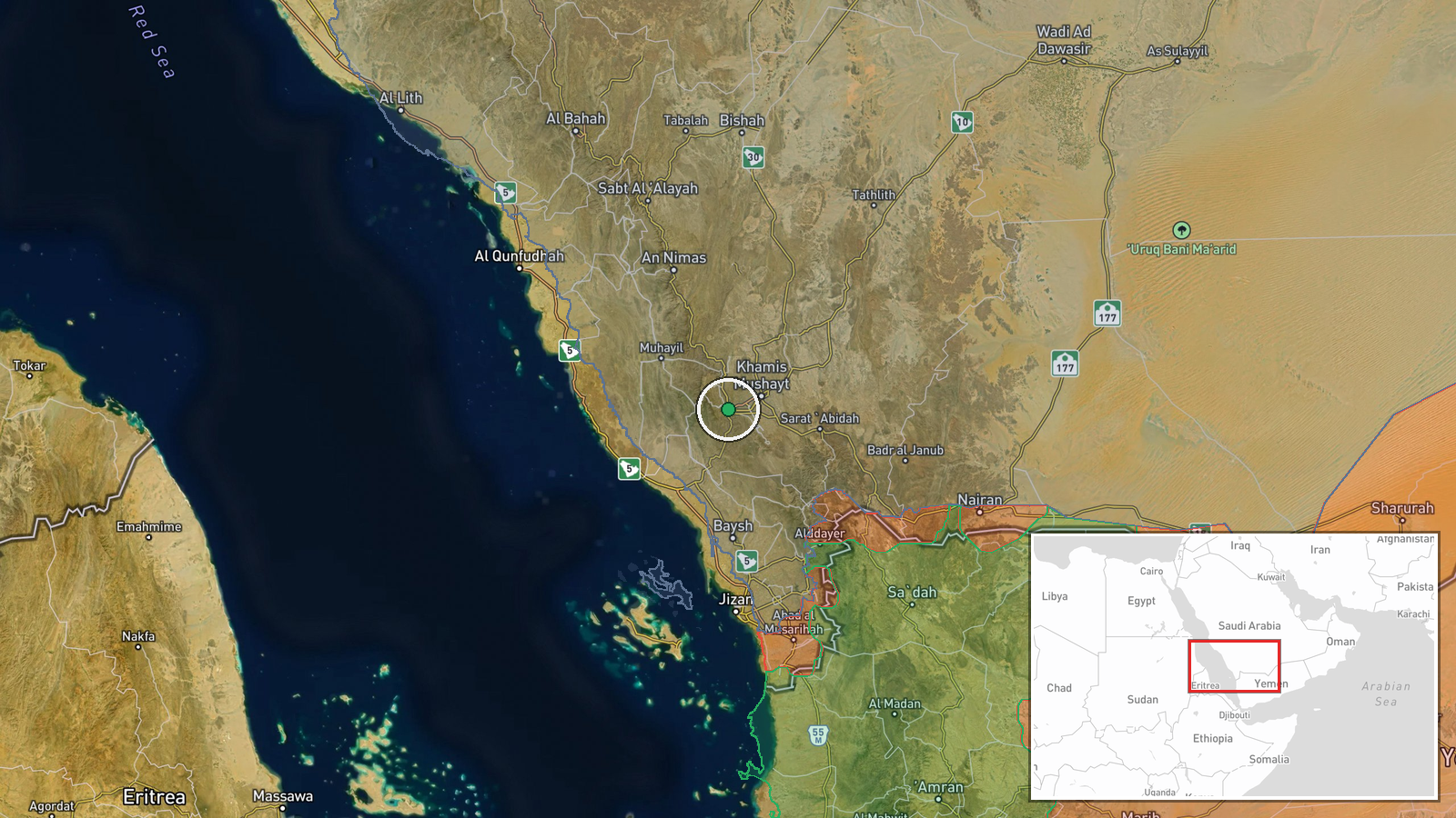
Saudi Arabia's Energy Ministry reported that Houthi forces struck multiple energy sector installations across the southern Asir region, including the Abha area, on September 8. The attacks involved ballistic missiles and unmanned aircraft. According to the ministry statement, the strikes ignited fires at several sites and caused temporary shutdowns of operational systems. Specialized teams were deployed to contain the fires, secure the facilities, and assess damage extent.
Context and assessment
The Abha and wider Asir region has emerged as a recurring target in the escalating Houthi campaign against Saudi energy infrastructure. This strike follows a major coordinated attack on Saudi Aramco's Jizan refinery on September 6—a 400,000 barrel-per-day facility that has remained substantially offline—and precedes another reported assault on southern facilities hours later on September 8 that reportedly wounded 73 civilians. The pattern suggests Houthi operations are broadening to multiple energy nodes across southern Saudi Arabia simultaneously, potentially straining air defenses and emergency response capacity. The temporary operational shutdowns indicate at least partial success in disrupting Saudi energy production.
Sources and confidence
Reported via Telegram channel @AJSyriaNow citing Saudi Energy Ministry statement. Single primary source limits independent verification; confidence score of 7.5 reflects official Saudi corroboration but absence of third-party confirmation. Confidence would increase with reports from regional media or energy sector monitors. Would decrease if subsequent Saudi statements contradict scope or damage claims.
Location
Abha, the capital of Asir Province in southwestern Saudi Arabia, and surrounding southern energy facilities in the region. Precision limited to regional level. Abha sits approximately 80 km east of the Red Sea coast at roughly 2,000 meters elevation. The area hosts both civilian infrastructure and energy sector installations targeted in recent months.
Related events nearby
- Saudi-led coalition reports Houthi attacks on southern Saudi Arabia wounded 73 civilians. Targets included civ2026-09-08 05:34 UTC · Statement · Abha, Asir, Saudi Arabia
- Houthi forces launched ballistic missiles and drones targeting Necran and Abha cities in southern Saudi Arabia2026-09-08 17:24 UTC · Ballistic Missile · Necran and Abha, Asir Region, Saudi Arabia
- Houthi spokesman Yahya Saree announces and confirms large military operation targeting Saudi energy infrastruc2026-09-08 08:14 UTC · Statement · Khamis Mushait, Asir Province, Saudi Arabia
- Houthis launched dozens of ballistic missiles and drones at Aramco facilities and military targets across sout2026-09-08 07:13 UTC · Ballistic Missile · Khamis Mushait, Asir Province, Saudi Arabia
- Houthi forces claimed to have struck aircraft hangars at King Khalid Air Base in Saudi Arabia with ballistic m2026-09-08 13:32 UTC · Ballistic Missile · King Khalid Air Base, Kharj, Riyadh Region, Saudi
▶ View this event on the live map
Intel Mapper aggregates open-source reports from monitored Telegram and X channels, geolocates them, cross-checks duplicates across sources and assigns a confidence score. Entries are updated as new confirmations arrive. Read how we verify events.