Israeli forces withdraw from Tal Ahmar after 20-hour incursion in Syria's Quneitra
What happened
Israeli occupation forces reportedly withdrew from Tal Ahmar in northern Quneitra countryside on September 13 after conducting military operations in the area lasting over 20 hours, according to Syria Now's Telegram channel. The withdrawal concluded an incursion that involved ground forces and armored vehicles operating in the settlement and surrounding countryside.
Context and assessment
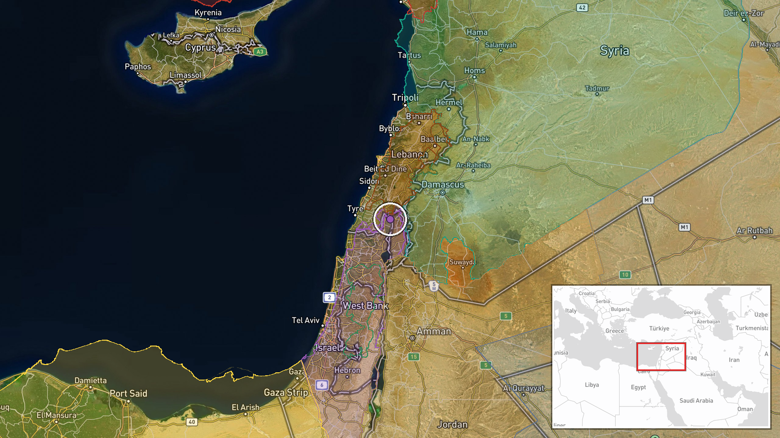
Tal Ahmar lies in northern Quneitra near the Syrian-Lebanese border, a strategically sensitive area where Israeli forces have conducted repeated operations in 2026. This withdrawal follows a broader pattern of Israeli ground incursions across Quneitra and rural Damascus on September 13, including deployments near Ayn al-Nouriyah involving at least six tanks and armored vehicles. The extended duration of the Tal Ahmar operation—over 20 hours—suggests deliberate tactical activity rather than a rapid probe. Concurrent Israeli artillery strikes on southern Lebanon and airstrikes indicate sustained regional military activity, though the specific objectives of the Tal Ahmar operation remain unclear from available reporting.
Sources and confidence
Single source: Telegram channel @AJSyriaNow (Syria Now). No independent cross-confirmation from other channels or outlets. Confidence score of 7.5 reflects direct reporting from a regional news source but lacks corroboration. Score would increase with confirmation from additional sources or Israeli military statements; would decrease if contradicted by later reporting.
Location
Tal Ahmar is a settlement in northern Quneitra Governorate near the village of Ayn al-Nouriyah, positioned close to the Syrian-Lebanese border. The area sits in southwestern Syria's countryside, approximately 25 kilometers south of the Israeli-occupied Golan Heights. Precision: settlement-level, based on geographic coordinates and regional conflict patterns.
Related events nearby
- Israeli forces detained a young shepherd herding sheep near a UN-affiliated facility west of Al-Rafid in Qunei2026-09-13 19:26 UTC · Security · Near Al-Rafid, Quneitra Governorate, Syria
- Lebanese President Joseph Aoun visited Nabatieh under heavy security, meeting residents and pledging state ser2026-09-13 20:02 UTC · Diplomacy · Nabatieh, South Governorate, Lebanon
- Israeli forces conducted new ground infiltrations in rural Damascus and Quneitra, establishing checkpoints, bu2026-09-13 12:49 UTC · Combat · Quneitra, Syria
- Israeli Air Force launched airstrikes on southern Lebanon. No specific targets or casualty figures provided in2026-09-13 16:55 UTC · Airstrike · Southern Lebanon
- Israeli artillery attacked the town of Beit Yahoun in southern Lebanon. Reported by Al-Manar correspondent.2026-09-13 16:28 UTC · Artillery · Beit Yahoun, Nabatiyeh Governorate, Lebanon
▶ View this event on the live map
Intel Mapper aggregates open-source reports from monitored Telegram and X channels, geolocates them, cross-checks duplicates across sources and assigns a confidence score. Entries are updated as new confirmations arrive. Read how we verify events.