Israeli forces advance on Mount Hermon in occupied Syria, citing normalization aims
What happened
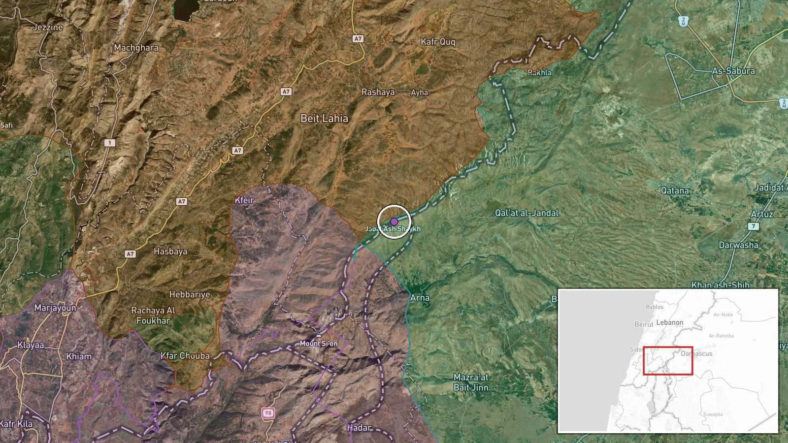
Israeli military forces reportedly advanced and consolidated positions on Mount Hermon (Jabal al-Sheikh) in Syria's Quneitra Governorate on September 16. According to a Telegram report from AJSyriaNow, the operation involved strengthening Israeli control over the strategic peak. The source attributes stated objectives to normalization efforts and electoral considerations, though these characterizations reflect the reporting channel's framing rather than direct Israeli statements.
Context and assessment
Mount Hermon, the highest peak in the region at 2,814 meters, has long held strategic importance for territorial control and surveillance across the Golan Heights and into Syria. Israeli forces have maintained a presence there since 1967, though recent advances suggest intensified consolidation. The timing coincides with elevated diplomatic activity in the region: a UN peacekeeping delegation (UNDOF) met with residents in nearby Sidna village on the same day to address security concerns about Israeli military incursions, and Syrian military leadership visited Russian positions at Hmeimim Air Base, potentially signaling coordination among Assad's allies. The framing of electoral and normalization motives suggests internal Israeli political dimensions alongside military strategy, though independent confirmation of these specific objectives remains limited.
Sources and confidence
Reported by a single Telegram channel (AJSyriaNow) with no cross-confirmation from other media outlets or official statements. The confidence score of 7.5 reflects the absence of corroborating sources and reliance on secondary reporting. Confirmation from Israeli military statements, Syrian government responses, or reports from on-ground observers would strengthen confidence. Contradictory accounts from other regional sources would lower it.
Location
Mount Hermon (Jabal al-Sheikh), the tri-border peak shared by Syria, Lebanon, and the Israeli-occupied Golan Heights, situated at approximately 33.416°N, 35.858°E in Quneitra Governorate. The location determination is exact based on geographic coordinates. The peak dominates the southern Syrian landscape and overlooks the occupied territories to the south and southeast.
Related events nearby
- Israeli occupation forces released a young man from Ruwihina village, Quneitra Countryside, after approximatel2026-09-15 15:56 UTC · Security · Ruwihina, Quneitra Countryside, Syria
- Syrian security forces in Al-Kiswa conducted an operation seizing approximately 4 kg of hashish distributed ac2026-09-16 07:09 UTC · Security · Al-Kiswa, Rif Dimashq Governorate, Syria
- Syrian Chief of General Staff Ali al-Nussan toured Hmeimim Air Base in Latakia, conducting meetings with Russi2026-09-16 13:46 UTC · Diplomacy · Damascus, Syria
- UNDOF delegation held discussions with residents and farmers of Sidna village (Golan) addressing security conc2026-09-16 11:55 UTC · Diplomacy · Quneitra Governorate, Golan Heights, Syria
- Jordanian military apprehended an individual attempting to illegally infiltrate from Syria into Jordanian terr2026-09-16 10:26 UTC · Security · Jordan-Syria Border, Daraa Governorate, Jordan
▶ View this event on the live map
Intel Mapper aggregates open-source reports from monitored Telegram and X channels, geolocates them, cross-checks duplicates across sources and assigns a confidence score. Entries are updated as new confirmations arrive. Read how we verify events.