Syrian government restores electricity to Al-Tamanah after 14-year outage
What happened
The Syrian Ministry of Energy announced the restoration of electrical power to Al-Tamanah subdistrict in rural Idlib Governorate on September 16, ending an outage lasting more than 14 years. The ministry stated that two aerial transformer centers with capacities of 200 and 400 kilovolt-amperes were installed to supply the area. The announcement was made via the official AJSyriaNow Telegram channel.
Context and assessment
Al-Tamanah lies in Idlib Governorate, a region that remained outside government control for most of Syria's civil war before recent territorial changes. The extended power outage reflects the breakdown of civilian infrastructure across opposition-held areas during years of conflict. Infrastructure restoration projects, particularly utilities serving rural populations, typically indicate consolidation of state authority and normalization efforts. The timing coincides with broader Syrian government initiatives to reassert administrative control over previously fragmented territories, though the scope and sustainability of such projects remain subject to operational and resource constraints.
Sources and confidence
Report sourced from AJSyriaNow Telegram channel; single-channel confirmation limits independent cross-verification. Confidence score of 7.5 reflects official government attribution and specificity of technical details, but absence of secondary confirmation or on-site verification. Score would increase with independent reporting from local witnesses or international observers; would decrease if contradicted by alternative accounts of grid status in the area.
Location
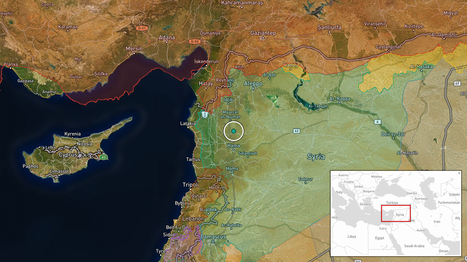
Al-Tamanah subdistrict is located in rural Idlib Governorate in northwestern Syria at approximately 35.46°N, 36.75°E. The settlement sits in the Idlib countryside, a predominantly agricultural region in the northern Syrian steppe terrain. Proximity to the Turkish border and historical opposition-held territory characterizes the broader area.
Related events nearby
- HTS Internal Security Directorate in Ar-Rastan arrested a network accused of contacting suspicious foreign ent2026-09-16 09:59 UTC · Security · Ar-Rastan, Homs Governorate, Syria
▶ View this event on the live map
Intel Mapper aggregates open-source reports from monitored Telegram and X channels, geolocates them, cross-checks duplicates across sources and assigns a confidence score. Entries are updated as new confirmations arrive. Read how we verify events.