HTS removes barriers, reopens roads in Ras al-Ayn after seven-year closure
What happened
The HTS-administered municipal authority in Ras al-Ayn, Hasaka Governorate, has removed concrete barriers blocking traffic within the town and reopened roads after approximately seven years of closure. According to a report from the Telegram channel AJSyriaNow, technical teams are installing speed bumps on streets as part of the reopening effort. The action restores vehicle circulation through the municipality following an extended period of restricted access.
Context and assessment
Ras al-Ayn lies in northeastern Syria near the Turkish border, a strategically significant location that has witnessed multiple control changes during the Syrian conflict. The seven-year closure suggests the barriers were erected during earlier phases of the conflict or following HTS consolidation in the region. The reopening and installation of safety infrastructure indicate normalization efforts by the current HTS administration, reflecting a shift toward municipal governance and civilian movement rather than active conflict operations. Such infrastructure changes typically signal stabilization phases where administrations prioritize civilian services and traffic management.
Sources and confidence
Reported by a single Telegram channel (AJSyriaNow). The confidence score of 7.5 reflects reliance on one source without cross-confirmation from independent observers or additional channels. Confidence would increase with corroboration from second sources, humanitarian organizations, or local media; it could lower if subsequent reports contradict the timeline or scope of the reopening.
Location
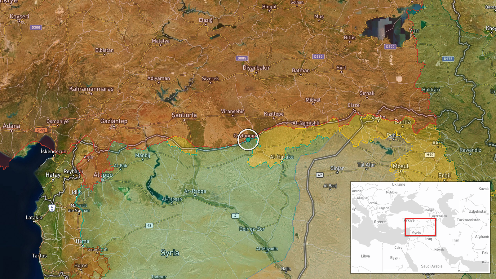
Ras al-Ayn is a settlement in Hasaka Governorate, northeastern Syria, positioned near the Turkish border. The coordinates place it in the town itself. The location is geographically significant as a crossing point and commercial hub in the region, with high confidence based on established settlement geography.
▶ View this event on the live map
Intel Mapper aggregates open-source reports from monitored Telegram and X channels, geolocates them, cross-checks duplicates across sources and assigns a confidence score. Entries are updated as new confirmations arrive. Read how we verify events.