Syrian authorities deploy heavy engineering equipment to rehabilitate Al-Mayadin bridge in Deir ez-Zor
What happened
Heavy engineering equipment arrived in the countryside near Al-Mayadin, Deir ez-Zor on 28 September to begin preparation and rehabilitation work on Al-Mayadin bridge. The deployment was announced as a civil infrastructure reconstruction project under Syrian Government authority. A local resident reportedly greeted the equipment arrival in what the source describes as a spontaneous welcome. The work represents part of broader infrastructure restoration efforts in the eastern Syrian governorate.
Context and assessment
Al-Mayadin lies in Deir ez-Zor, a region that experienced prolonged conflict and remains strategically significant given its oil resources and location along the Euphrates River corridor. Bridge rehabilitation typically indicates normalization and reconnection of transport routes across fragmented territory. This announcement follows a period of Syrian Government security operations, including a multi-governorate ISIS cell dismantling operation on 27 September and a HTS custody release in nearby Al-Busirah on 28 September. The timing suggests possible coordination between security clearing and infrastructure restoration as part of broader stabilization efforts in the governorate.
Sources and confidence
Single source via Telegram channel @AJSyriaNow, which reported the arrival with user-generated imagery. No cross-confirmation from other channels at time of posting. Confidence of 7.5 reflects single-source reporting of a routine infrastructure announcement, though the source is established. Confirmation by Syrian Government statements, additional media outlets, or documented progress on the bridge would strengthen confidence; contradictory reports or denial of the project would lower it.
Location
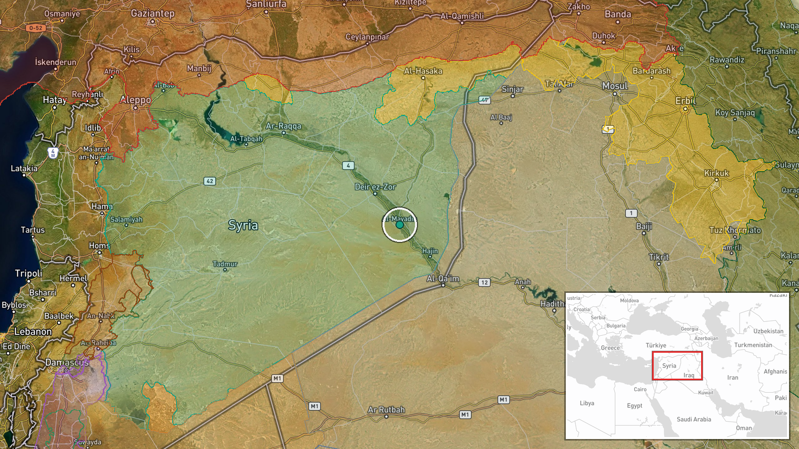
Al-Mayadin, a settlement in Deir ez-Zor Governorate along the Euphrates River in eastern Syria. Coordinates place the bridge location near the town center (35.02°N, 40.45°E). The area lies approximately 90 kilometers southeast of Deir ez-Zor city and is accessible via primary regional highways. Al-Mayadin serves as a local transport hub connecting communities across the river.
Related events nearby
- HTS Interior Security released Eid Hamid Al-Abdullah, a youth kidnapped in Al-Busirah, after 12 hours in custo2026-09-28 06:22 UTC · Security · Al-Busirah, Deir ez-Zor, Syria
- Syrian Internal Security Forces conducted multi-governorate security operation dismantling ISIS cell. Seized e2026-09-27 18:42 UTC · Security · Multiple Governorates, Syria
▶ View this event on the live map
Intel Mapper aggregates open-source reports from monitored Telegram and X channels, geolocates them, cross-checks duplicates across sources and assigns a confidence score. Entries are updated as new confirmations arrive. Read how we verify events.