Israeli forces establish temporary checkpoint at Syria border crossing
What happened
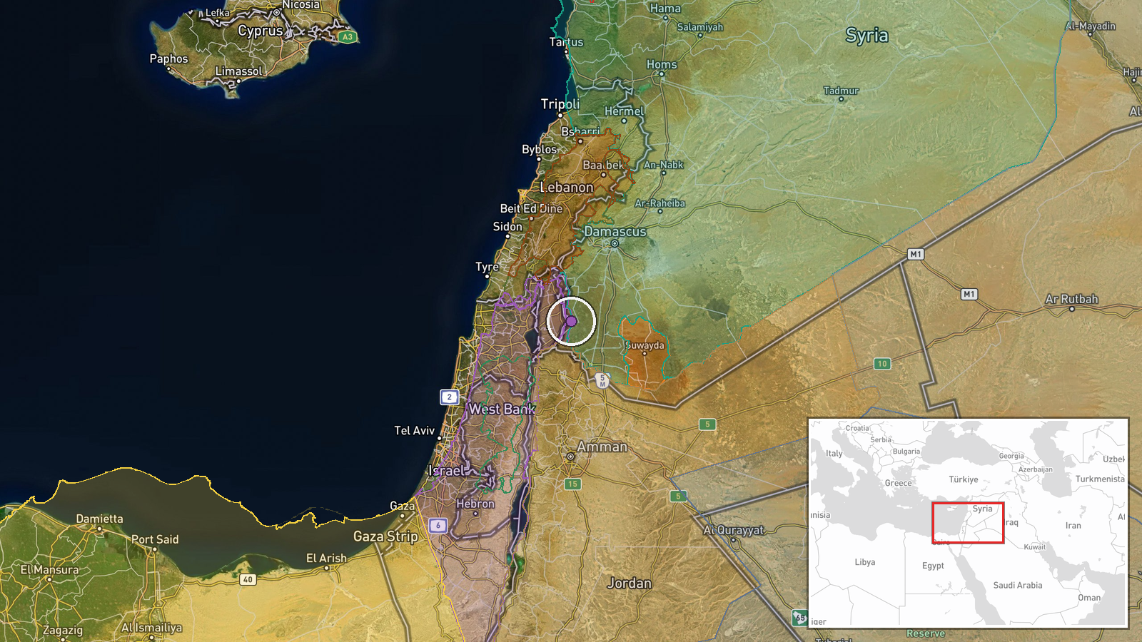
Israeli occupation forces reportedly set up a temporary checkpoint at Wadi al-Ruqqad Bridge, which spans the border between Quneitra and Daraa governorates in southwestern Syria. The checkpoint was established on October 5 at approximately 08:30 UTC. The report comes from a single Telegram channel and describes a security measure rather than a combat engagement.
Context and assessment
The checkpoint placement occurs amid a pattern of intensified Israeli military activity in the Quneitra Golan Heights region. On October 4, Israeli forces conducted operations including armored vehicle movements through Al-Asbah village, reconnaissance flights, and continued earthwork construction on what has been termed 'Project Sofa 53'—an expansion of positions on the occupied Golan Heights. Jordan's Foreign Ministry condemned these activities as violations of Syrian sovereignty. The checkpoint may reflect efforts to control movement across the Quneitra-Daraa border during a period of heightened Israeli operations in the area, though its specific purpose and duration remain unclear from available reporting.
Sources and confidence
Single source: Telegram channel @AJSyriaNow. No cross-confirmation from other channels or agencies reported. Confidence score of 7.5 reflects reliance on a single open-source channel without independent verification. Confirmation from additional regional sources or Israeli military statements would substantially raise confidence. Lower confidence is typical for checkpoint establishment reports, which often lack secondary corroboration.
Location
Wadi al-Ruqqad Bridge located on the administrative boundary between Quneitra and Daraa governorates in southwestern Syria, coordinates 32.947°N 35.928°E. The bridge crosses a seasonal watercourse (wadi) in the Golan Heights region. This area sits near the Israeli-occupied zone and has been a focal point of recent Israeli military expansion activities.
Related events nearby
- Israeli military force with multiple armored vehicles infiltrating village of Al-Asbah in Quneitra. Illuminati2026-10-04 20:35 UTC · Combat · Al-Asbah, Quneitra Governorate, Syria
- Israeli forces shot and killed a 22-year-old Palestinian from Damascus who attempted to infiltrate an Israeli 2026-10-05 07:07 UTC · Security · Golan Heights border, Israel-Syria demarcation lin
- Israeli forces shot and killed an individual attempting to infiltrate an Israeli military position in southern2026-10-04 21:43 UTC · Security · Quneitra Governorate, Golan Heights, Syria
- Israeli 'Project Sofa 53' military operations advance south of Quneitra with ongoing excavation and earthwork 2026-10-04 17:53 UTC · Deployment · Quneitra Governorate, Golan Heights, Syria-Israel
- Jordan's Foreign Ministry condemns Israel's resumption of operations on 'Line 53' in Quneitra, Syria, calling 2026-10-04 16:14 UTC · Statement · Quneitra Governorate (Line 53), Golan Heights, Syr
▶ View this event on the live map
Intel Mapper aggregates open-source reports from monitored Telegram and X channels, geolocates them, cross-checks duplicates across sources and assigns a confidence score. Entries are updated as new confirmations arrive. Read how we verify events.