Israeli forces detonate abandoned barracks west of Damascus
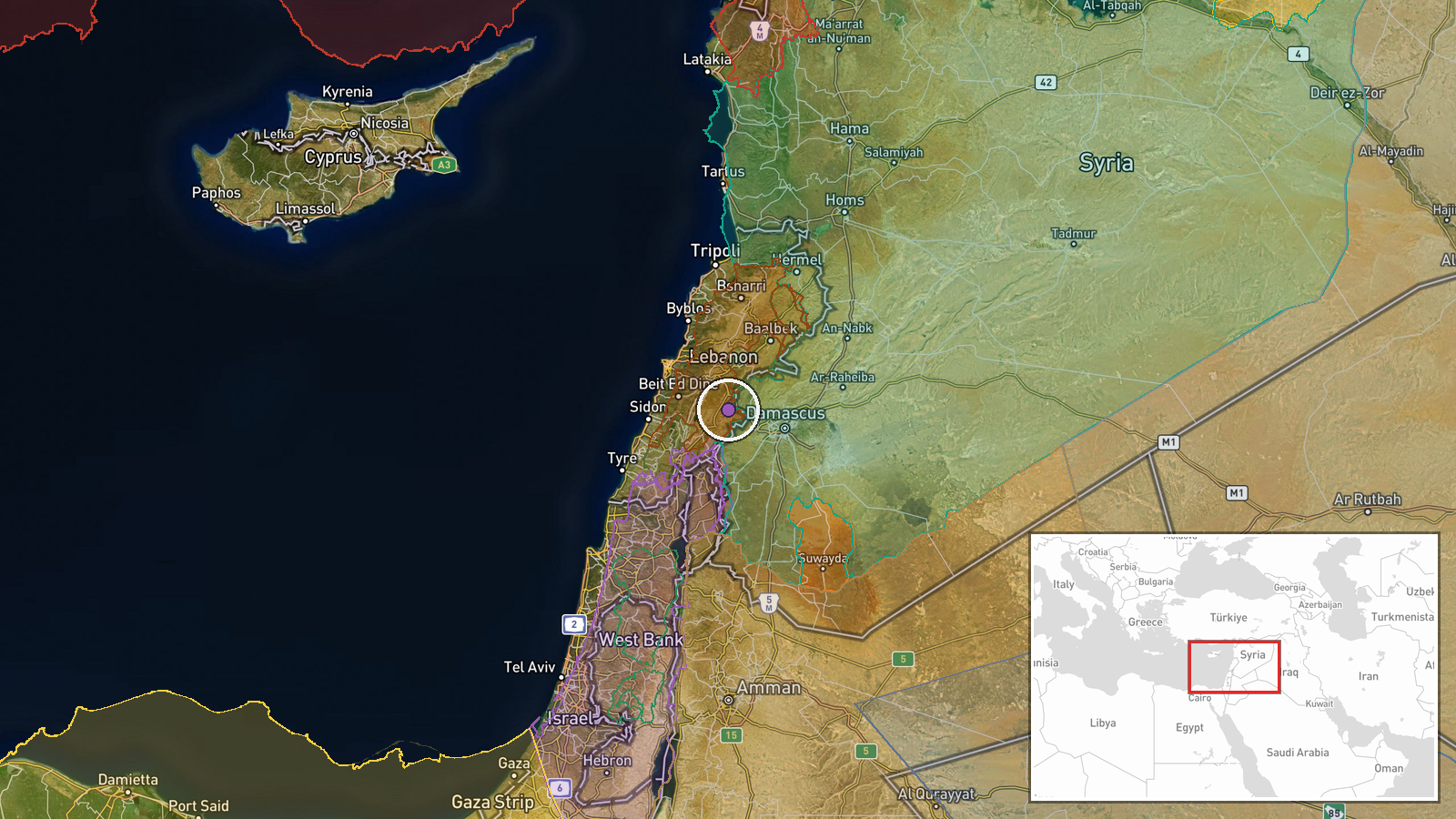
What happened
Israeli Air Force carried out an airstrike and detonation of an abandoned military barracks at Tel Harbon near Beit Jan, located west of Damascus, on 12 October 2026 at 14:50 UTC, according to local sources reporting via Telegram. The facility targeted was described as unoccupied at the time of the strike.
Context and assessment
Tel Harbon lies in Rif Dimashq, the rural district surrounding Damascus, an area that has periodically seen Israeli military operations targeting suspected Iranian or Hezbollah positions and infrastructure. The demolition of an abandoned military barracks suggests Israeli intent to deny potential use of the site, consistent with a broader pattern of strikes aimed at degrading Syria-based assets or infrastructure that could support regional militant groups. The precision targeting of a specific facility rather than surrounding civilian areas indicates either pre-planned demolition or response to identified military value, though the abandonment status limits assessment of operational impact.
Sources and confidence
Single-source reporting from Telegram channel @AJSyriaNow. Confidence score of 7.6 reflects limited corroboration; local channels often report Israeli strikes in Syria, but independent verification is difficult. Cross-confirmation from additional Syrian or international sources would strengthen confidence. Direct Israeli military statement or regional media outlets would raise confidence; absence of corroboration from Damascus or contention of details would lower it.
Location
Tel Harbon, a hilltop settlement identifier, lies near Beit Jan village in Rif Dimashq governorate approximately 40 kilometers west of Damascus city center. The area sits within the rural Ghouta region, historically contested terrain during Syria's civil conflict. Geographic precision is at settlement level based on named location references provided by source.
Related events nearby
- Israeli occupation forces advance into Wadi al-Raqad outskirts in rural Daraa via multiple military vehicles. 2026-10-12 15:54 UTC · Combat · Wadi al-Raqad, Daraa Governorate, Syria
- A Hezbollah rocket submunition detonated on a school hike at Ramim Ridge, killing 1 teenager and wounding 24 o2026-10-12 15:25 UTC · Explosion · Ramim Ridge, Northern Israel
- IDF preliminary investigation concluded a Hezbollah cluster munition left in northern Israel detonated. Invest2026-10-12 14:50 UTC · Explosion · Northern Israel, Israel
- Syrian Energy Ministry launches maintenance and rehabilitation project for new water distribution facility at 2026-10-12 14:35 UTC · Humanitarian Aid · Al-Qusayr, Homs Governorate, Syria
▶ View this event on the live map

Intel Mapper aggregates open-source reports from monitored Telegram and X channels, geolocates them, cross-checks duplicates across sources and assigns a confidence score. Entries are updated as new confirmations arrive. Read how we verify events.