Heavy rain causes water accumulation in Wadi al-Shula, eastern Syria
What happened
Heavy rainfall across Syria on Monday, 12 October resulted in water pooling in Wadi al-Shula, a valley in Deir ez-Zor Governorate in eastern Syria. Meteorological monitoring of the situation is ongoing, according to the Telegram channel Syria Now. The report notes rainfall occurred across multiple areas of Syria during the same period, though no specific accumulation measurements or flood impacts are detailed.
Context and assessment
Wadi al-Shula lies in the arid badlands region of eastern Deir ez-Zor Governorate, where precipitation is infrequent and drainage infrastructure limited. Heavy rainfall in this terrain typically causes temporary water accumulation in seasonal watercourses. The timing coincides with a reported oil tanker explosion in Deir ez-Zor city on the same date, though the two incidents appear unrelated. Water management and drainage conditions in the wider region remain relevant for humanitarian operations, particularly given ongoing displacement movements in neighboring Hasaka Governorate. The report reflects routine meteorological monitoring rather than an emergency situation.
Sources and confidence
Single source: Telegram channel @AJSyriaNow, posting in Arabic. No independent corroboration available. Confidence score of 7.8 reflects factual nature of weather reporting but single-source limitation. Cross-confirmation from meteorological agencies or humanitarian organizations would strengthen confidence. Absence of corroboration does not indicate inaccuracy, given routine nature of weather reports.
Location
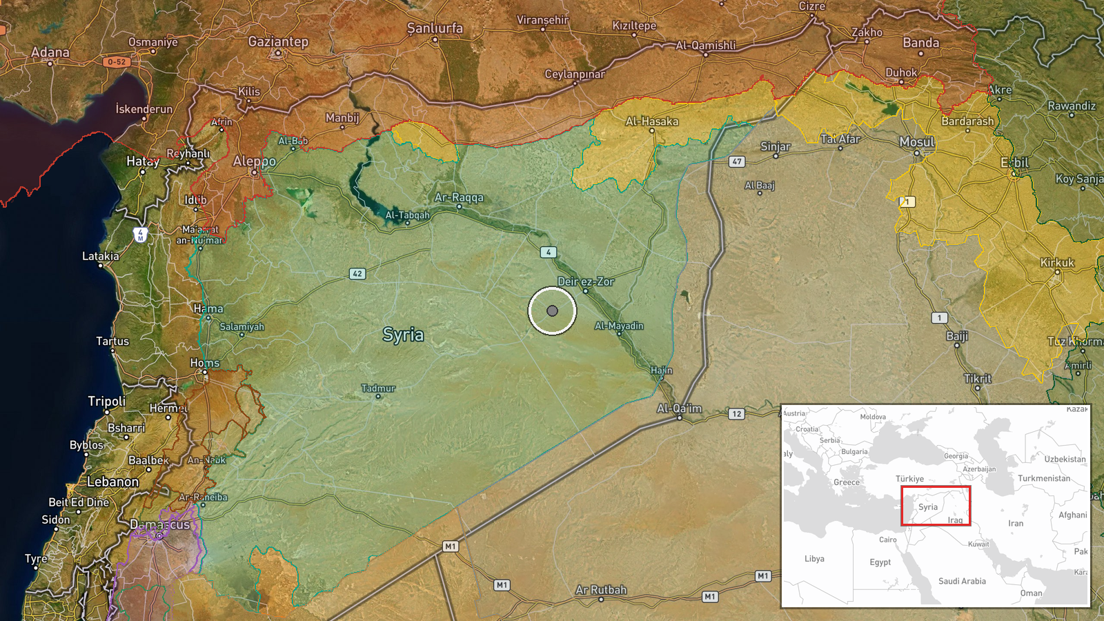
Wadi al-Shula is a seasonal valley in Deir ez-Zor Governorate's badlands region, approximately 35 km north-northeast of Deir ez-Zor city center. The governorate is Syria's easternmost territory, bordering Iraq. Precision: regional (wadi-level). Coordinates place the feature in sparsely populated steppe terrain with minimal infrastructure.
Related events nearby
- Oil tanker explosion reported in Deir ez-Zor city, eastern Syria. No casualties or additional details availabl2026-10-12 22:23 UTC · Explosion · Deir ez-Zor, Deir ez-Zor Governorate, Syria
- Approximately 385 families depart Tal'i displacement camp in Hasaka, heading to their original areas in Ras al2026-10-13 07:42 UTC · Displacement · Syria (location not reported)
▶ View this event on the live map

Intel Mapper aggregates open-source reports from monitored Telegram and X channels, geolocates them, cross-checks duplicates across sources and assigns a confidence score. Entries are updated as new confirmations arrive. Read how we verify events.