Water levels declining at Al-Wahdah Dam on Syria-Jordan border
What happened
Syria Now, a Telegram channel, documented a decline in water levels at Al-Wahdah Dam situated on the Syria-Jordan border. The report includes video documentation of the reduced water level at the facility. The observation was made on 13 October 2026. No specific cause for the decline was stated in the available report, which framed the matter as ongoing meteorological monitoring.
Context and assessment
Al-Wahdah Dam serves as a critical water infrastructure asset for both Syria and Jordan, managing flow in the Yarmouk River basin. The timing of this documentation coincides with a period of elevated Israeli military activity in southern Syria, including incursions into Daraa and Quneitra governorates on 12-13 October. While water-level fluctuations can result from natural seasonal variation, drought, or routine water management, the concurrent security situation in the border region warrants consideration of whether operational factors may be affecting dam management or access. Syrian government assessments of conditions in affected areas were ongoing during this period.
Sources and confidence
Reported solely by Syria Now (@AJSyriaNow) Telegram channel. No cross-confirmation from alternative sources or official Syrian dam management statements is currently available. The single-source status and lack of independent verification accounts for the moderate confidence score of 7.6. Confirmation from Jordanian water authorities, satellite imagery analysis, or Syrian government statements would substantiate the observation.
Location
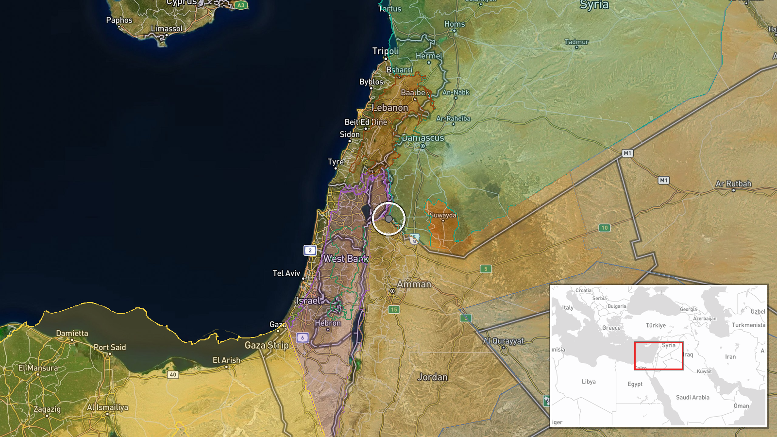
Al-Wahdah Dam is located on the Yarmouk River at the Syria-Jordan border, approximately 32.73°N, 35.87°E in the southern borderland region. The dam serves as a transboundary water management facility. The surrounding area is part of the contested southern Syria frontier zone experiencing active military operations.
Related events nearby
- Israeli military and reconnaissance aircraft conducted aerial operations over Daraa Governorate airspace.2026-10-12 17:15 UTC · Combat Aircraft · Daraa Governorate, Syria
- Israeli occupation forces advance into Wadi al-Raqad outskirts in rural Daraa via multiple military vehicles. 2026-10-12 15:54 UTC · Combat · Wadi al-Raqad, Daraa Governorate, Syria
- Israeli military patrol comprising 4 armored vehicles penetrated Breqaa village in Quneitra Governorate and co2026-10-12 17:16 UTC · Security · Breqaa, Quneitra Governorate, Syria
- Israeli occupation forces abducted a young man from Breiqah village in Quneitra countryside and released him a2026-10-13 07:03 UTC · Security · Breiqah, Quneitra Countryside, Syria
- Syrian Government delegation from the People's Council visited Quneitra Governorate to assess local conditions2026-10-13 09:30 UTC · Statement · Quneitra, Quneitra Governorate, Syria
▶ View this event on the live map

Intel Mapper aggregates open-source reports from monitored Telegram and X channels, geolocates them, cross-checks duplicates across sources and assigns a confidence score. Entries are updated as new confirmations arrive. Read how we verify events.