Fuel shipment arrives at Banyas port as Syria tightens monitoring procedures
What happened
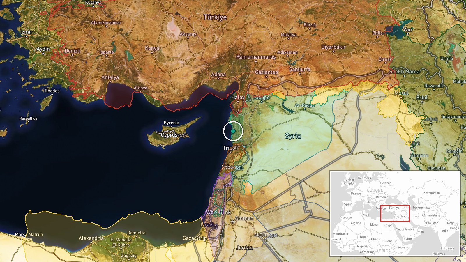
A new fuel shipment reportedly arrived at Banyas port in Tartous Governorate on October 13, according to Syrian state media. The report notes that the delivery occurred amid enhanced monitoring procedures. This continues a pattern of fuel supply operations to Syrian refineries and distribution networks that have been documented over consecutive days at the same facility.
Context and assessment
Banyas port serves as Syria's primary oil export and import terminal on the Mediterranean coast, making fuel arrivals strategically significant for the country's energy infrastructure. The timing follows at least two prior documented fuel shipments at the same location within 24 hours—one involving 500,000 tonnes of product and another 65,000 tonnes of diesel. The repeated emphasis on monitoring procedures may reflect heightened scrutiny of maritime traffic, possibly related to international sanctions frameworks or regional security concerns. The scale and frequency of these operations suggest Syria is prioritizing fuel supply to maintain refinery operations and domestic distribution networks.
Sources and confidence
Single source: Telegram channel @AJSyriaNow, reportedly aligned with Syrian state media. No cross-confirmation from independent monitors or international agencies documented. Confidence score of 7.6 reflects the single-source limitation and vague reporting language ('new shipment'). Confirmation from satellite imagery of vessel movements, port activity monitoring, or secondary news sources would substantially increase confidence.
Location
Banyas (also Banias) port is located in Tartous Governorate on Syria's Mediterranean coast at approximately 35.18°N, 35.95°E. Precision is regional rather than precise due to source wording. The port facility sits north of the city of Tartous and represents Syria's main maritime petroleum infrastructure node.
Related events nearby
- Syria Monitoring reports 15 fuel tankers carrying 500,000 tonnes of gasoline and diesel arrived at Banyas oil 2026-10-13 13:43 UTC · Report · Banyas Oil Terminal, Tartous Governorate, Syria
- Lebanese Army seized ~1,000 tons of explosives smuggled from Syria through Bekaa warehouses last month. All Ir2026-10-13 11:47 UTC · Security · Bekaa Region, Lebanon
- Hezbollah announces housing assistance program for Lebanese families displaced by conflict, covering rent and 2026-10-13 09:25 UTC · Statement · Dahiyeh, Beirut, Lebanon
- Lebanese President announces ceasefire agreement with Israel, stating the deal limits Israeli attacks while fa2026-10-13 10:55 UTC · Statement · Beirut, Lebanon
- Lebanese Justice Minister Adel Nassar confirms seizure of Hezbollah explosives truck, stating the load could h2026-10-12 17:47 UTC · Statement · Beirut, Lebanon
▶ View this event on the live map

Intel Mapper aggregates open-source reports from monitored Telegram and X channels, geolocates them, cross-checks duplicates across sources and assigns a confidence score. Entries are updated as new confirmations arrive. Read how we verify events.