OPCW Director Visits Chemical Weapons Massacre Memorial in Zamlaka, Syria
What happened
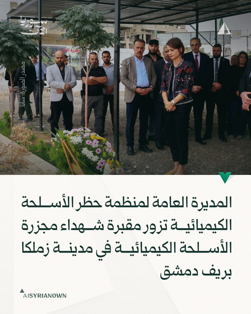
The Director-General of the Organisation for the Prohibition of Chemical Weapons, Sabrina Dallafior, visited a cemetery memorial in Zamlaka, Rif Dimashq, on 14 October to commemorate victims of chemical weapons attacks. The visit was reported by Syrian state media (SANA) via Telegram. It follows high-level meetings between Dallafior and Syrian Foreign Minister Asaad Al-Shebani in Damascus the previous day regarding Syria's chemical weapons file and accountability mechanisms.
Context and assessment
Zamlaka, a suburb east of Damascus in rural Rif Dimashq, experienced documented chemical weapons attacks during Syria's civil war. The OPCW visit appears part of ongoing diplomatic engagement to finalize Syria's compliance with the Chemical Weapons Convention. The timing coincides with Syria's stated bid to secure a natural position within the OPCW itself, suggesting an effort to rehabilitate its international standing on chemical weapons accountability. Dallafior's visit to a victims' memorial indicates symbolic recognition of past harms while formal discussions with the Foreign Ministry address institutional mechanisms for resolving outstanding issues in Syria's chemical weapons file.
Sources and confidence
Reported by Syrian state news agency SANA via Telegram channel @AJSyriaNow. Single source limits confirmation; no independent verification from OPCW official channels or international media is evident in the provided data. Confidence score of 7.6 reflects reliable state media sourcing but lack of corroborating reports. Confirmation from OPCW press releases or international news outlets would strengthen confidence.
Location
Zamlaka is a settlement located in Rif Dimashq (rural Damascus governorate), approximately 15 kilometres east of central Damascus at coordinates 33.53°N, 36.35°E. The suburb lies in the agricultural belt surrounding the Syrian capital and was among areas affected by chemical weapons use documented during the Syrian conflict.
Related events nearby
- Syrian Foreign Minister Asaad Al-Shebani condemns Israeli violations within Syrian territory during press conf2026-10-13 17:24 UTC · Statement · Damascus, Syria
- Syria's Ministry of Energy tasked the Syrian Petroleum Company with creating a mechanism to compensate citizen2026-10-13 16:23 UTC · Statement · Damascus, Syria
- Syrian Foreign Minister Al-Shebani met with OPCW Director-General Sabrina Dalvaviour in Damascus to discuss fi2026-10-13 16:17 UTC · Diplomacy · Damascus, Syria
- Syrian Foreign Minister Asaad Al-Shebani accuses Israel of supporting and arming an outlawed militia in As-Suw2026-10-13 15:58 UTC · Statement · Damascus, Syria
- Syrian Foreign Minister Asaad Al-Shebani states Syria seeks a natural position within the Organisation for the2026-10-13 15:48 UTC · Statement · Damascus, Syria
▶ View this event on the live map

Intel Mapper aggregates open-source reports from monitored Telegram and X channels, geolocates them, cross-checks duplicates across sources and assigns a confidence score. Entries are updated as new confirmations arrive. Read how we verify events.