Israeli convoy of five vehicles reportedly advances toward al-Mu'akar, southern Quneitra
What happened
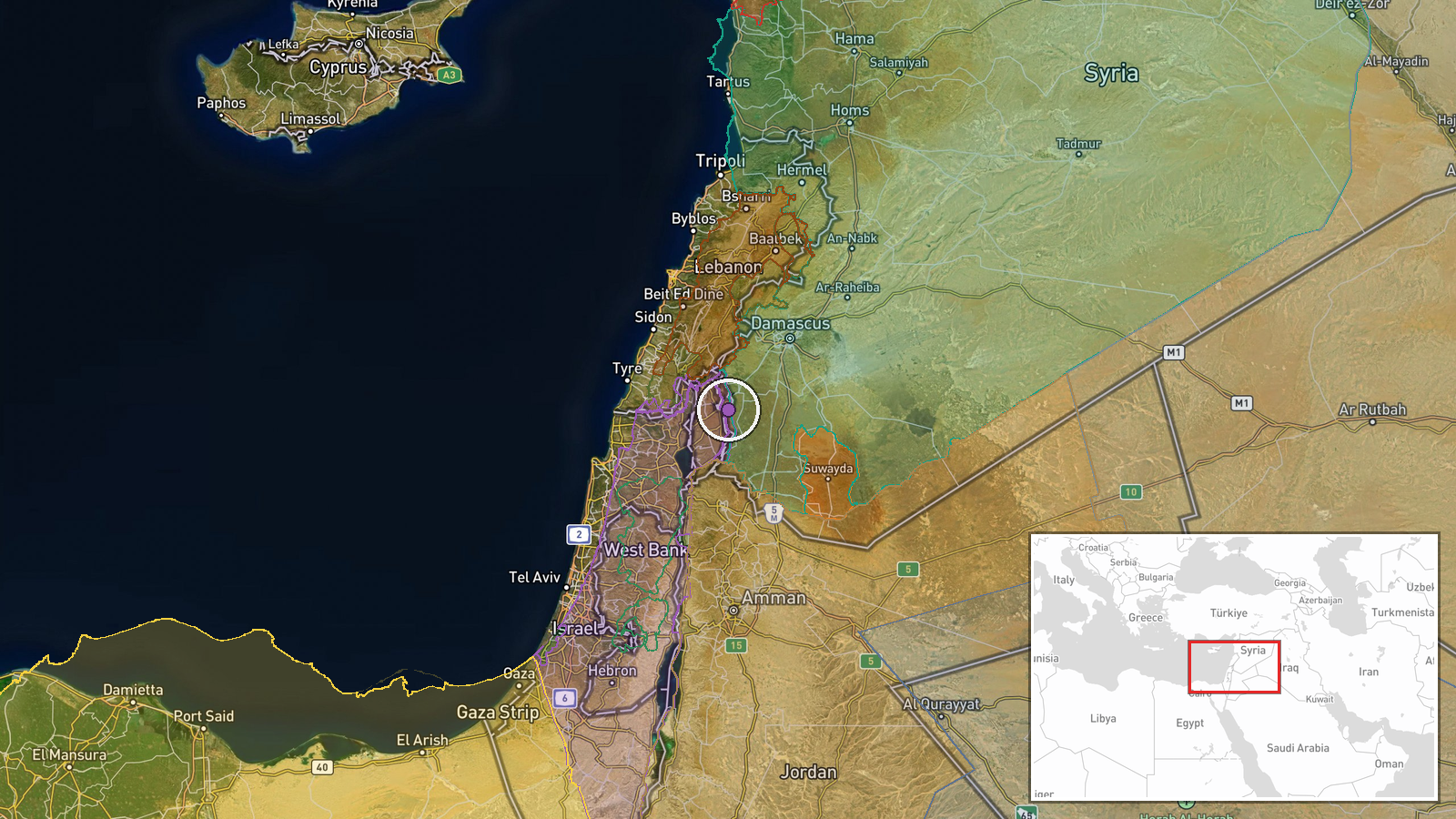
A Telegram channel listed as @AJSyriaNow reported that Israeli forces advanced with five military vehicles from the Tal Abu al-Ghaith gate toward the al-Mu'akar area, west of Mazraat al-Hanut in the southern countryside of Quneitra Governorate, Syria. The post is attributed to a correspondent and written in Arabic. Its wording describes the force as penetrating the area, but it does not mention gunfire, casualties, detentions, or damage. The event is timestamped 16 October 2026 at 09:21 UTC and is classified as a convoy movement. Because the claim rests on one channel and no visual material is attached, the report describes movement only and should be read as a field account rather than a confirmed military action.
Context and assessment
Quneitra's southern countryside sits inside the area that has long been separated from Israeli-held Golan under the 1974 disengagement arrangements, so vehicle movements there draw close attention. The report fits a wider pattern visible in the surrounding reporting. On 15 October, Israeli forces reportedly struck military positions on the Mount Hermon slopes above Baqsam in western Rif Dimashq, placing activity along the same high ground that overlooks the Quneitra and Damascus countryside. The next morning, Lebanese reports described Israeli fire on Beit Yahoun and Al-Mansouri in the south of Lebanon, though the weapon type was not specified. Separately, a Syrian government official accused Israel of interfering in Suwayda and arming militias there. Read together, these items suggest a sustained Israeli focus on the southern Syrian frontier. A convoy moving through farmland west of Mazraat al-Hanut could indicate patrolling, route establishment, or reinforcement of positions, but the single-source report does not establish which.
Sources and confidence
The event rests on one source, a Telegram channel that relayed a correspondent's post. No second outlet, official statement, or image in the record confirms the convoy. The confidence score of 7.6 reflects a plausible, specific, and internally consistent report that names a launch point and a destination, offset by the lack of corroboration and the absence of verifiable media. Confidence would rise with local or wire reporting, Syrian or Israeli official comment, or geolocated footage matching the route. It would fall if the post were deleted, if residents or local outlets disputed it, or if satellite imagery showed no relevant movement.
Location
The location is recorded at settlement precision, placed at al-Mu'akar in Quneitra Governorate with a location confidence rated high. The coordinates, roughly 33.108 N and 35.886 E, mark the settlement area rather than a specific road or facility. The origin point, Tal Abu al-Ghaith, lies in the same governorate. The area is rural, with farmland and small villages in the southern Quneitra countryside, a few kilometres from the Golan ceasefire zone.
Related events nearby
- Israeli occupation forces conducted airstrikes on military positions on Mount Hermon slopes above Baqsam villa2026-10-15 12:17 UTC · Airstrike · Baqsam, Rif Dimashq, Syria
- Lebanese reports say Beit Yahoun and Al-Mansouri in southern Lebanon are under Israeli fire. Weapon type not s2026-10-16 07:40 UTC · Artillery · Beit Yahoun, South Lebanon
- Syrian Foreign Ministry delegation led by Asaad Shbani visits Riyadh in official diplomatic mission to strengt2026-10-15 14:04 UTC · Diplomacy · Damascus, Syria
- Aerial footage documents extensive destruction and rubble across Jobar district in Damascus, resulting from re2026-10-15 15:12 UTC · Report · Jobar, Damascus, Syria
- Syrian Government official condemns Israeli interference in Suwayda's internal affairs, accuses Israel of armi2026-10-15 17:57 UTC · Statement · Suwayda Governorate, Syria
▶ View this event on the live map

Intel Mapper aggregates open-source reports from monitored Telegram and X channels, geolocates them, cross-checks duplicates across sources and assigns a confidence score. Entries are updated as new confirmations arrive. Read how we verify events.