Drone strike reportedly kills six schoolchildren at Sana Elementary in South Gondar, Ethiopia
What happened
A drone strike reportedly hit Sana Elementary School in Dera Woreda, South Gondar Zone, Amhara region, Ethiopia. According to preliminary reports cited by Addis Standard, the strike killed at least six schoolchildren and injured more than 20 others. The source text places the attack on Tuesday, 20 October, amid renewed fighting between federal forces and armed opponents in the region. The database timestamp reads 22 October 2026 at 13:38 UTC, a gap that likely reflects reporting or logging lag rather than a separate incident. The casualty figures are described as preliminary, and the report does not name the operator of the drone, the armed group involved, or the exact time of the strike. Eyewitness and resident accounts are relayed through the outlet and have not been independently verified by this desk.
Context and assessment
Amhara has been a major theatre of armed conflict since 2023, when fighting broke out between federal forces and Fano, an armed movement drawing on Amhara grievances, after the wider northern war in Tigray ended under the Pretoria agreement. Both sides have been accused of abuses against civilians, and armed drones have become a visible part of the conflict, with prior reports of strikes in rural areas that human rights observers said caused civilian harm. This database contains no related events for this location or period, so a specific pattern cannot be confirmed from the data here. A strike on a school would be significant if confirmed, since schools are protected civilian infrastructure under international humanitarian law. Operationally, a strike in a settlement may indicate that a drone was aimed at an armed presence or movement nearby, though this is speculation, and misidentification or a separate targeting error cannot be ruled out. Attribution to any party remains unresolved in the available reporting.
Sources and confidence
The event rests on a single channel, the Telegram account of the English edition of Addis Standard, which relayed eyewitness and resident accounts. No second outlet in the database independently confirms the strike, the casualty figures, or the location. The confidence score of 6.5 reflects single-channel sourcing, preliminary casualty counts, and an unresolved date discrepancy, balanced against the outlet's established reporting record in Ethiopia. Confidence would rise with corroboration from wire services, UN or humanitarian agencies, hospital or health bureau statements, or verified imagery. It would fall if the outlet revises or retracts the report or if official accounts contradict the casualty figures.
Location
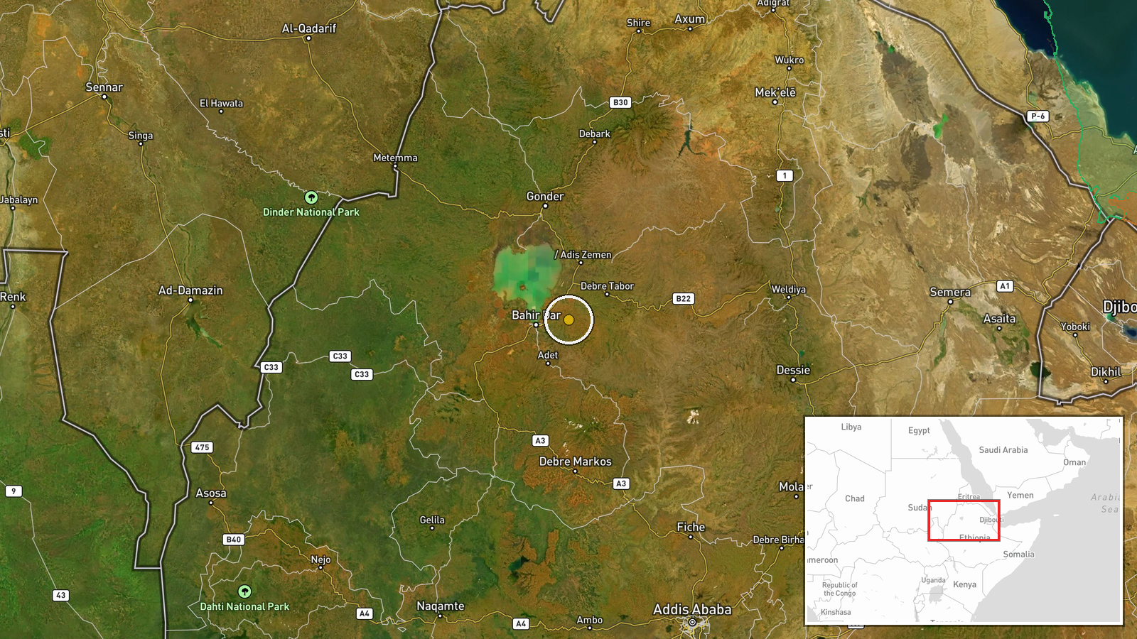
The coordinates, 11.64 N and 37.67 E, are set at settlement precision and place the event within the approximate centre of Dera Woreda rather than at the exact school building. The setting is the highland plateau of South Gondar, a mountainous zone in north-central Amhara with terraced farmland and dispersed rural villages. Lake Tana lies to the northwest of the wider zone, and road access in many rural woredas is limited, which can slow verification of incidents.
▶ View this event on the live map

Intel Mapper aggregates open-source reports from monitored Telegram and X channels, geolocates them, cross-checks duplicates across sources and assigns a confidence score. Entries are updated as new confirmations arrive. Read how we verify events.