Oromia and Somali regional forces clash in Moyale, spreading to three more districts
What happened
According to a report carried by Addis Standard and relayed through its Telegram channel, a dispute over the raising of a Somali Regional State flag in Moyale town, Borana Zone, Oromia Region, escalated into sustained fighting. The dispute followed the killing of a 13-year-old girl on October 18. The outlet says tensions built from Wednesday night and became open clashes on Thursday, with security forces from the Oromia and Somali regions exchanging heavy gunfire. Residents and local security officials told the outlet that the fighting spread to parts of Gumi Eldallo, Wachile and Arero districts in South Oromia. The report gives no casualty figures, and its wording presents these details as accounts from residents and officials rather than independently verified facts.
Context and assessment
Moyale sits on the Ethiopia-Kenya frontier and serves as a commercial and transit node between southern Ethiopia and northern Kenya, which makes control of the town economically and politically significant. Its position at the junction of Oromia and the Somali Regional State also places it along a boundary that has long been contested between the two regions and their associated communities. Disputes over administrative borders, local government and the display of regional symbols such as flags have repeatedly become flashpoints in this part of Ethiopia, and a flag dispute can serve as a visible marker of wider claims to territory and authority. The reported spread from one town to neighbouring districts in South Oromia suggests the disagreement moved beyond a single local incident. The fact that the reporting describes exchanges of heavy gunfire between regional security forces, rather than only crowd violence, may indicate organised armed units were involved, though the available account does not identify commanders, unit structures or their chain of command. No related events are linked to this entry, so the assessment of a wider pattern rests on the broader regional background rather than on a documented sequence of recent incidents.
Sources and confidence
The entry rests on a single channel, Addis Standard's Telegram account, which in turn cites residents and local security officials without naming them. No second outlet, official statement or independent monitoring source is attached in the data, so cross-confirmation is absent. The confidence score of 7.1 reflects a reputable regional outlet with a specific, dated and place-named account, offset by the single-source basis and the anonymous attribution. Confidence would rise with corroboration from another news organisation, a statement from the Oromia or Somali regional government, or imagery or verified local video. It would fall if officials denied the clashes, if the district names could not be matched to actual administrative units, or if later reporting revised the timeline or the scale of the fighting.
Location
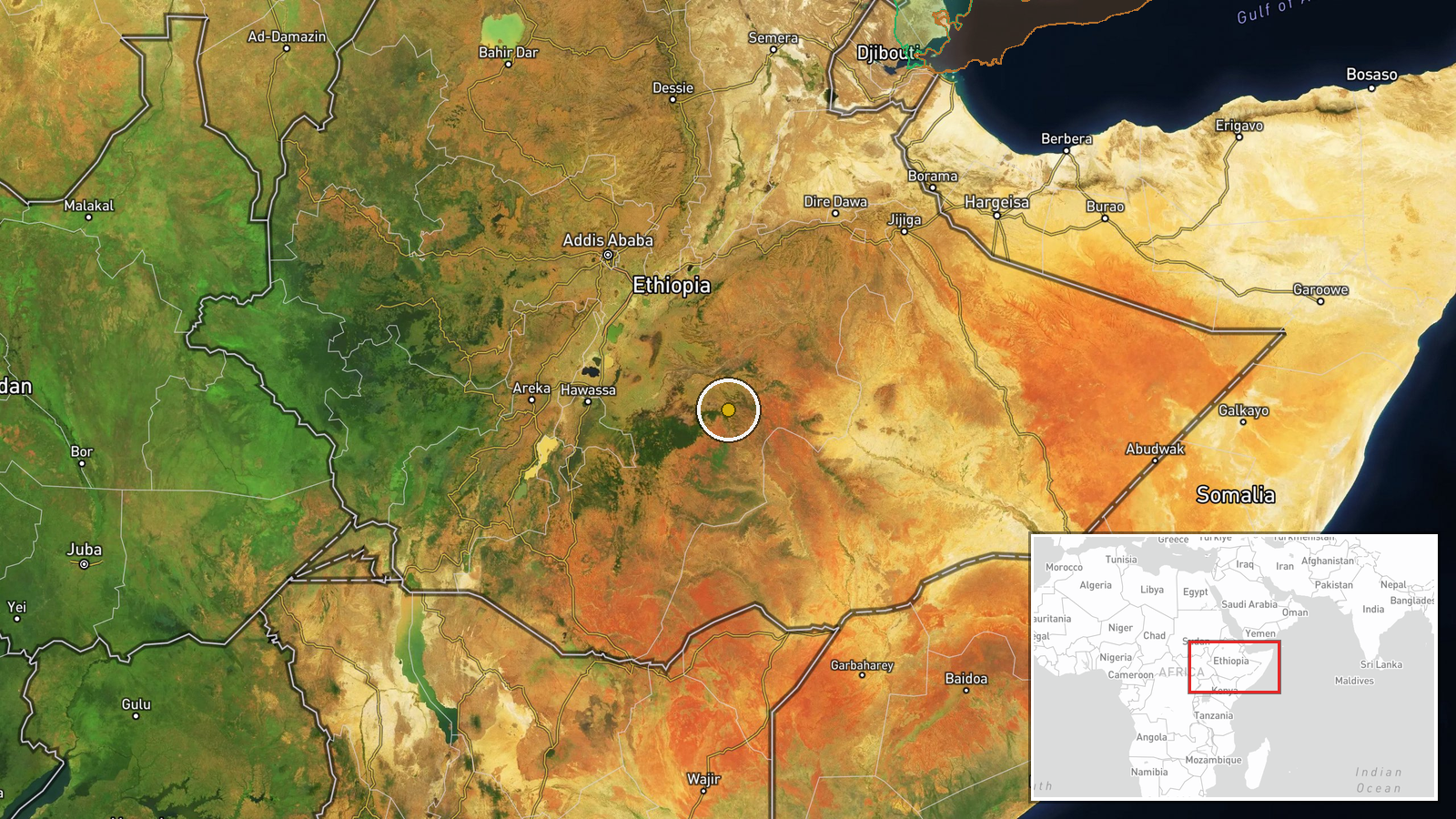
The coordinates place the event at the regional level rather than at a specific street or facility, and the location confidence is recorded as low, so the marker should be read as approximate to the wider Moyale area. Moyale town lies in the Borana Zone of Oromia near the Kenyan border, and the reported districts of Gumi Eldallo, Wachile and Arero are described as parts of South Oromia. The setting is semi-arid lowland and borderland, with the frontier crossing and transit routes forming notable local features. Exact positions of the named districts relative to the town were not provided in the data.
▶ View this event on the live map

Intel Mapper aggregates open-source reports from monitored Telegram and X channels, geolocates them, cross-checks duplicates across sources and assigns a confidence score. Entries are updated as new confirmations arrive. Read how we verify events.