Iran's IRGC Navy strikes LPG tanker south of Strait of Hormuz
What happened
Iran's Islamic Revolutionary Guard Corps Navy reportedly struck the liquefied petroleum gas tanker NV Sunshine south of the Strait of Hormuz on October 9, causing a major fire in the vessel's engine room and propulsion systems. According to the IRGC statement, the tanker was transiting an "unauthorized route." The Iranian military warned that companies cooperating with the United States would face sanctions and that vessels using unauthorized routes would be pursued throughout the region, extending beyond the Strait of Hormuz itself.
Context and assessment
The attack follows a pattern of escalating maritime incidents in the Persian Gulf and Gulf of Oman region, including a tanker strike in the Strait of Hormuz the previous day. Iran's stated rationale—unauthorized routing and U.S. cooperation—reflects broader maritime disputes over shipping lanes and sanctions enforcement in strategically critical waters. The IRGC's explicit warning that vessels throughout the region face pursuit may indicate an attempt to assert control over navigation beyond traditional chokepoints. These incidents occur amid heightened regional tensions and may signal Iranian willingness to target commercial shipping to pressure foreign governments and companies aligned with U.S. policy.
Sources and confidence
Reported via Telegram channel @ClashReport on October 9. Single-source reporting limits independent verification of specific damage claims and attack attribution. Confidence score of 7.0 reflects the direct IRGC statement but absence of corroborating independent sources. Cross-confirmation from shipping industry monitors, maritime authorities, or third-party observers would strengthen confidence; reports of casualties or salvage operations would lower it if inconsistent with the account provided.
Location
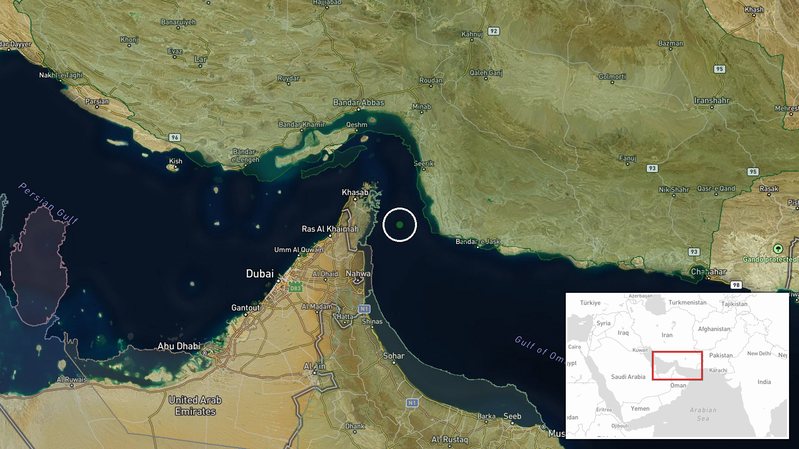
South of the Strait of Hormuz in the Gulf of Oman, approximately 25.9°N, 56.8°E. The Strait of Hormuz is the narrow waterway between Iran and Oman connecting the Persian Gulf to the Gulf of Oman and Arabian Sea. The attack location sits outside the strait proper, in open-ocean approaches where international shipping typically routes around the chokepoint.
Related events nearby
- Oil tanker struck in the Strait of Hormuz. Details on attacker identity, damage, and casualties pending.2026-10-08 14:57 UTC · Naval · Strait of Hormuz, Persian Gulf
▶ View this event on the live map

Intel Mapper aggregates open-source reports from monitored Telegram and X channels, geolocates them, cross-checks duplicates across sources and assigns a confidence score. Entries are updated as new confirmations arrive. Read how we verify events.