Tanker struck by projectile, catches fire in Strait of Hormuz
What happened
The UK Maritime Trade Operations (UKMTO) reported that an outbound tanker was struck by an unknown projectile on its port side in the Strait of Hormuz on October 10, igniting a fire aboard the vessel. The projectile's origin and the attacker remain unidentified. UKMTO, a British naval authority, monitors merchant shipping and reports incidents in strategic waterways. The strike occurred during daylight hours in one of the world's most critical chokepoints for oil transit.
Context and assessment
The Strait of Hormuz, between Iran and Oman, handles roughly one-third of global seaborne oil trade. This incident follows a pattern of maritime incidents in the waterway on the same day: Iranian Revolutionary Guards (IRGC) released video of kamikaze drone attacks against shipping, and separately claimed a supertanker hit a naval mine while using an unauthorized exit route. The clustering of reported incidents suggests heightened maritime tensions or operations in the corridor, though attribution remains unclear. Tanker strikes in contested waterways often reflect broader regional security disputes affecting global energy markets.
Sources and confidence
UKMTO reported via Telegram channel @ClashReport. Single-source reporting limits confidence to 7.1 out of 10. The report lacks cross-confirmation from independent maritime monitors or vessel tracking data. Confirmation from the tanker's operator, insurance surveyors, or additional maritime authorities would strengthen confidence. Visual evidence or statements from the vessel would provide definitive attribution of the projectile type.
Location
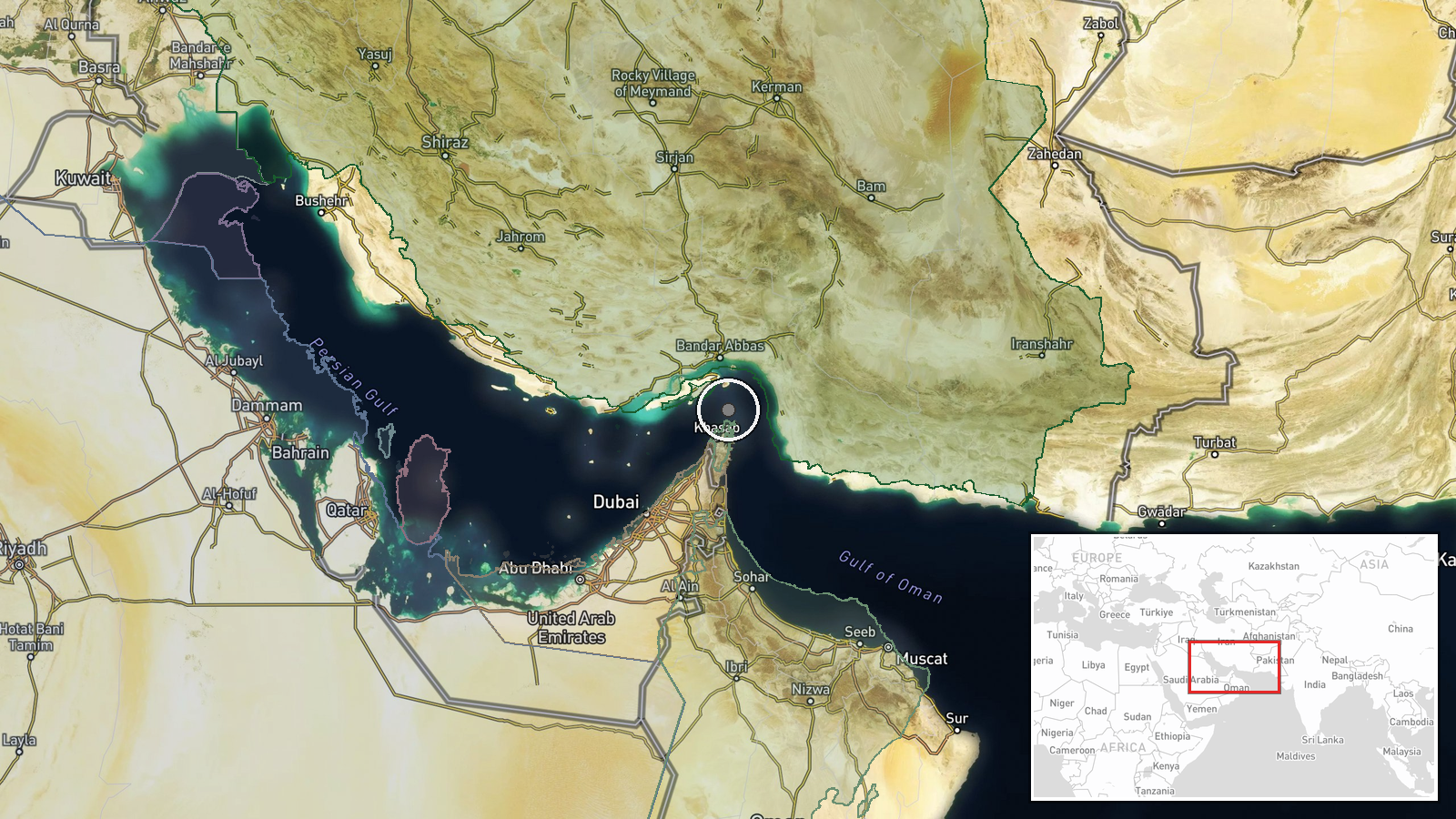
The Strait of Hormuz, a 54-mile-wide waterway between Iran's coast to the north and Oman to the south, narrows to approximately 21 miles at its deepest point. The coordinates (26.55°N, 56.4°E) place the incident in the central strait region. Precision is low, as 'outbound tanker' indicates a vessel departing the Persian Gulf but the exact strike point within the waterway was not specified in available reporting.
Related events nearby
- Iran's IRGC claims a supertanker carrying crude oil struck a naval mine while attempting to exit the Strait of2026-10-10 17:07 UTC · Report · Strait of Hormuz, Persian Gulf
- Iranian Revolutionary Guards (IRGC) released video footage demonstrating kamikaze drone attacks against shippi2026-10-10 07:41 UTC · UAS Strike · Strait of Hormuz, Persian Gulf
▶ View this event on the live map

Intel Mapper aggregates open-source reports from monitored Telegram and X channels, geolocates them, cross-checks duplicates across sources and assigns a confidence score. Entries are updated as new confirmations arrive. Read how we verify events.