Tanker reportedly struck by unknown projectile about 68 nm northeast of Al Jubayl, Saudi Arabia
What happened
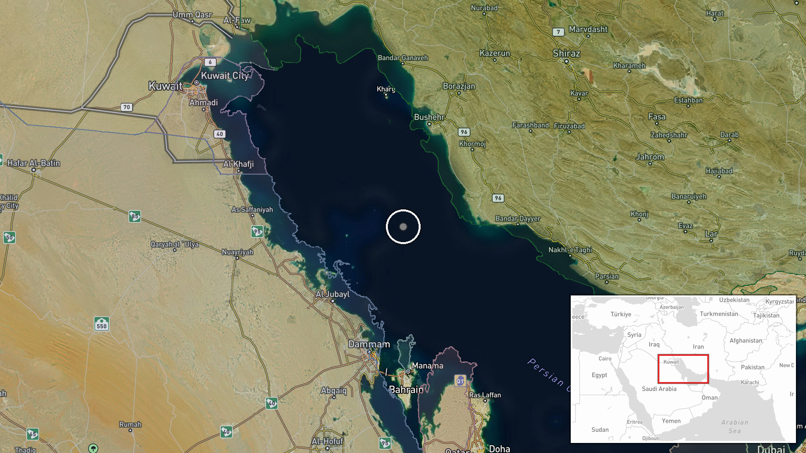
UKMTO, the UK Maritime Trade Operations service that relays incident reports from the Gulf and wider region, reportedly stated that a tanker was struck by an unknown projectile about 68 nautical miles northeast of Al Jubayl, Saudi Arabia, in the Persian Gulf. The recorded time is 17 October 2026 at 06:40 UTC. The report does not identify the attacker, the projectile type, the vessel's name, or whether anyone was injured or the ship was damaged beyond the strike itself. The event reached us through two sources: a Telegram channel, @ClashReport, and an X account, @ConflictTR. The original wording uses the present tense, 'is struck', and describes a tanker, while our feed classifies the vessel as a cargo ship.
Context and assessment
The Persian Gulf is one of the world's most important energy shipping corridors, and the waters northeast of Al Jubayl sit in the approaches used by vessels moving between Gulf export terminals and the wider sea lanes. Al Jubayl is a major Saudi industrial and petrochemical port on the Gulf coast, so tankers in this area are often carrying or positioning for energy exports. No related events are linked to this record, so this report cannot be placed within a local pattern from our own data. Background is relevant, however. Since late 2023, shipping across the Red Sea and the Gulf of Aden has faced repeated attacks by Houthi-linked forces, and the Gulf has seen earlier episodes involving drones, mines, and disputed incidents near commercial traffic. An attack 68 nautical miles offshore suggests the vessel was in open water, beyond the close security zones around ports. An unidentified projectile at that range may point to a drone, missile, or small-arms fire, but the wording alone does not establish which. Analysts would normally look for a claim of responsibility, a flag-state statement, or imagery before drawing firmer conclusions.
Sources and confidence
The event rests on two channels: a Telegram account and an X account. The original text is attributed to UKMTO, an official maritime advisory body, which is the strongest element of the record. However, the data does not show an independent wire service, operator statement, or second maritime agency confirming the strike. The confidence score of 8.0 reflects the official-style attribution and the presence of two sources, with some discount because the vessel type is inconsistent between the report and our classification. Confidence would rise with a second official notice, a statement from the vessel's operator or flag state, or verified imagery. It would fall if the UKMTO notice cannot be located, if the vessel type or position is contradicted, or if the two channels turn out to be relaying a single unverified post.
Location
The coordinates, 27.8173 N and 50.5205 E, were derived from the distance and bearing given in the report, measured from Al Jubayl. They therefore mark an approximate reference point rather than a confirmed incident site. The precision tag reads 'settlement', which does not fit an offshore event, though the location confidence is recorded as high. The point lies in open waters of the central Gulf, away from the Saudi coastline and closer to the Iranian shore than to Al Jubayl itself. No port, island, or platform is named in the report as the position of the strike.
▶ View this event on the live map

Intel Mapper aggregates open-source reports from monitored Telegram and X channels, geolocates them, cross-checks duplicates across sources and assigns a confidence score. Entries are updated as new confirmations arrive. Read how we verify events.