LNG tanker reportedly fired on by small boat with seven occupants off Yemen's Al Mukalla coast
What happened
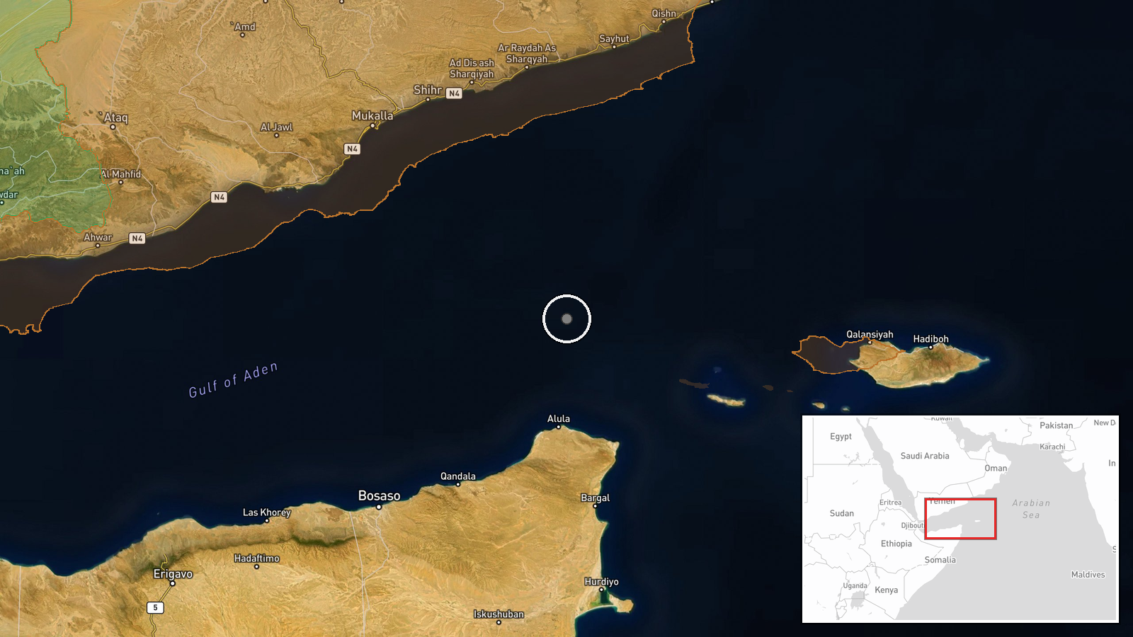
UKMTO, the UK maritime security reporting service, reportedly relayed that an LNG tanker came under fire from a small boat carrying seven people, about 140 nautical miles southeast of Yemen's port city of Al Mukalla. The wording as carried by the Telegram channel @ClashReport is that the tanker 'comes under fire,' and the report does not describe damage, casualties, or whether the vessel was struck, boarded, or able to continue. The attackers are unidentified, and the small boat is the only vessel type mentioned. The incident is logged at 13:24 UTC on 17 October 2026, and the account has not yet been independently confirmed in the data available.
Context and assessment
Waters off Yemen's southern coast have been a recurring theatre for attacks on merchant shipping, and the Gulf of Aden and western Arabian Sea approaches have seen armed approaches by small craft at several points during the wider regional conflict. Al Mukalla, the capital of Hadhramaut governorate, sits on a coast that lies along the sea lanes linking the Gulf of Aden with the Arabian Sea and onward to Asian and European trade routes. An LNG carrier is a high-value and slow-moving target, which makes it a notable choice for an approach by a small boat. No related events are linked in the current data, so this report cannot be placed within a verified sequence of incidents on this route. Operationally, a small-boat approach with seven occupants is consistent with a probing or harassing action, or with an attempt to board or divert a vessel, but the data does not establish intent or which of these it was. Anyone assessing the event should treat the tactical picture as open until a maritime security authority publishes detail on the vessel's status and the attackers' conduct.
Sources and confidence
The only source in the data is a single Telegram channel, @ClashReport, which attributes the information to UKMTO. The attribution to UKMTO is second-hand, since the channel is relaying the authority's wording rather than being the authority itself, and no separate outlet or official feed is listed as confirming it. The confidence score of 7.1 reflects a credible maritime-security attribution combined with a single relaying channel and no corroborating reports. Confidence would rise if UKMTO or a flag state or operator published its own notice, or if an independent maritime monitoring service matched the vessel and position. It would fall if the vessel's operator denied the attack or if the report could not be traced to the original UKMTO notice.
Location
The coordinates place the pin at the settlement of Al Mukalla, the port city in Hadhramaut governorate, rather than at the reported incident position. The incident is described as roughly 140 nautical miles southeast of the city, which is well out to sea, so the map marker marks the reference point and not the attack site. The surrounding area is the Gulf of Aden coast of southern Yemen, where the arid shoreline meets open water toward the Arabian Sea.
▶ View this event on the live map

Intel Mapper aggregates open-source reports from monitored Telegram and X channels, geolocates them, cross-checks duplicates across sources and assigns a confidence score. Entries are updated as new confirmations arrive. Read how we verify events.