IRGC Navy says tanker hit naval mine off southern Strait of Hormuz, causing engine-room fire
What happened
Iran's Revolutionary Guard Corps Navy says an oil tanker struck a naval mine south of the Strait of Hormuz, causing an explosion and fire in the vessel's engine room. The report is dated 18 October 2026, logged at about 20:53 UTC. The only attribution in the data is the IRGC Navy's own statement, relayed through two channels: a Telegram account, @ClashReport, and an X account, @Osint613. The original wording describes a naval mine, while the event summary places the tanker on the southern Strait of Hormuz route. No vessel name, flag state, casualty figures, or independent confirmation of the blast were included. The event is recorded under the attack type artillery, which does not fit a mine strike and should be treated as a classification artifact.
Context and assessment
The Strait of Hormuz is one of the world's most important energy chokepoints, carrying a large share of seaborne crude and refined products from Gulf producers, so any reported damage to a tanker there draws wide attention. Mines in shipping lanes have been a long-standing concern in the area, and tanker incidents in and around the Gulf of Oman have repeatedly prompted security warnings in recent years. No related events are linked to this entry in the dataset, so it cannot be placed within a recent sequence on Intel Mapper, and any pattern claim would rest on general background only. Operationally, a mine strike announced by the IRGC Navy would be a significant claim. The Guard's navy operates in these waters and has its own interests in maritime control and in how incidents are described, so an official statement may frame events in ways that serve wider political or military messaging. Naval mines are typically laid covertly, and a confirmed strike would imply a device in or near a transit route, with consequences for insurers, shipping routes, and mine clearance. The mismatch with the artillery attack type also suggests the record may need correction once the nature of the incident is clearer. Readers should weigh the account against what maritime authorities and vessel operators later report.
Sources and confidence
The report circulated through two channels, a Telegram account named @ClashReport and an X account named @Osint613. Both are listed as sources, but the data does not show whether either obtained the claim independently or simply repeated the IRGC Navy statement, so cross-confirmation appears weak and the two may reflect one underlying claim. The confidence score of 8.2 reflects a credible official origin and two listed sources, but it stops short of the highest range because no imagery, vessel identifiers, or maritime authority confirmation appear in the record. Confidence would rise with reports from UKMTO, the vessel's operator or flag state, or satellite or photographic evidence. It would fall if the tanker cannot be identified or the claim is contradicted.
Location
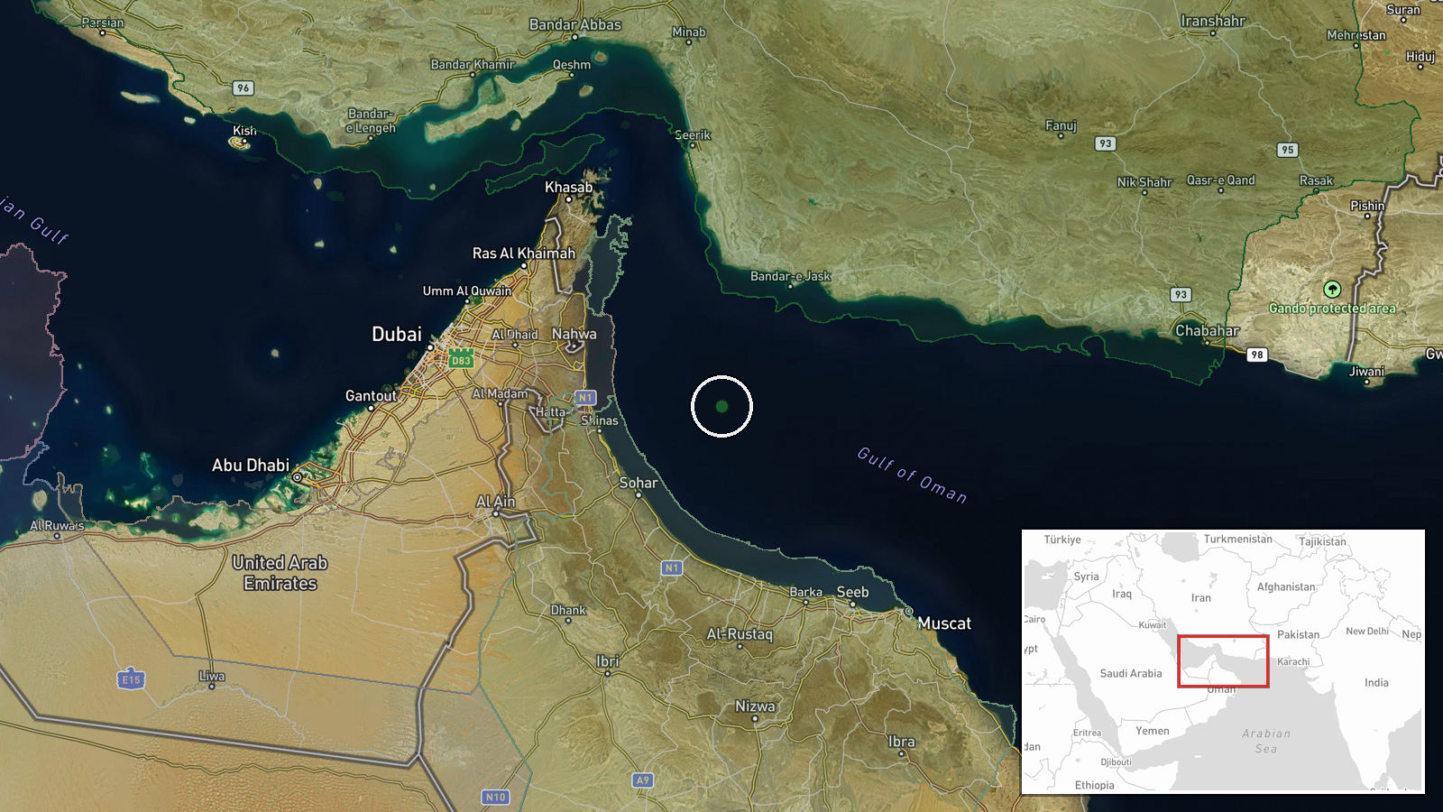
The coordinates, 24.9 N and 57.3 E, form a region-level point in the Gulf of Oman south of the Strait of Hormuz, so the pin marks an approximate area rather than a specific position or named facility. Precision is classed as region and location confidence as normal. The setting is open sea between Iran's southern coast and Oman's Musandam Peninsula, with the Makran coast and ports such as Jask in the general vicinity. Because the point lies offshore, the exact site of the reported blast is not established.
▶ View this event on the live map

Intel Mapper aggregates open-source reports from monitored Telegram and X channels, geolocates them, cross-checks duplicates across sources and assigns a confidence score. Entries are updated as new confirmations arrive. Read how we verify events.