Iran's IRGC claims shootdown of U.S. MQ-9 drone over Strait of Hormuz; claim unverified
What happened
According to the summary and original text, Iran's Islamic Revolutionary Guard Corps (IRGC) says it shot down a U.S. MQ-9 drone over the Strait of Hormuz early on 20 October 2026, using what it describes as a newly developed advanced air defense system. The IRGC also claims this was the 54th U.S. drone it has destroyed. The report is unverified: the available data contains no independent confirmation of the shootdown, no wreckage or imagery, and no official U.S. statement. The item was first circulated on Telegram via @ClashReport and was also posted on X by @Osint613, with a timestamp of 06:08 UTC. The source wording attributes the action to the IRGC as its own claim. The event record lists the actor as USA, which reflects the targeted platform's nationality rather than the party making the claim, so readers should treat the attribution as an Iranian assertion.
Context and assessment
The Strait of Hormuz is one of the most important maritime chokepoints in the world, linking the Persian Gulf with the Gulf of Oman and carrying a large share of seaborne oil exports from the region. That geography explains why any military incident there draws attention from markets and navies alike. The most relevant related item is an intelligence assessment dated 19 October 2026, reported from Tehran, which says Iranian officials may aim to keep oil prices high through attacks on shipping in and around the strait. That summary is truncated and describes an assessment rather than confirmed action, so it should be read as context, not corroboration. The claim's framing as the 54th U.S. drone downed implies a long running series of similar assertions, which, if accurate, would suggest a sustained pattern of contested airspace over the waterway. Operationally, if a shootdown occurred, it would indicate air defense coverage over the maritime approaches. However, the claimed 'new system' is not described in technical terms, and claims of this kind are often used for signaling. Without wreckage, imagery, or a U.S. response, the event cannot be assessed beyond the claim itself.
Sources and confidence
The event draws on two channels: a Telegram account, @ClashReport, and an X account, @Osint613. Both relay the same IRGC claim, so the reporting is not independent of the original assertion and should not be treated as cross-confirmation. The confidence score of 7.6 reflects two named channels, a specific timestamp, and a claim concrete enough to be checked, offset by the single-origin nature of the statement and the absence of imagery, debris, or official U.S. comment. Confidence would rise with imagery or video of the engagement, wreckage reports, or a statement from U.S. Central Command or the Pentagon. It would fall if the claim is retracted, if it is contradicted by flight tracking, or if no further corroboration appears.
Location
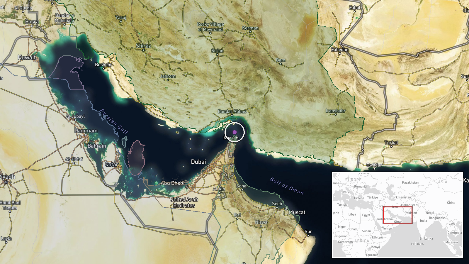
The location is approximate and region-level, with low location confidence. The coordinates of 26.55 N, 56.40 E sit in the broad strait area rather than at a recorded incident point, and no settlement or facility is named. The strait lies between Iran's Hormozgan coast to the north and Oman's Musandam peninsula to the south, narrowing to roughly 40 kilometres at its narrowest. Its islands, shipping lanes, and nearby Iranian and Omani coastal installations are the main features that shape activity in the area.
Related events nearby
- Intelligence assessment says Iranian officials plan to keep oil prices high through attacks on shipping in and2026-10-19 11:39 UTC · Report · Tehran, Iran
▶ View this event on the live map

Intel Mapper aggregates open-source reports from monitored Telegram and X channels, geolocates them, cross-checks duplicates across sources and assigns a confidence score. Entries are updated as new confirmations arrive. Read how we verify events.