UKMTO reports tanker interaction with military forces about 121 nm east of Duqm, Oman
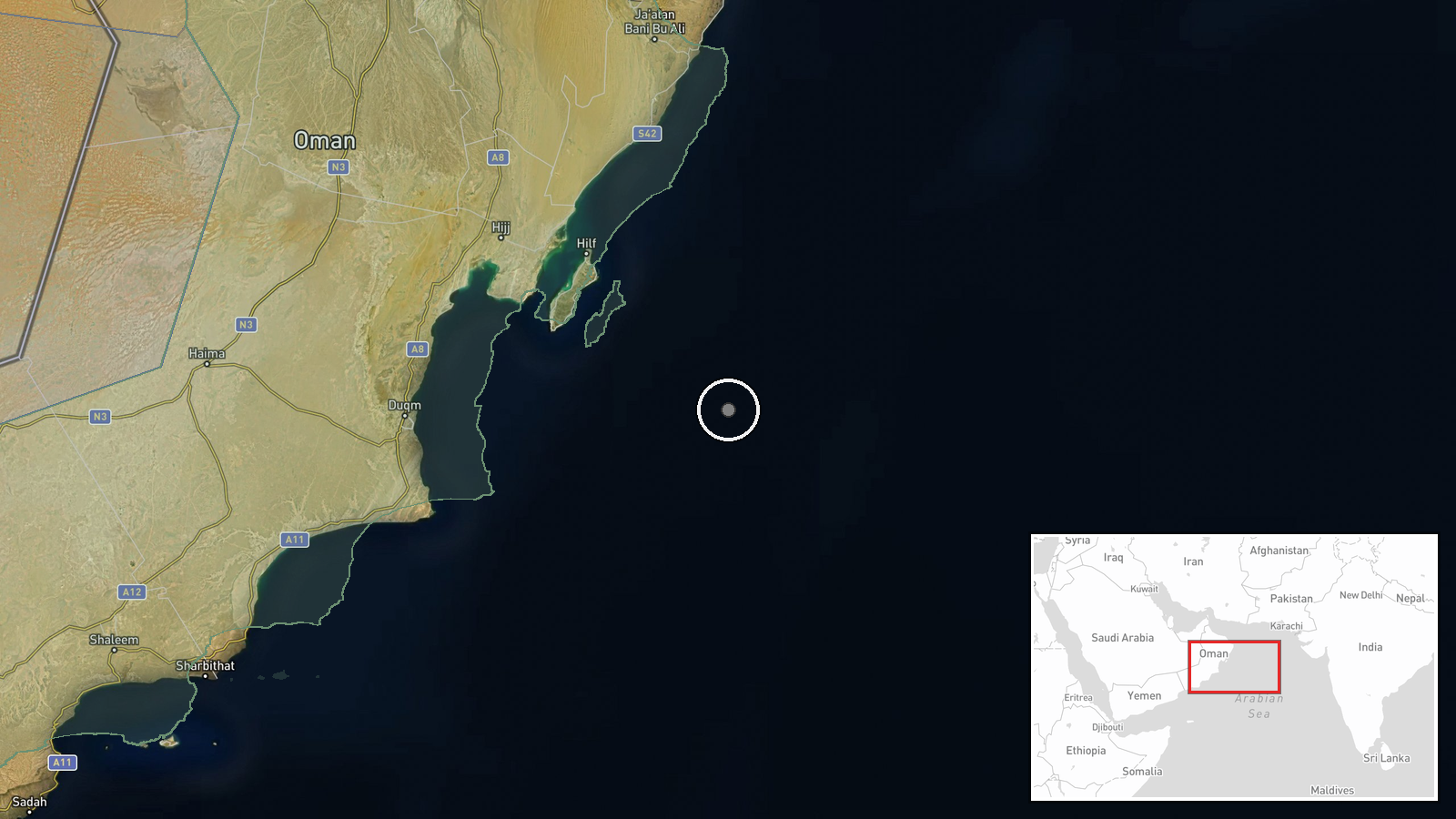
What happened
The UK Maritime Trade Operations centre (UKMTO), which monitors shipping security in the region, reportedly recorded an incident involving a tanker and military forces about 121 nautical miles east of Duqm, Oman, on October 19. According to the source wording, the tanker was involved in an interaction linked to ongoing military activity in the region. The report states that no casualties or damage were reported. The actor is listed only as unidentified military forces, and the record gives no vessel name, flag state, or nationality for the forces. The item reached the platform through a Telegram channel, @ClashReport, which appears to relay the UKMTO notice. The platform timestamp reads 20 October 2026 at 11:33 UTC, one day after the date in the source text, which likely reflects reporting or ingestion lag.
Context and assessment
Duqm is a deep-water port on the Arabian Sea coast of Oman, in Al Wusta Governorate, with commercial port facilities, a dry dock, and logistics infrastructure that serve merchant and naval traffic. The reported position lies well offshore in the Arabian Sea, on approaches that connect the Gulf of Oman and the Strait of Hormuz to the northwest with routes running toward the Indian Ocean and, further west, the Red Sea. Waters in this corridor are routinely used by oil and product tankers, which is why UKMTO issues advisories and incident reports for the area. No related events were supplied, so this report cannot be placed within a sequence of incidents, and nothing in the record shows a pattern of attacks on this vessel or area. The phrase interaction with military forces is vague and does not reveal whether the contact involved boarding, inspection, a radio warning, electronic interference, or simple proximity. Ambiguous contacts of this kind in busy, contested waters can reflect routine enforcement, navigational tension, or activity tied to wider regional confrontations, and the report does not indicate which. Follow-up UKMTO notices, shipping-tracking gaps, or statements from Omani or other regional authorities would help test those possibilities.
Sources and confidence
The item was reported by a single channel in the record, the Telegram account @ClashReport, which attributes the underlying information to UKMTO. No second outlet, captured UKMTO notice, or independent maritime tracking source is listed, so cross-confirmation is absent. The confidence score of 7.1 reflects a plausible official attribution within a single-source entry, with a restrained summary that avoids embellishment, offset by the lack of a primary link and the unexplained one-day date discrepancy. Confidence would rise with a copy or link of the UKMTO advisory, corroboration from a security firm or vessel tracking data, or a statement from the tanker's operator. It would fall if the advisory cannot be located or the date mismatch points to a separate event.
Location
The location was derived from a stated distance and bearing from Duqm, so the coordinates of 19.6621 N, 59.8414 E mark an approximate offshore reference point rather than a confirmed vessel position. The precision field reads settlement, which refers to the reference town rather than the sea point itself. The setting is open Arabian Sea water roughly 121 nautical miles east of the Omani coast, with no named island or port feature in the record at that position.
Related events nearby
- US deploys USS Theodore Roosevelt Carrier Strike Group and 13th MEU to the Middle East, adding about 10,000 pe2026-10-20 12:13 UTC · Aircraft Carrier · Arabian Sea
▶ View this event on the live map

Intel Mapper aggregates open-source reports from monitored Telegram and X channels, geolocates them, cross-checks duplicates across sources and assigns a confidence score. Entries are updated as new confirmations arrive. Read how we verify events.