Iraq closes its main southern Al Sheeb crossing with Iran for security review
What happened
A report from a single Telegram channel, @ClashReport, says Iraq has closed its main southern border crossing with Iran, Al Sheeb in Maysan Governorate, until further notice. The post says the closure was ordered by Prime Minister Ali Al Zaidi and that officials described it as allowing a security review and the installation of equipment to stop the smuggling of prohibited materials. The report describes Al Sheeb as a key route for food, construction materials and Iranian pilgrims travelling to Najaf and Karbala. It also says other crossings with Iran are expected to close gradually, which could disrupt trade and raise prices in southern Iraq, and notes that bilateral trade topped $10 billion last year. Tehran reportedly protested that it received no advance notice, as bilateral rules require. The post is timestamped 21 October 2026, 11:23 UTC.
Context and assessment
Al Sheeb is a land crossing in Maysan, one of Iraq's southern provinces bordering Iran, and it carries commercial traffic and religious travel. Iranian pilgrims use border routes like this one to reach the shrine cities of Najaf and Karbala, so a closure affects both trade and pilgrimage movement. Iraq and Iran have a large trading relationship, and border controls on smuggling, fuel and restricted goods have long been a recurring theme in relations between the two neighbours. The dataset contains no related events, so this report cannot be placed against a recent pattern of closures or incidents at the same crossing, and any reading of a wider trend rests on background knowledge rather than on documented sequences. The security framing and the plan for equipment installation suggest a state-led administrative measure rather than a military or kinetic event, and the staged closure of other crossings would point to a coordinated policy rather than an isolated decision. The reported protest over lack of notice indicates diplomatic friction, though the depth of that friction cannot be judged from one channel. Whether the closure is temporary or lasting would depend on the length of the review and on any bilateral arrangements that follow.
Sources and confidence
Only one channel is listed: Telegram @ClashReport. The event data contains no corroboration from wire services, Iraqi or Iranian government statements, border authorities or independent outlets, and the Tehran protest is attributed only within this single post. The confidence score of 7.1 reflects a specific, internally consistent report that names an official and a plausible rationale, offset by the absence of any cross-confirmation. Confidence would rise with an official Iraqi statement, an Iranian foreign ministry response, or notices from the crossing operator or transport bodies. It would fall if officials deny the closure or if crossing traffic continues normally after the stated date.
Location
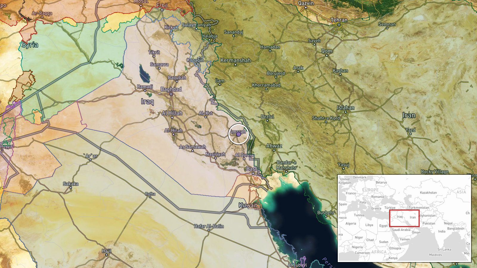
The location is the Al Sheeb crossing in Maysan Governorate, labelled at facility level, but the location confidence is low and the coordinates of 31.9 and 47.2 are approximate, so the marker may sit some distance from the actual post. The crossing lies in southern Iraq along the Iranian frontier, in flat, low-lying terrain of marshes and farmland typical of the region. Basra Governorate lies to the south and west, and the Tigris and the southern marshlands are nearby.
▶ View this event on the live map

Intel Mapper aggregates open-source reports from monitored Telegram and X channels, geolocates them, cross-checks duplicates across sources and assigns a confidence score. Entries are updated as new confirmations arrive. Read how we verify events.