U.S. Navy vessels evade Iranian ballistic missiles; CENTCOM retaliates against oil tankers
What happened
U.S. Central Command reported that two American Navy warships in the Persian Gulf successfully evaded ballistic missile attacks launched by Iran's Islamic Revolutionary Guard Corps on September 5. In response, CENTCOM conducted strikes on three Iranian-flagged oil tankers: the M/T Downy and M/T Stark 1 were reportedly disabled, while the M/T Kylo (also known as Noxen) was destroyed after its crew evacuated. CENTCOM stated no U.S. personnel were injured in the Iranian attack.
Context and assessment
The Persian Gulf remains a focal point of U.S.–Iran tension, with the waterway critical to global energy supplies and a zone where both navies maintain active presence. Iranian ballistic missile attacks on U.S. naval vessels represent a significant escalation in direct military confrontation, moving beyond unmanned systems or proxy forces. The targeting of Iranian oil tankers in response suggests CENTCOM may be pursuing economic pressure alongside kinetic action. Such tit-for-tat exchanges in the Gulf have historically risked rapid escalation, though both sides have shown restraint in the past when casualties were avoided. The tankers' designation and registry may reflect broader maritime sanctions enforcement or targeting of Iran's energy sector.
Sources and confidence
Reported by Telegram channel @ClashReport on September 5. Single-source reporting limits independent verification; cross-confirmation from official U.S. or Iranian statements, maritime tracking databases, or news agencies would strengthen confidence. Confidence score of 7.0 reflects CENTCOM's direct attribution but lack of secondary corroboration. Satellite imagery of the three vessels' status or statements from crew members would raise confidence; contradictory accounts from Tehran would lower it.
Location
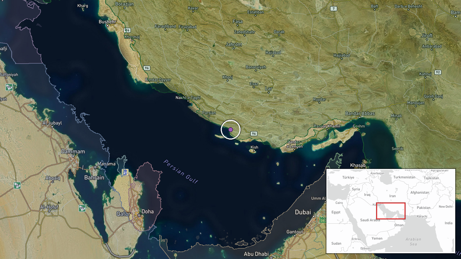
The Persian Gulf between Iran and the United Arab Emirates, at approximately 26.95°N, 53.5°E. This location places the incident in the central Gulf, a major shipping lane and contested waters where both U.S. and Iranian naval forces routinely operate. The region is bounded by Iranian coastal territory to the north and west, and UAE to the south, with the Strait of Hormuz to the southeast connecting to the Gulf of Oman.
▶ View this event on the live map
Intel Mapper aggregates open-source reports from monitored Telegram and X channels, geolocates them, cross-checks duplicates across sources and assigns a confidence score. Entries are updated as new confirmations arrive. Read how we verify events.