Iran's IRGC claims ballistic missile strikes on U.S. Navy carrier and destroyer in Persian Gulf
What happened
Iran's Islamic Revolutionary Guard Corps reportedly announced on September 5 that it launched ballistic missiles at a U.S. aircraft carrier and destroyer in the North Arabian Sea and Persian Gulf region. According to the IRGC statement, the warships were targeted in response to alleged prior hostile actions against Iranian vessels. The IRGC claimed the American ships sustained damage and withdrew from the area, and warned of escalated retaliation if U.S. hostile operations continue. The claims have not been independently verified.
Context and assessment
The Persian Gulf and North Arabian Sea remain zones of intense naval competition between U.S. and Iranian forces. U.S. carrier strike groups routinely operate through these waters as part of broader Middle East deployments, while Iran has historically used ballistic missiles and drone strikes as asymmetric responses to perceived threats. IRGC statements alleging damage to U.S. naval vessels are common during periods of heightened tension but typically lack independent corroboration. This incident, if it occurred, would represent a significant escalation in direct military confrontation between the two powers in a strategically vital waterway. The IRGC's warning of further retaliation suggests an intent to signal resolve while potentially deterring additional U.S. operations.
Sources and confidence
The report originates from a single Telegram channel (@ClashReport) with no cross-confirmation from U.S. military statements, allied sources, or other intelligence channels as of the report date. The confidence score of 7.0 reflects the IRGC's direct claim but acknowledges the absence of independent verification. Confirmation from U.S. Navy or allied defense statements, damage photographic evidence, or reporting from multiple independent channels would strengthen confidence. Absence of such corroboration or explicit U.S. denial would lower confidence.
Location
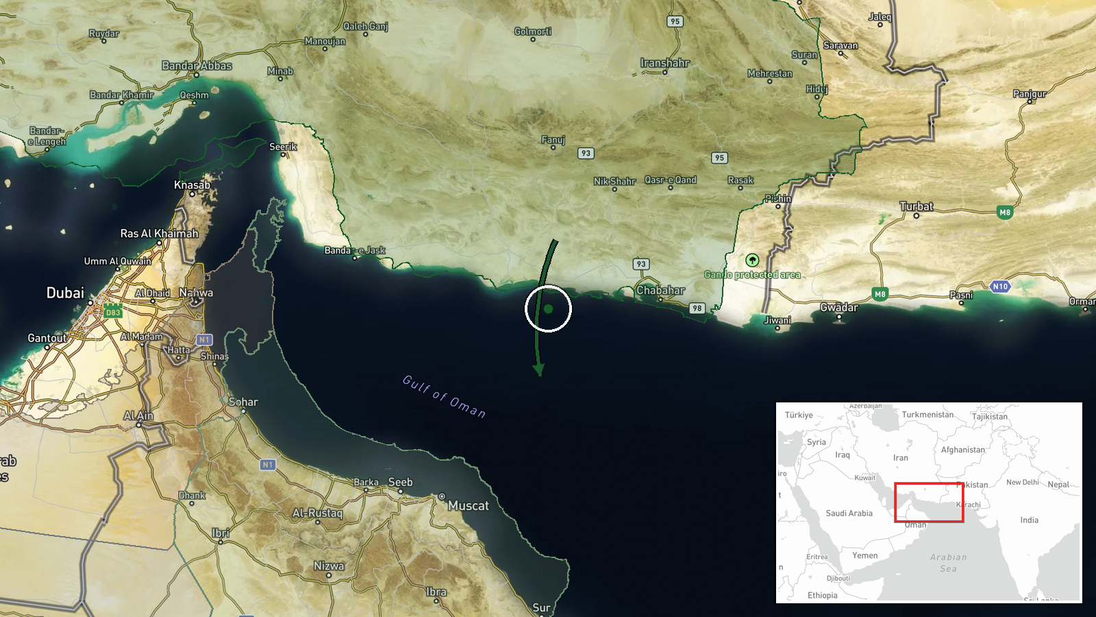
The incident was reported to occur in the North Arabian Sea and Persian Gulf region at approximate coordinates 24.5°N, 59.5°E. This places the area in international waters of the Gulf, a major shipping corridor and frequent operational zone for U.S. naval task forces. The region encompasses open water south of Iran's coast and near major maritime chokepoints including the Strait of Hormuz to the west.
▶ View this event on the live map
Intel Mapper aggregates open-source reports from monitored Telegram and X channels, geolocates them, cross-checks duplicates across sources and assigns a confidence score. Entries are updated as new confirmations arrive. Read how we verify events.