U.S. and Iran trade tanker strikes in Hormuz; traffic collapses, oil surges to $97
What happened
The United States and Iran exchanged strikes on commercial vessels in the Strait of Hormuz over the weekend of September 6–7. According to @ClashReport, the U.S. sank one Iranian tanker and disabled two others, including one near Iran's primary export terminal. Iran responded by striking three tankers within the Strait and three additional U.S.-linked vessels elsewhere. CENTCOM characterized the U.S. action as proportional retaliation, stating it imposed economic costs exceeding the initial Iranian provocation. Transit traffic through Hormuz fell sharply to approximately ten ships daily, down from dozens before the escalation.
Context and assessment
The Strait of Hormuz, through which roughly one-third of global seaborne oil passes, has become a flashpoint for direct naval confrontation between U.S. and Iranian forces. This weekend's tanker strikes follow a U.S. Navy missile strike on an Iranian communications complex in Kuhestak on September 6, and a covert four-month mine-clearing operation in the strait. Iran's Security Council has declared portions of the Hormuz corridor and Persian Gulf restricted zones, threatening sanctions against vessels that enter. The rapid collapse in transit traffic—to the lowest levels since May—reflects market fear of further escalation. Brent crude oil reached $97.48, a nearly 8 percent weekly gain, with Goldman Sachs modeling scenarios reaching $120 if attacks broaden. The escalation pattern suggests both sides are testing economic leverage and demonstrating resolve amid broader regional tensions.
Sources and confidence
@ClashReport on Telegram provided the primary account. The report cites CENTCOM statements and Iranian Security Council declarations. With a single source channel and regional precision rather than independent confirmation of specific vessel names or damage assessments, confidence is moderate (7.0). Oil price movements and shipping traffic data from public markets corroborate the disruption claim. Higher confidence would require additional independent reporting on specific vessel identities and damage; lower confidence could result from contradictory assessments of strike outcomes or revised casualty figures.
Location
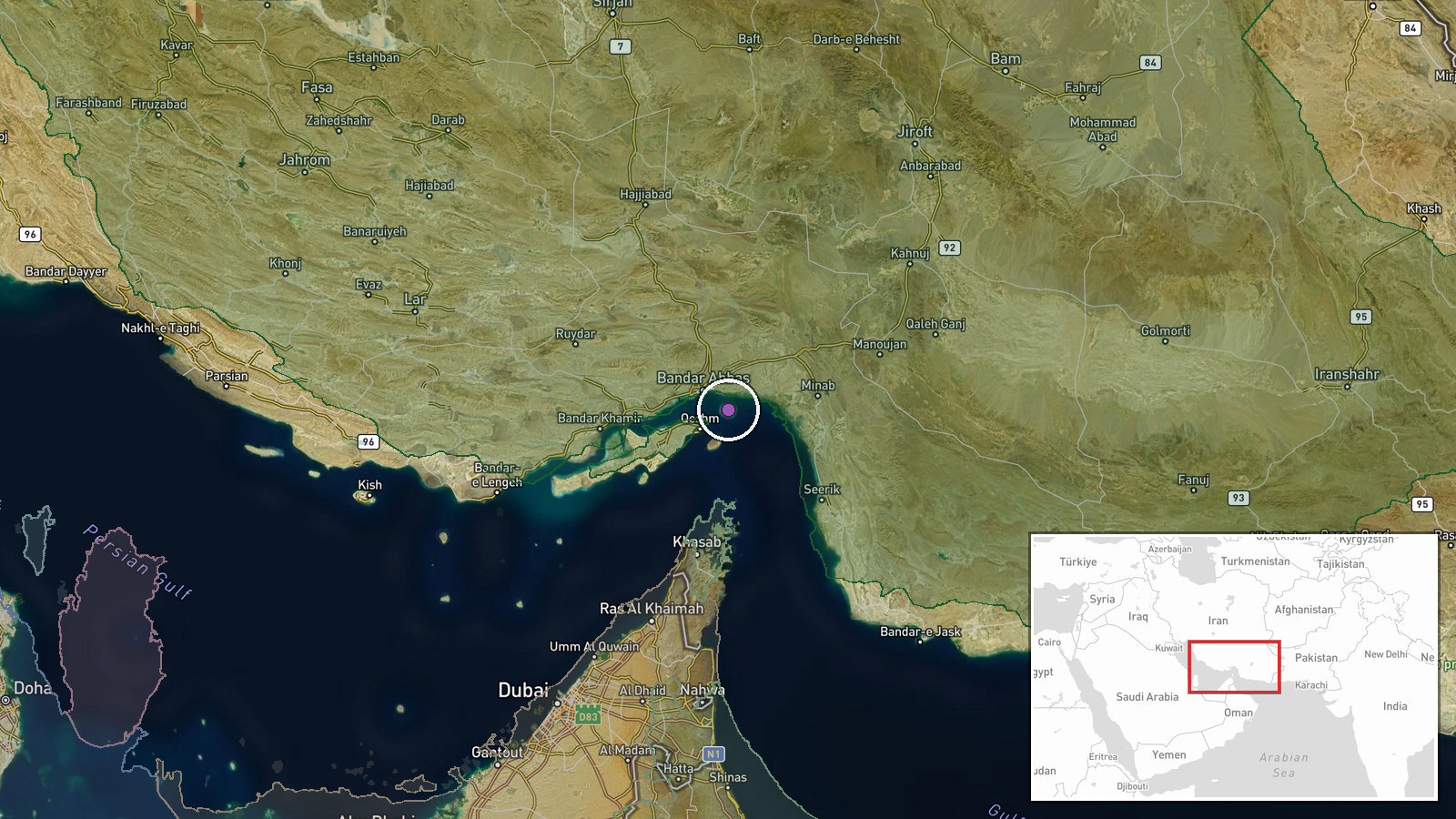
The Strait of Hormuz, a 54-nautical-mile waterway separating Iran from Oman at the entrance to the Persian Gulf. The reported Iranian tanker near Iran's main export terminal likely refers to Kharg Island or the Khark export facility on Iran's western coast. U.S. and Iranian vessels operate throughout this strategic chokepoint, which is bounded by Iranian territorial waters to the north and Omani waters to the south.
▶ View this event on the live map
Intel Mapper aggregates open-source reports from monitored Telegram and X channels, geolocates them, cross-checks duplicates across sources and assigns a confidence score. Entries are updated as new confirmations arrive. Read how we verify events.