Iran claims shootdown of U.S. MQ-1 reconnaissance drone over Strait of Hormuz
What happened
Iran claimed on September 8 that it shot down a U.S. MQ-1 Predator drone over the Strait of Hormuz in the Persian Gulf. The MQ-1 is a medium-altitude reconnaissance and light attack aircraft operated by the U.S. military. The claim was reported via Telegram and has not yet been independently verified by third parties or U.S. military confirmation.
Context and assessment
The Strait of Hormuz, through which roughly one-third of global maritime oil trade passes, has been a zone of recurring U.S.-Iranian military tension. U.S. reconnaissance operations in the region are routine, but Iranian air defense claims in this corridor have a mixed track record of verification. If confirmed, such an incident could signal escalation in regional maritime tensions or represent Iranian demonstration of air defense capability. The operational context—whether the drone was conducting surveillance related to regional developments or routine patrols—remains unclear from available reporting.
Sources and confidence
The claim originated from the Telegram channel @ClashReport. No independent confirmation from U.S. military sources, regional observers, or other open-source intelligence channels is currently available. The single-source reporting and lack of corroboration accounts for the moderate confidence score of 7.0. Confirmation from U.S. Central Command or recovery of debris would substantially strengthen confidence.
Location
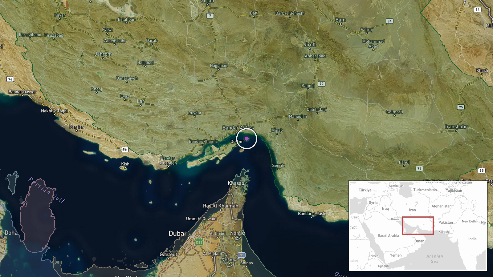
The Strait of Hormuz, located between Iran and Oman, connects the Persian Gulf to the Gulf of Oman and the Arabian Sea. The coordinates place the reported incident in the central strait region. The waterway is approximately 30 miles wide at its narrowest point and is one of the world's most strategically vital maritime chokepoints.
Related events nearby
- Iranian air defenses intercepted and destroyed a U.S. MQ-1 Predator drone over the Strait of Hormuz. Footage r2026-09-08 17:26 UTC · Air Defense · Strait of Hormuz, Persian Gulf
- Iran's IRGC Navy claims seizure of a modern U.S. unmanned underwater vehicle (UUV) at the entrance to the Stra2026-09-08 14:52 UTC · Security · Strait of Hormuz, Persian Gulf
- Iran's military claims its air defenses downed a U.S. drone over Bandar Abbas. Report unconfirmed; no casualty2026-09-08 14:02 UTC · Drone Shootdown · Bandar Abbas, Hormozgan Province, Iran
▶ View this event on the live map
Intel Mapper aggregates open-source reports from monitored Telegram and X channels, geolocates them, cross-checks duplicates across sources and assigns a confidence score. Entries are updated as new confirmations arrive. Read how we verify events.